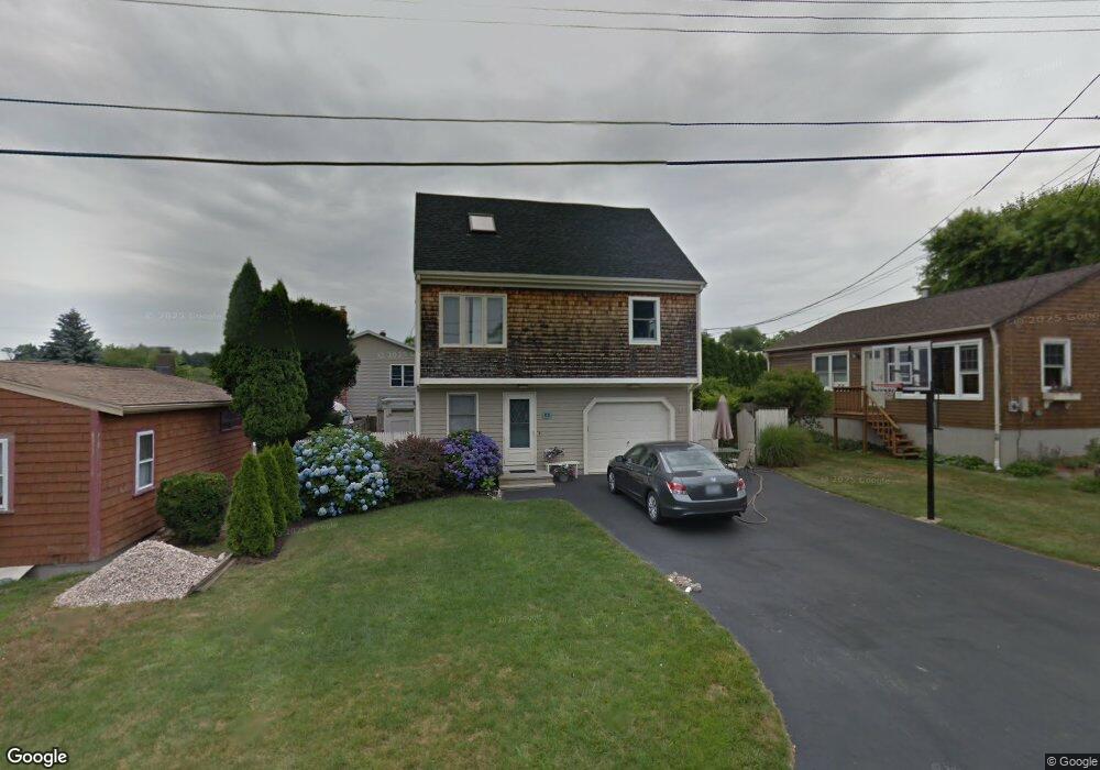
129 Islington Ave Portsmouth, RI 02871
Common Fence Point NeighborhoodEstimated Value: $598,000 - $738,000
2
Beds
1
Bath
1,500
Sq Ft
$437/Sq Ft
Est. Value
About This Home
This home is located at 129 Islington Ave, Portsmouth, RI 02871 and is currently estimated at $655,866, approximately $437 per square foot. 129 Islington Ave is a home located in Newport County with nearby schools including Portsmouth High School.
Ownership History
Date
Name
Owned For
Owner Type
Purchase Details
Closed on
Apr 30, 2001
Sold by
Hamilton Keith F and Hamilton Jill M
Bought by
Barrett Alison N
Current Estimated Value
Home Financials for this Owner
Home Financials are based on the most recent Mortgage that was taken out on this home.
Original Mortgage
$156,250
Interest Rate
6.88%
Mortgage Type
Purchase Money Mortgage
Purchase Details
Closed on
Oct 22, 1997
Sold by
Reis Virginia M
Bought by
Hamilton Keith E and Hamilton Jill
Purchase Details
Closed on
Sep 27, 1994
Sold by
Deangelis Matthew and Deangelis Rosemarie
Bought by
Reis Virginia M
Create a Home Valuation Report for This Property
The Home Valuation Report is an in-depth analysis detailing your home's value as well as a comparison with similar homes in the area
Home Values in the Area
Average Home Value in this Area
Purchase History
| Date | Buyer | Sale Price | Title Company |
|---|---|---|---|
| Barrett Alison N | $164,500 | -- | |
| Hamilton Keith E | $116,500 | -- | |
| Reis Virginia M | $110,000 | -- |
Source: Public Records
Mortgage History
| Date | Status | Borrower | Loan Amount |
|---|---|---|---|
| Open | Reis Virginia M | $168,000 | |
| Closed | Reis Virginia M | $159,000 | |
| Closed | Reis Virginia M | $174,500 | |
| Closed | Reis Virginia M | $156,250 |
Source: Public Records
Tax History Compared to Growth
Tax History
| Year | Tax Paid | Tax Assessment Tax Assessment Total Assessment is a certain percentage of the fair market value that is determined by local assessors to be the total taxable value of land and additions on the property. | Land | Improvement |
|---|---|---|---|---|
| 2025 | $6,434 | $484,500 | $189,300 | $295,200 |
| 2024 | $6,386 | $484,500 | $189,300 | $295,200 |
| 2023 | $6,192 | $484,500 | $189,300 | $295,200 |
| 2022 | $5,452 | $350,400 | $151,500 | $198,900 |
| 2021 | $5,365 | $350,400 | $151,500 | $198,900 |
| 2020 | $5,281 | $350,400 | $151,500 | $198,900 |
| 2019 | $4,963 | $302,600 | $113,400 | $189,200 |
| 2018 | $4,833 | $302,600 | $113,400 | $189,200 |
| 2017 | $4,666 | $302,600 | $113,400 | $189,200 |
| 2016 | $3,774 | $235,900 | $105,300 | $130,600 |
| 2015 | $3,727 | $235,900 | $105,300 | $130,600 |
| 2014 | $3,727 | $235,900 | $105,300 | $130,600 |
Source: Public Records
Map
Nearby Homes
- 134 Greenfield Ave
- 0 Common Fence Blvd Unit 1364650
- 0 Common Fence Blvd Unit 1397142
- 72 Rhode Island Blvd
- 0 Island Rd
- 0 Dighton Ave
- 1055 Anthony Rd
- 10 Mount Hope Ave
- 169 Narragansett Blvd
- 1350 Anthony Rd
- 8 Tucker Ave
- 42 Lewis St
- 50 Stevens St
- 83 Waters Edge Unit 24
- 87 Waters Edge
- 9 Cutter Ln
- 47 Watermark Dr
- 171 Leeshore Ln
- 1660 Main Rd
- 15 Rocky Ave
- 127 Islington Ave
- 135 Islington Ave
- 48 Common Fence Blvd
- 121 Islington Ave
- 130 Islington Ave
- 136 Islington Ave
- 115 Islington Ave
- 122 Islington Ave
- 147 Islington Ave
- 46 Kensington Ave
- 72 Common Fence Blvd
- 114 Islington Ave
- 105 Islington Ave
- 80 Common Fence Blvd
- 121 Holliston Ave
- 84 Common Fence Blvd
- 107 Holliston Ave
- 100 Islington Ave
- 97 Islington Ave
- 106 Islington Ave