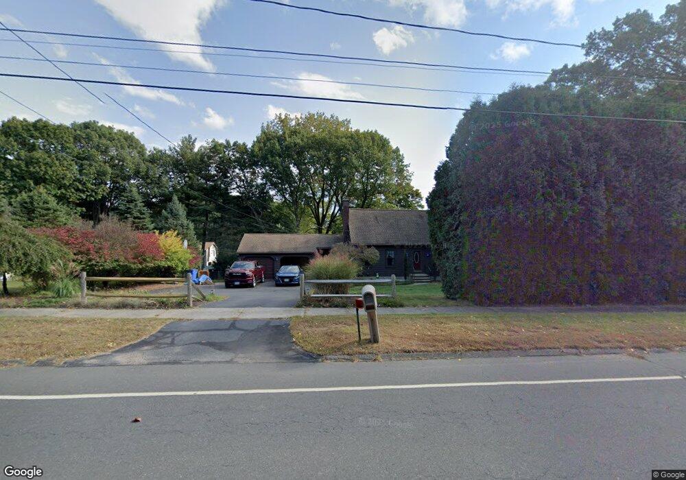
129 James P Casey Rd Bristol, CT 06010
North Bristol NeighborhoodEstimated Value: $448,841 - $486,000
4
Beds
3
Baths
1,784
Sq Ft
$258/Sq Ft
Est. Value
About This Home
This home is located at 129 James P Casey Rd, Bristol, CT 06010 and is currently estimated at $460,710, approximately $258 per square foot. 129 James P Casey Rd is a home located in Hartford County with nearby schools including West Bristol Sch, Bristol Central High School, and St. Joseph School.
Ownership History
Date
Name
Owned For
Owner Type
Purchase Details
Closed on
Nov 27, 1996
Sold by
Johns Charles E and Johns Patricia M
Bought by
Romano Anthony R and Romano Robin S
Current Estimated Value
Home Financials for this Owner
Home Financials are based on the most recent Mortgage that was taken out on this home.
Original Mortgage
$126,000
Outstanding Balance
$12,947
Interest Rate
7.82%
Mortgage Type
Unknown
Estimated Equity
$447,763
Create a Home Valuation Report for This Property
The Home Valuation Report is an in-depth analysis detailing your home's value as well as a comparison with similar homes in the area
Home Values in the Area
Average Home Value in this Area
Purchase History
| Date | Buyer | Sale Price | Title Company |
|---|---|---|---|
| Romano Anthony R | $140,000 | -- |
Source: Public Records
Mortgage History
| Date | Status | Borrower | Loan Amount |
|---|---|---|---|
| Closed | Romano Anthony R | $55,500 | |
| Open | Romano Anthony R | $126,000 | |
| Previous Owner | Romano Anthony R | $88,000 | |
| Previous Owner | Romano Anthony R | $90,000 |
Source: Public Records
Tax History Compared to Growth
Tax History
| Year | Tax Paid | Tax Assessment Tax Assessment Total Assessment is a certain percentage of the fair market value that is determined by local assessors to be the total taxable value of land and additions on the property. | Land | Improvement |
|---|---|---|---|---|
| 2025 | $7,874 | $233,310 | $58,660 | $174,650 |
| 2024 | $6,874 | $215,810 | $58,660 | $157,150 |
| 2023 | $6,550 | $215,810 | $58,660 | $157,150 |
| 2022 | $5,976 | $155,820 | $45,850 | $109,970 |
| 2021 | $5,976 | $155,820 | $45,850 | $109,970 |
| 2020 | $5,976 | $155,820 | $45,850 | $109,970 |
| 2019 | $5,929 | $155,820 | $45,850 | $109,970 |
| 2018 | $5,747 | $155,820 | $45,850 | $109,970 |
| 2017 | $5,599 | $155,400 | $62,370 | $93,030 |
| 2016 | $5,599 | $155,400 | $62,370 | $93,030 |
| 2015 | $5,378 | $155,400 | $62,370 | $93,030 |
| 2014 | $5,378 | $155,400 | $62,370 | $93,030 |
Source: Public Records
Map
Nearby Homes
- 62 (Lot 13-1) James P Casey Rd
- 0 Hart St Unit 170255530
- 1970 Perkins St
- 114 El Toro Dr
- 90 Battle St
- 439 James P Casey Rd
- 35 James P Casey Rd
- 48 Boivin St
- 276 Hart St
- 146 Perkins St
- 112 Ambler Rd
- 454 Maple Ave
- 116 Larkspur Ln
- 88 N Pond St
- 36 Henderson St
- 15 Alder St
- 321 Matthews St
- 6 Sand Hill Rd
- 127 Curtiss St
- 15 Jan Rd
- 120 James P Casey Rd
- 120 Elberta St
- 104 Elberta St
- 99 Elberta St
- 108 James P Casey Rd
- 99 James P Casey Rd
- 398 Baldwin Dr
- 397 Baldwin Dr
- 86 Elberta St
- 98 James P Casey Rd
- 85 James P Casey Rd
- 382 Baldwin Dr
- 175 Mcintosh Dr
- 381 Baldwin Dr
- 86 James P Casey Rd
- 68 Elberta St
- 176 Mcintosh Dr
- 159 Mcintosh Dr
- 370 Baldwin Dr
- 160 Mcintosh Dr