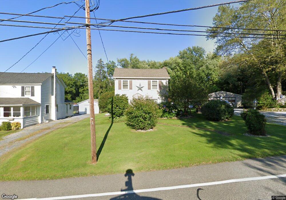
129 Jonestown Rd Oxford, NJ 07863
Estimated Value: $260,328 - $344,000
--
Bed
--
Bath
1,232
Sq Ft
$256/Sq Ft
Est. Value
About This Home
This home is located at 129 Jonestown Rd, Oxford, NJ 07863 and is currently estimated at $314,832, approximately $255 per square foot. 129 Jonestown Rd is a home located in Warren County with nearby schools including Oxford Central School.
Ownership History
Date
Name
Owned For
Owner Type
Purchase Details
Closed on
Mar 23, 2000
Sold by
Perrine Roger E and Perrine Barbara
Bought by
Kern Richard A and Kern Dawn M
Current Estimated Value
Home Financials for this Owner
Home Financials are based on the most recent Mortgage that was taken out on this home.
Original Mortgage
$90,000
Outstanding Balance
$30,743
Interest Rate
8.4%
Mortgage Type
FHA
Estimated Equity
$284,089
Create a Home Valuation Report for This Property
The Home Valuation Report is an in-depth analysis detailing your home's value as well as a comparison with similar homes in the area
Home Values in the Area
Average Home Value in this Area
Purchase History
| Date | Buyer | Sale Price | Title Company |
|---|---|---|---|
| Kern Richard A | $91,000 | -- |
Source: Public Records
Mortgage History
| Date | Status | Borrower | Loan Amount |
|---|---|---|---|
| Open | Kern Richard A | $90,000 |
Source: Public Records
Tax History Compared to Growth
Tax History
| Year | Tax Paid | Tax Assessment Tax Assessment Total Assessment is a certain percentage of the fair market value that is determined by local assessors to be the total taxable value of land and additions on the property. | Land | Improvement |
|---|---|---|---|---|
| 2025 | $6,582 | $135,800 | $56,400 | $79,400 |
| 2024 | $6,061 | $135,800 | $56,400 | $79,400 |
| 2023 | $5,958 | $135,800 | $56,400 | $79,400 |
| 2022 | $5,958 | $135,800 | $56,400 | $79,400 |
| 2021 | $5,569 | $135,800 | $56,400 | $79,400 |
| 2020 | $5,666 | $135,800 | $56,400 | $79,400 |
| 2019 | $5,454 | $135,800 | $56,400 | $79,400 |
| 2018 | $5,454 | $135,800 | $56,400 | $79,400 |
| 2017 | $5,333 | $135,800 | $56,400 | $79,400 |
| 2016 | $5,364 | $135,800 | $56,400 | $79,400 |
| 2015 | $5,831 | $187,800 | $99,500 | $88,300 |
| 2014 | $5,467 | $187,800 | $99,500 | $88,300 |
Source: Public Records
Map
Nearby Homes
- 76 Washington Ave
- 40 Washington Ave
- 15 Henderson St
- 100 Pinehurst Dr Unit 505
- 95 Pinehurst Dr Unit 602
- 15 Pinehurst Dr Unit 1903
- 81 Pinehurst Dr Unit 804
- 20 Belvidere Ave
- 55 Congressional Blvd Unit 1302
- 56 Congressional Blvd Unit 1301
- 50 Zulauf Ln
- 49 Henry St
- 138 Belvidere Ave
- 11 Scranton Pkwy
- 5 Orams Ln
- 121 New St
- 45 Bush St
- 9 Front St
- 11 Front St
- 7 Pebble Beach Way
- 127 Jonestown Rd
- 123 Jonestown Rd
- 121 Jonestown Rd
- 119 Jonestown Rd
- 115 Jonestown Rd
- 111 Jonestown Rd
- 109 Jonestown Rd
- 105 Jonestown Rd
- 103 Jonestown Rd
- 99 Jonestown Rd
- 95 Jonestown Rd
- 93 Jonestown Rd
- 89 Jonestown Rd
- 165B Jonestown Rd
- 165 Jonestown Rd
- 165 Jonestown Rd Unit A-B
- 170 Jonestown Rd
- 87 Jonestown Rd
- 171 Jonestown Rd
- 81 Jonestown Rd