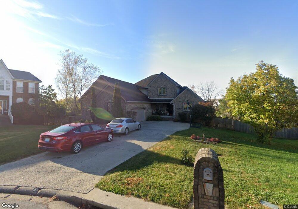
129 Keelridge Dr Georgetown, KY 40324
Estimated Value: $363,000 - $430,276
4
Beds
4
Baths
2,349
Sq Ft
$172/Sq Ft
Est. Value
About This Home
This home is located at 129 Keelridge Dr, Georgetown, KY 40324 and is currently estimated at $404,819, approximately $172 per square foot. 129 Keelridge Dr is a home located in Scott County with nearby schools including Anne Mason Elementary School, Creekside Elementary School, and Scott County Middle School.
Ownership History
Date
Name
Owned For
Owner Type
Purchase Details
Closed on
Mar 2, 2021
Sold by
Lobitz Richard H and Lobitz Janet G
Bought by
Smith Kristi L and Young Kandi L
Current Estimated Value
Home Financials for this Owner
Home Financials are based on the most recent Mortgage that was taken out on this home.
Original Mortgage
$209,000
Outstanding Balance
$187,354
Interest Rate
2.7%
Mortgage Type
New Conventional
Estimated Equity
$217,465
Create a Home Valuation Report for This Property
The Home Valuation Report is an in-depth analysis detailing your home's value as well as a comparison with similar homes in the area
Home Values in the Area
Average Home Value in this Area
Purchase History
| Date | Buyer | Sale Price | Title Company |
|---|---|---|---|
| Smith Kristi L | -- | None Available |
Source: Public Records
Mortgage History
| Date | Status | Borrower | Loan Amount |
|---|---|---|---|
| Open | Smith Kristi L | $209,000 |
Source: Public Records
Tax History Compared to Growth
Tax History
| Year | Tax Paid | Tax Assessment Tax Assessment Total Assessment is a certain percentage of the fair market value that is determined by local assessors to be the total taxable value of land and additions on the property. | Land | Improvement |
|---|---|---|---|---|
| 2024 | $2,926 | $325,400 | $0 | $0 |
| 2023 | $2,737 | $301,900 | $50,000 | $251,900 |
| 2022 | $2,399 | $282,200 | $42,000 | $240,200 |
| 2021 | $2,495 | $264,900 | $42,000 | $222,900 |
| 2020 | $2,164 | $251,900 | $42,000 | $209,900 |
| 2019 | $2,137 | $244,900 | $0 | $0 |
| 2018 | $2,024 | $233,250 | $0 | $0 |
| 2017 | $2,034 | $233,250 | $0 | $0 |
| 2016 | $1,878 | $233,250 | $0 | $0 |
| 2015 | $1,851 | $231,300 | $0 | $0 |
| 2014 | $1,918 | $231,300 | $0 | $0 |
| 2011 | $146 | $236,029 | $0 | $0 |
Source: Public Records
Map
Nearby Homes
- 129 Cornwallis Dr
- 145 Inverness Dr
- 177 Swilcan Bridge Way
- 245 Sturbridge Dr
- 106 Plymouth Ct
- 194 Shinnecock Hill Dr
- 98 Delissa Dr
- 210 Taylorsville Trail
- 141 Shinnecock Hill Dr
- 442 General John Payne Blvd
- 106 Cave Run Ct
- 103 War Admiral Way
- 516 Oak St
- 126 Autumn Leaf Path
- 109 Blackberry Ln
- 209 Christal Dr
- 109 Acorn Path
- 113 Blackberry Ln
- 116 Falls Creek Dr
- 119 Acorn Path
- 133 Keelridge Dr
- 125 Keelridge Dr
- 137 Keelridge Dr
- 137 Keelridge Dr Unit 1
- 121 Keelridge Dr
- 141 Keelridge Dr
- 96 Stony Point Dr
- 117 Keelridge Dr
- 100 Minuteman Dr
- 101 Minuteman Dr
- 132 Keelridge Dr
- 101 Stony Point Dr
- 100 Wabash Dr
- 145 Keelridge Dr
- 113 Keelridge Dr
- 103 Minuteman Dr
- 116 Keelridge Dr
- 101 Wabash Dr
- 102 Wabash Dr
- 104 Minuteman Dr