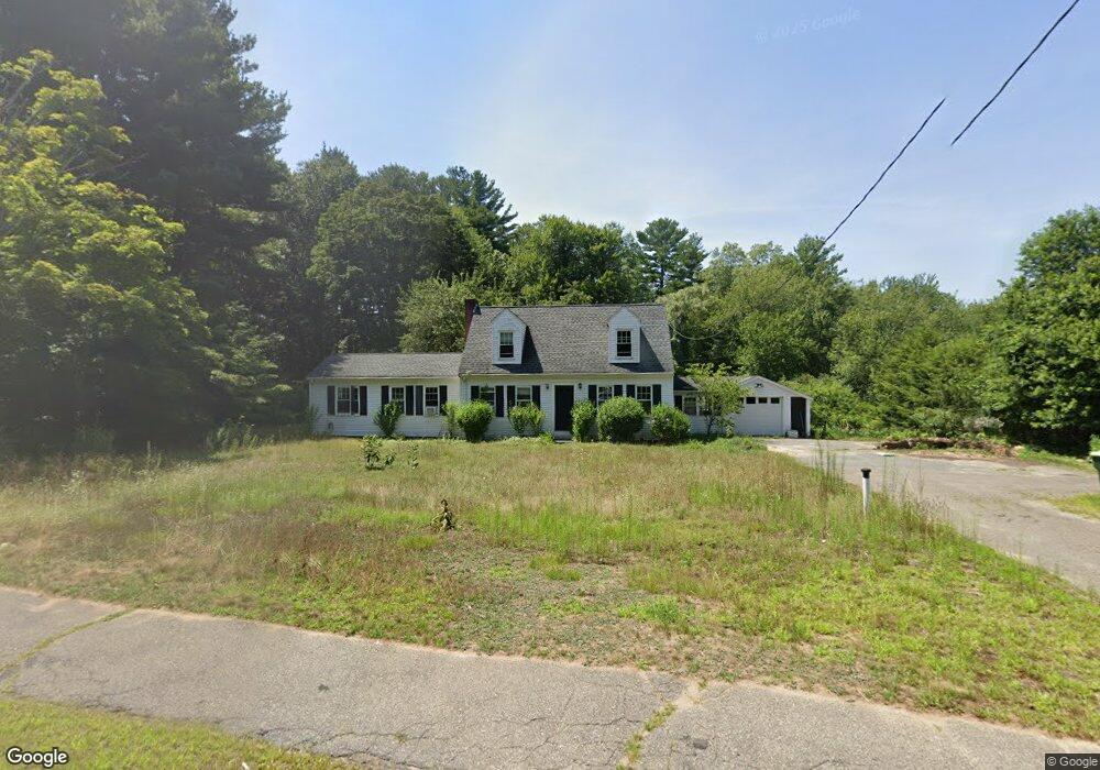
129 Landham Rd Sudbury, MA 01776
Estimated Value: $790,000 - $860,000
3
Beds
2
Baths
1,641
Sq Ft
$498/Sq Ft
Est. Value
About This Home
This home is located at 129 Landham Rd, Sudbury, MA 01776 and is currently estimated at $817,600, approximately $498 per square foot. 129 Landham Rd is a home located in Middlesex County with nearby schools including Israel Loring Elementary School, Ephraim Curtis Middle School, and Lincoln-Sudbury Regional High School.
Ownership History
Date
Name
Owned For
Owner Type
Purchase Details
Closed on
Sep 16, 2009
Sold by
Cutler Roger E and Cutler Joseph S
Bought by
Macdonald-Jack Gwynneth J
Current Estimated Value
Home Financials for this Owner
Home Financials are based on the most recent Mortgage that was taken out on this home.
Original Mortgage
$279,000
Outstanding Balance
$183,297
Interest Rate
5.28%
Mortgage Type
Purchase Money Mortgage
Estimated Equity
$634,303
Purchase Details
Closed on
Aug 16, 2004
Sold by
Cutler Virginia
Bought by
Cutler Joseph S and Cutler Roger E
Create a Home Valuation Report for This Property
The Home Valuation Report is an in-depth analysis detailing your home's value as well as a comparison with similar homes in the area
Home Values in the Area
Average Home Value in this Area
Purchase History
| Date | Buyer | Sale Price | Title Company |
|---|---|---|---|
| Macdonald-Jack Gwynneth J | $331,500 | -- | |
| Cutler Joseph S | -- | -- |
Source: Public Records
Mortgage History
| Date | Status | Borrower | Loan Amount |
|---|---|---|---|
| Open | Macdonald-Jack Gwynneth J | $279,000 |
Source: Public Records
Tax History Compared to Growth
Tax History
| Year | Tax Paid | Tax Assessment Tax Assessment Total Assessment is a certain percentage of the fair market value that is determined by local assessors to be the total taxable value of land and additions on the property. | Land | Improvement |
|---|---|---|---|---|
| 2025 | $10,129 | $691,900 | $434,000 | $257,900 |
| 2024 | $9,797 | $670,600 | $421,600 | $249,000 |
| 2023 | $9,874 | $626,100 | $384,000 | $242,100 |
| 2022 | $9,707 | $537,800 | $353,200 | $184,600 |
| 2021 | $9,532 | $506,200 | $353,200 | $153,000 |
| 2020 | $9,339 | $506,200 | $353,200 | $153,000 |
| 2019 | $9,066 | $506,200 | $353,200 | $153,000 |
| 2018 | $8,969 | $500,200 | $357,200 | $143,000 |
| 2017 | $8,506 | $479,500 | $345,200 | $134,300 |
| 2016 | $8,206 | $461,000 | $332,400 | $128,600 |
| 2015 | $7,821 | $444,400 | $317,200 | $127,200 |
| 2014 | $7,766 | $430,700 | $306,400 | $124,300 |
Source: Public Records
Map
Nearby Homes
- 0 Wagonwheel Rd
- 63 Landham Rd
- 216 Landham Rd
- 84 Hopestill Brown Rd
- 23 Cider Mill Rd
- 23 Massasoit Ave
- 94 Goodmans Hill Rd
- 6 Old County Rd Unit 16
- 36 Concord Rd
- 30 Edith Rd
- 1011 Boston Post Rd
- 14 Eisenhower Rd
- 8 Clara Rd
- 24 Pinewood Dr
- 91 Eaton Rd W
- 14 Francine Rd
- 128 Nobscot Rd
- 27 Sloane Dr
- 81 Nicholas Rd Unit B
- 19 Nob Hill Dr
- 121 Landham Rd
- 5 Blackmer Rd
- 3 Woodside Rd
- 4 Blackmer Rd
- 141 Landham Rd
- 11 Blackmer Rd
- 96 Cutler Farm Rd
- 146 Landham Rd
- 113 Landham Rd
- 16 Woodside Rd
- 14 Blackmer Rd
- 88 Cutler Farm Rd
- 15 Woodside Rd
- 15 Blackmer Rd
- 15 Blackmer Rd Unit 15
- 155 Landham Rd
- 105 Landham Rd
- 80 Cutler Farm Rd
- 24 Woodside Rd
- 93 Cutler Farm Rd