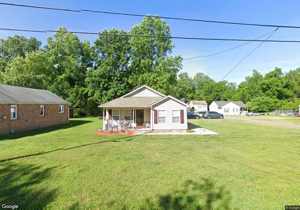
129 Magruder Ave Williamsburg, VA 23185
Kingsmill NeighborhoodEstimated Value: $190,000 - $306,000
3
Beds
2
Baths
1,158
Sq Ft
$211/Sq Ft
Est. Value
About This Home
This home is located at 129 Magruder Ave, Williamsburg, VA 23185 and is currently estimated at $244,289, approximately $210 per square foot. 129 Magruder Ave is a home located in James City County with nearby schools including James River Elementary School, Berkeley Middle School, and Jamestown High School.
Ownership History
Date
Name
Owned For
Owner Type
Purchase Details
Closed on
Jan 23, 2006
Sold by
Pen Habitat For Humanity
Bought by
White Joyce
Current Estimated Value
Home Financials for this Owner
Home Financials are based on the most recent Mortgage that was taken out on this home.
Original Mortgage
$80,550
Outstanding Balance
$45,382
Interest Rate
6.31%
Mortgage Type
New Conventional
Estimated Equity
$198,907
Create a Home Valuation Report for This Property
The Home Valuation Report is an in-depth analysis detailing your home's value as well as a comparison with similar homes in the area
Home Values in the Area
Average Home Value in this Area
Purchase History
| Date | Buyer | Sale Price | Title Company |
|---|---|---|---|
| White Joyce | $150,000 | -- |
Source: Public Records
Mortgage History
| Date | Status | Borrower | Loan Amount |
|---|---|---|---|
| Open | White Joyce | $80,550 |
Source: Public Records
Tax History Compared to Growth
Tax History
| Year | Tax Paid | Tax Assessment Tax Assessment Total Assessment is a certain percentage of the fair market value that is determined by local assessors to be the total taxable value of land and additions on the property. | Land | Improvement |
|---|---|---|---|---|
| 2025 | $1,213 | $155,500 | $81,900 | $73,600 |
| 2024 | $1,213 | $155,500 | $81,900 | $73,600 |
| 2023 | $1,213 | $126,000 | $52,400 | $73,600 |
| 2022 | $1,046 | $126,000 | $52,400 | $73,600 |
| 2021 | $957 | $113,900 | $40,300 | $73,600 |
| 2020 | $957 | $113,900 | $40,300 | $73,600 |
| 2019 | $950 | $113,100 | $39,500 | $73,600 |
| 2018 | $950 | $113,100 | $39,500 | $73,600 |
| 2017 | $926 | $110,200 | $36,600 | $73,600 |
| 2016 | $926 | $110,200 | $36,600 | $73,600 |
| 2015 | $459 | $109,400 | $35,800 | $73,600 |
| 2014 | $842 | $109,400 | $35,800 | $73,600 |
Source: Public Records
Map
Nearby Homes
- 112 Ron Springs Dr
- 1873 Ferrell Dr
- 149 Howard Dr
- 123 Howard Dr
- 110 Tarleton Bivouac
- 1704 Skiffes Creek Cir
- 1653 Skiffes Creek Cir
- 1641 Skiffes Creek Cir
- 111 Rivers Edge
- 104 Captaine Graves
- 116 Greens Way
- 117 Pierces Ct
- 215 Rivers Edge Unit A
- 215 Rivers Edge
- 132 Jeffersons Hundred
- 302 Rivers Edge
- 412 Rivers Edge
- 424 Rivers Edge
- 203 Warehams Point
- 127 Magruder Ave
- 123 Magruder Ave
- 131 Magruder Ave
- 132 Magruder Ave
- 122 Magruder Ave
- 137 Magruder Ave
- 135 Magruder Ave
- 124 Ron Springs Dr
- 134 Magruder Ave
- 136 Magruder Ave
- 139 Magruder Ave
- 119 Magruder Ave
- 118 Magruder Ave
- 133 Magruder Ave
- 143 Magruder Ave
- 116 Magruder Ave
- 140 Magruder Ave
- 115 Magruder Ave
- 8715 Pocahontas Trail
- 142 Magruder Ave