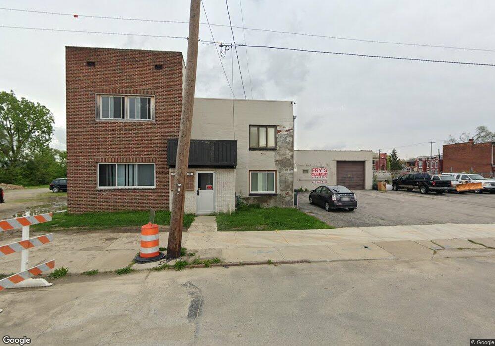
129 Maumee Ave Toledo, OH 43609
Southside Neighborhood
--
Bed
--
Bath
11,164
Sq Ft
--
Built
About This Home
This home is located at 129 Maumee Ave, Toledo, OH 43609. 129 Maumee Ave is a home located in Lucas County with nearby schools including Marshall Stemm Academy, Jesup W. Scott High School, and Summit Academy - Toledo.
Ownership History
Date
Name
Owned For
Owner Type
Purchase Details
Closed on
Oct 22, 2015
Sold by
Deal Paul W and Kapszukiewicz Wade
Bought by
Fry Donald and Fry Diana
Purchase Details
Closed on
May 22, 1998
Sold by
Deal Carol J
Bought by
Deal Paul W
Purchase Details
Closed on
Sep 25, 1995
Sold by
Trst Duane S Love
Bought by
Deal Paul W and Deal Carol J
Home Financials for this Owner
Home Financials are based on the most recent Mortgage that was taken out on this home.
Original Mortgage
$171,700
Interest Rate
7.78%
Mortgage Type
Commercial
Purchase Details
Closed on
Aug 25, 1995
Sold by
Duane S Love Trst
Bought by
Deal Carol J and Deal Paul W
Home Financials for this Owner
Home Financials are based on the most recent Mortgage that was taken out on this home.
Original Mortgage
$171,700
Interest Rate
7.78%
Mortgage Type
Commercial
Purchase Details
Closed on
Dec 19, 1990
Create a Home Valuation Report for This Property
The Home Valuation Report is an in-depth analysis detailing your home's value as well as a comparison with similar homes in the area
Home Values in the Area
Average Home Value in this Area
Purchase History
| Date | Buyer | Sale Price | Title Company |
|---|---|---|---|
| Fry Donald | $44,172 | None Available | |
| Deal Paul W | -- | -- | |
| Deal Paul W | $192,000 | -- | |
| Deal Carol J | $192,000 | -- | |
| -- | -- | -- |
Source: Public Records
Mortgage History
| Date | Status | Borrower | Loan Amount |
|---|---|---|---|
| Previous Owner | Deal Paul W | $171,700 | |
| Previous Owner | Deal Carol J | $171,700 |
Source: Public Records
Tax History Compared to Growth
Tax History
| Year | Tax Paid | Tax Assessment Tax Assessment Total Assessment is a certain percentage of the fair market value that is determined by local assessors to be the total taxable value of land and additions on the property. | Land | Improvement |
|---|---|---|---|---|
| 2024 | $10,263 | $81,585 | $2,520 | $79,065 |
| 2023 | $2,147 | $18,375 | $2,485 | $15,890 |
| 2022 | $2,114 | $18,375 | $2,485 | $15,890 |
| 2021 | $2,146 | $18,375 | $2,485 | $15,890 |
| 2020 | $2,197 | $17,500 | $2,380 | $15,120 |
| 2019 | $2,157 | $17,500 | $2,380 | $15,120 |
| 2018 | $3,665 | $17,500 | $2,380 | $15,120 |
| 2017 | $2,149 | $17,500 | $2,380 | $15,120 |
| 2016 | $2,192 | $50,000 | $6,800 | $43,200 |
| 2015 | $5,185 | $139,700 | $6,800 | $132,900 |
| 2014 | $6,521 | $48,900 | $2,380 | $46,520 |
| 2013 | $4,347 | $48,900 | $2,380 | $46,520 |
Source: Public Records
Map
Nearby Homes
- 233 Garland Ave
- 407 Western Ave
- 318 Courtland Ave
- 215 Eastern Ave
- 308 Crittenden Ave
- 205 Eastern Ave
- 210 Western Ave
- 18 City Park Ave
- 520 Emerald Ave
- 413 Walbridge Ave
- 647 Curtis St
- 58 City Park
- 702 Boalt St
- 356 Sumner St
- 650 Curtis St
- 244 Knower St
- 518 South Ave
- 714 Walbridge Ave
- 323 Langdon St
- 223 Charles St
- 112 Carroll Place
- 118 Carroll Place
- 110 Carroll Place
- 124 Carroll Place
- 120 Carroll Place
- 440 Segur Ave
- 637 Segur Ave
- 357 Garland Ave
- 203 Maumee Ave
- 418 Segur Ave
- 431 Segur Ave
- 443 Segur Ave
- 439 Segur Ave
- 425 Segur Ave
- 435 Segur Ave
- 207 Maumee Ave
- 416 Segur Ave
- 351 Garland Ave
- 209 Maumee Ave
- 206 Maumee Ave