Estimated Value: $250,000 - $293,361
Studio
2
Baths
2,380
Sq Ft
$115/Sq Ft
Est. Value
About This Home
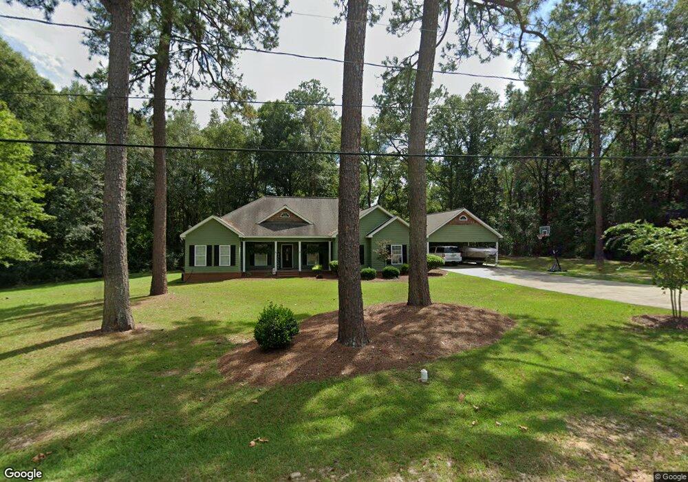
This home is located at 129 Mcbride Ave, Lyons, GA 30436 and is currently estimated at $273,840, approximately $115 per square foot. 129 Mcbride Ave is a home located in Toombs County with nearby schools including Toombs County High School and Robert Toombs Christian Academy.
Ownership History
Date
Name
Owned For
Owner Type
Purchase Details
Closed on
Dec 16, 2008
Sold by
Plowman Michael A
Bought by
Plowman Michael A
Current Estimated Value
Home Financials for this Owner
Home Financials are based on the most recent Mortgage that was taken out on this home.
Original Mortgage
$163,098
Outstanding Balance
$105,979
Interest Rate
5.96%
Mortgage Type
New Conventional
Estimated Equity
$167,861
Purchase Details
Closed on
Sep 2, 2008
Sold by
Suntrust Mortgage Inc
Bought by
Federal Home Loan Mortgage Corporation
Purchase Details
Closed on
Dec 6, 2005
Sold by
Johnson Edward
Bought by
Wingate Ralph Douglas
Purchase Details
Closed on
Sep 7, 1999
Sold by
Hartsell Audie M and Hartsell Wade
Bought by
Johnson Edward
Purchase Details
Closed on
Apr 27, 1990
Sold by
Mims George and Mims Elizabeth
Bought by
Hartsell Audie M and Hartsell Wade
Create a Home Valuation Report for This Property
The Home Valuation Report is an in-depth analysis detailing your home's value as well as a comparison with similar homes in the area
Home Values in the Area
Average Home Value in this Area
Purchase History
| Date | Buyer | Sale Price | Title Company |
|---|---|---|---|
| Plowman Michael A | $159,900 | -- | |
| Federal Home Loan Mortgage Corporation | $210,000 | -- | |
| Not Provided | $210,000 | -- | |
| Wingate Ralph Douglas | $9,000 | -- | |
| Johnson Edward | $2,400 | -- | |
| Hartsell Audie M | $65,000 | -- |
Source: Public Records
Mortgage History
| Date | Status | Borrower | Loan Amount |
|---|---|---|---|
| Open | Plowman Michael A | $163,098 |
Source: Public Records
Tax History
| Year | Tax Paid | Tax Assessment Tax Assessment Total Assessment is a certain percentage of the fair market value that is determined by local assessors to be the total taxable value of land and additions on the property. | Land | Improvement |
|---|---|---|---|---|
| 2025 | $1,504 | $127,704 | $3,840 | $123,864 |
| 2024 | $1,531 | $127,704 | $3,840 | $123,864 |
| 2023 | $1,558 | $114,816 | $3,840 | $110,976 |
| 2022 | $1,545 | $101,781 | $3,840 | $97,941 |
| 2021 | $1,571 | $91,200 | $3,840 | $87,360 |
| 2020 | $1,599 | $89,162 | $3,840 | $85,322 |
| 2019 | $1,544 | $89,162 | $3,840 | $85,322 |
| 2018 | $1,486 | $88,616 | $3,840 | $84,776 |
| 2017 | $1,485 | $82,719 | $3,840 | $78,879 |
| 2016 | $1,560 | $82,719 | $3,840 | $78,879 |
| 2015 | -- | $62,208 | $3,840 | $58,368 |
| 2014 | -- | $62,208 | $3,840 | $58,368 |
Source: Public Records
Map
Nearby Homes
- 172 W Leo Trapnell Ave
- 0 N Washington St
- 0 Mclemore St Unit 10678733
- 105 Skyline Blvd
- 614 N Victory Dr
- 177 Skyline Blvd
- 134 Alexander Ave
- 0 Victory Cir Unit 23870
- 0 Victory Cir Unit 10657838
- 306 W Wesley Ave
- 0 N State St Unit 26009
- 169 Ext N Jefferson St
- 253 McDilda Dr
- 107 Newton Dr
- 165 N Hamilton St
- 130 S Washington St
- 444 Aiken Cir
- 564 W Oglethorpe Ave
- 127 W Stuart Ave
- 0 Hilton Ct Unit 10498788
- 560 N Washington St
- 521 N State St
- 579 N State St
- 561 N Washington St
- 582 N Washington St
- 591 N State St
- 4237 Route 1
- 35 Acres Route 1
- 1739 Route 1
- 0 U S Highway 1 N
- 552 N Jefferson St
- 583 N Washington St
- 176 Mcbride Ave
- 497 N State St
- 498 N Jefferson St
- 545 N Jefferson St
- 555 N Jefferson St
- 596 N Jefferson St
- 535 N Jefferson St
- 525 N Jefferson St
Your Personal Tour Guide
Ask me questions while you tour the home.