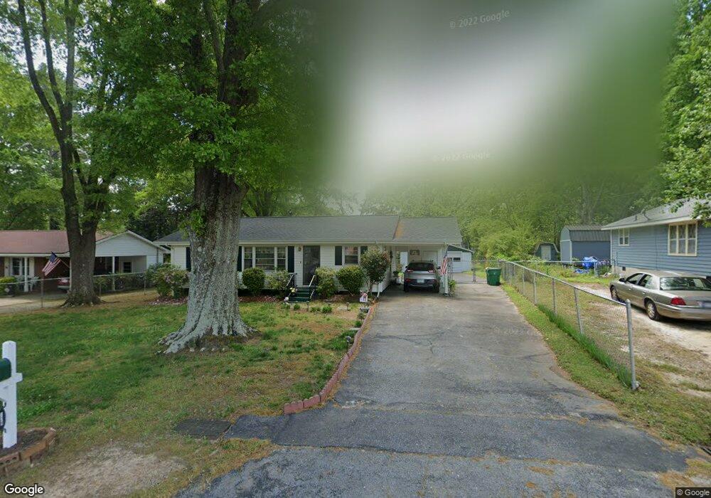
129 Mcelroy St Winder, GA 30680
Estimated Value: $222,378 - $267,000
2
Beds
1
Bath
1,080
Sq Ft
$222/Sq Ft
Est. Value
About This Home
This home is located at 129 Mcelroy St, Winder, GA 30680 and is currently estimated at $239,345, approximately $221 per square foot. 129 Mcelroy St is a home located in Barrow County with nearby schools including Holsenbeck Elementary School, Bear Creek Middle School, and Winder-Barrow High School.
Ownership History
Date
Name
Owned For
Owner Type
Purchase Details
Closed on
Jul 24, 2006
Sold by
Hensley Troy and Hensley Burgundy
Bought by
Hamilton Myra A
Current Estimated Value
Home Financials for this Owner
Home Financials are based on the most recent Mortgage that was taken out on this home.
Original Mortgage
$44,625
Outstanding Balance
$25,998
Interest Rate
6.6%
Mortgage Type
New Conventional
Estimated Equity
$213,347
Purchase Details
Closed on
Feb 15, 1984
Bought by
Brown Jane S
Create a Home Valuation Report for This Property
The Home Valuation Report is an in-depth analysis detailing your home's value as well as a comparison with similar homes in the area
Home Values in the Area
Average Home Value in this Area
Purchase History
| Date | Buyer | Sale Price | Title Company |
|---|---|---|---|
| Hamilton Myra A | $89,300 | -- | |
| Brown Jane S | $30,000 | -- |
Source: Public Records
Mortgage History
| Date | Status | Borrower | Loan Amount |
|---|---|---|---|
| Open | Hamilton Myra A | $44,625 |
Source: Public Records
Tax History
| Year | Tax Paid | Tax Assessment Tax Assessment Total Assessment is a certain percentage of the fair market value that is determined by local assessors to be the total taxable value of land and additions on the property. | Land | Improvement |
|---|---|---|---|---|
| 2025 | $649 | $62,056 | $12,000 | $50,056 |
| 2024 | $654 | $60,502 | $12,000 | $48,502 |
| 2023 | $460 | $60,502 | $12,000 | $48,502 |
| 2022 | $550 | $40,732 | $12,000 | $28,732 |
| 2021 | $432 | $38,920 | $12,000 | $26,920 |
| 2020 | $372 | $31,486 | $10,000 | $21,486 |
| 2019 | $311 | $26,695 | $8,000 | $18,695 |
| 2018 | $300 | $26,695 | $8,000 | $18,695 |
| 2017 | $704 | $23,587 | $8,000 | $15,587 |
| 2016 | $162 | $23,587 | $8,000 | $15,587 |
| 2015 | $345 | $23,587 | $8,000 | $15,587 |
| 2014 | $214 | $21,075 | $5,488 | $15,587 |
| 2013 | -- | $20,374 | $5,488 | $14,886 |
Source: Public Records
Map
Nearby Homes
- 221 Martin Luther King jr Dr
- 227 Martin Luther King jr Dr
- 208 Shields St
- 270 Griffith St
- 317 Georgia Ave
- 337 Mary Alice Dr
- 403 Corinth Church Rd
- 209 Georgia Ave
- 267 Nancy St
- 131 Pinehurst Dr
- 18 E New St
- 122 Capitol Ave
- 323 Lumpkin St
- 260 Westlyn Way
- 184 Capitol Ave
- 72 Shoal Ct
- 74 Shoal Ct
- 76 Shoal Ct
- 10 W Wright St
- 88 E Stephens St
- 125 Mcelroy St
- 133 Mcelroy St
- 121 Mcelroy St
- 224 King St
- 216 King St
- 182 Shields St
- 178 Shields St
- 128 Mcelroy St
- 120 Mcelroy St
- 117 Mcelroy St
- 174 Shields St
- 212 King St
- 212 Martin Luther King jr Dr
- 136 Mcelroy St
- 116 Mcelroy St
- 170 Shields St
- 217 King St
- 113 Mcelroy St
- 177 Folly St
- 225 Martin Luther King jr Dr
Your Personal Tour Guide
Ask me questions while you tour the home.