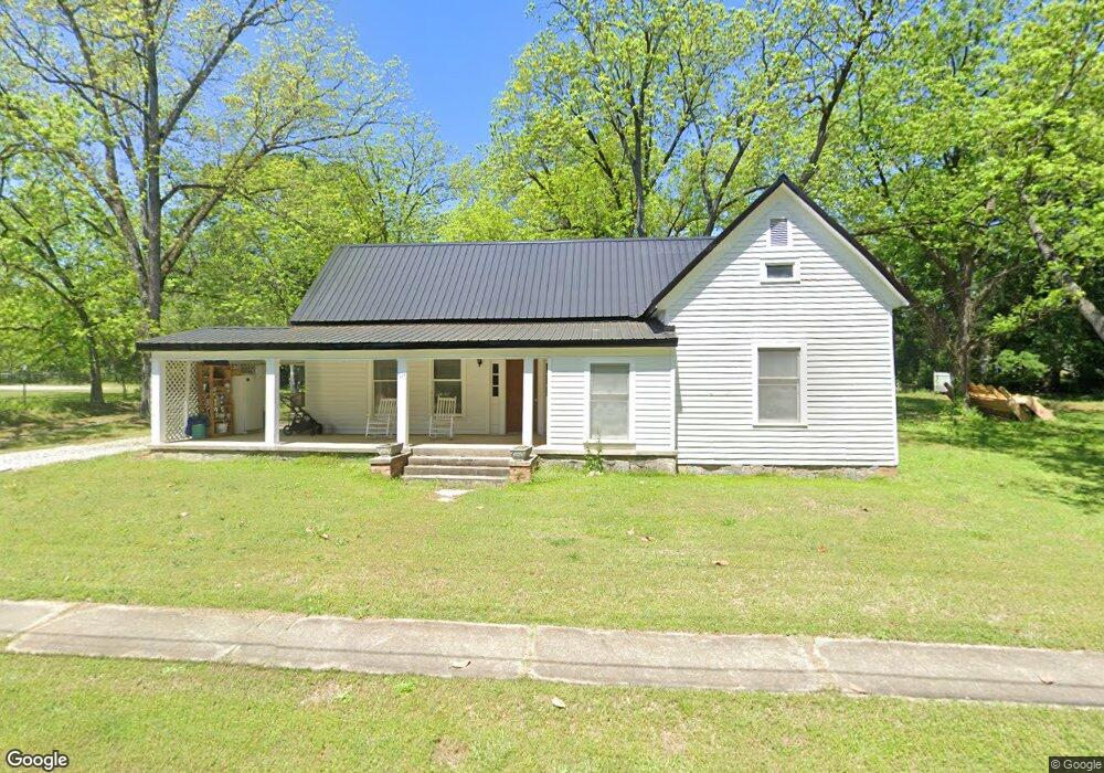
129 N Broad St Bowman, GA 30624
Estimated Value: $172,000 - $251,000
--
Bed
2
Baths
1,501
Sq Ft
$130/Sq Ft
Est. Value
About This Home
This home is located at 129 N Broad St, Bowman, GA 30624 and is currently estimated at $195,700, approximately $130 per square foot. 129 N Broad St is a home located in Elbert County with nearby schools including Elbert County Elementary School, Elbert County Primary School, and Elbert County Middle School.
Ownership History
Date
Name
Owned For
Owner Type
Purchase Details
Closed on
Nov 6, 2020
Sold by
Garmon Sarah Gene
Bought by
Davis John Mallory and Davis Jessica C
Current Estimated Value
Purchase Details
Closed on
May 21, 1981
Purchase Details
Closed on
May 1, 1981
Purchase Details
Closed on
Apr 1, 1976
Purchase Details
Closed on
Sep 15, 1975
Purchase Details
Closed on
Apr 1, 1974
Purchase Details
Closed on
Jan 1, 1944
Purchase Details
Closed on
Jan 1, 1930
Create a Home Valuation Report for This Property
The Home Valuation Report is an in-depth analysis detailing your home's value as well as a comparison with similar homes in the area
Home Values in the Area
Average Home Value in this Area
Purchase History
| Date | Buyer | Sale Price | Title Company |
|---|---|---|---|
| Davis John Mallory | $40,000 | -- | |
| -- | -- | -- | |
| -- | $33,000 | -- | |
| -- | $11,000 | -- | |
| -- | -- | -- | |
| -- | $17,500 | -- | |
| -- | -- | -- | |
| -- | -- | -- |
Source: Public Records
Tax History Compared to Growth
Tax History
| Year | Tax Paid | Tax Assessment Tax Assessment Total Assessment is a certain percentage of the fair market value that is determined by local assessors to be the total taxable value of land and additions on the property. | Land | Improvement |
|---|---|---|---|---|
| 2024 | $1,450 | $58,945 | $8,000 | $50,945 |
| 2023 | $1,450 | $58,945 | $8,000 | $50,945 |
| 2022 | $944 | $38,361 | $6,800 | $31,561 |
| 2021 | $397 | $38,361 | $6,800 | $31,561 |
| 2020 | $992 | $35,976 | $8,000 | $27,976 |
| 2019 | $1,024 | $35,976 | $8,000 | $27,976 |
| 2018 | $1,047 | $35,976 | $8,000 | $27,976 |
| 2017 | $981 | $31,230 | $8,000 | $23,230 |
| 2016 | $917 | $31,230 | $8,000 | $23,230 |
| 2015 | -- | $31,230 | $8,000 | $23,230 |
| 2014 | -- | $31,230 | $8,000 | $23,230 |
| 2013 | -- | $31,230 | $8,000 | $23,230 |
Source: Public Records
Map
Nearby Homes
- 0 Bowers St Unit LOT 1-8 10576344
- 0 Bowers St Unit LOT 1-8 CL335681
- 227 Rehoboth Rd
- 1963 Rehoboth Rd Unit EXTENSION
- 1963 Rehoboth Rd
- 0 Five Forks Rd Unit 10619685
- 3075 Sycamore Rd
- 3075 Sycamore Rd
- 2732 Zero O Dr
- 2198 Bennett Rd
- 0 Jess Guest Rd Unit CL336922
- 0 Jess Guest Rd Unit 10586921
- 0 LOT A Jess Guest Rd
- 2587 Quill Rd
- 2851 Bowman Hwy
- 2784 Stanley Maxwell Rd
- 0 Fork Creek Rd Unit 10616779
- 0 Fork Creek Rd Unit 7659678
- 0 Dusty Rd Unit 10569563
- 0 Dusty Rd Unit 7619983
- 110 N Broad St
- 101 N Broad St
- 163 N Broad St
- 151 Adams Cir
- 158 Adams Cir
- 108 N Broad St
- 85 N Broad St
- 136 Adams Cir
- 187 N Broad St
- 74 N Broad St
- 127 Adams Cir
- 69 N Broad St
- 63 N Broad St
- 63 N Broad St
- 54 N Broad St
- 134 Adams Cir
- 0 N Broad St Unit 8282165
- 0 N Broad St Unit 10373495
- 0 N Broad St Unit 10243725
- 0 N Broad St Unit 1013990