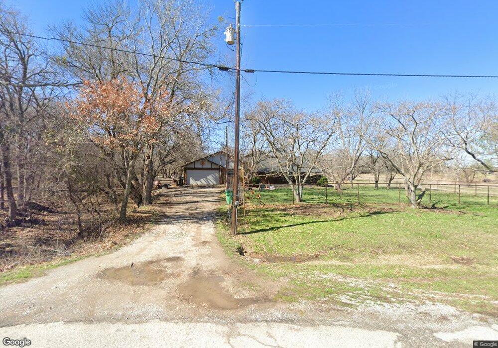
129 N Longhorn Dr Weatherford, TX 76085
Estimated Value: $498,000 - $589,000
3
Beds
2
Baths
2,018
Sq Ft
$263/Sq Ft
Est. Value
About This Home
This home is located at 129 N Longhorn Dr, Weatherford, TX 76085 and is currently estimated at $530,189, approximately $262 per square foot. 129 N Longhorn Dr is a home located in Parker County with nearby schools including Springtown Elementary School, Springtown Intermediate School, and Springtown Middle School.
Ownership History
Date
Name
Owned For
Owner Type
Purchase Details
Closed on
Jul 22, 2014
Sold by
Lathem Rodney A and Lathem Crystal L
Bought by
Eden Anthony
Current Estimated Value
Home Financials for this Owner
Home Financials are based on the most recent Mortgage that was taken out on this home.
Original Mortgage
$181,649
Outstanding Balance
$140,104
Interest Rate
4.5%
Mortgage Type
FHA
Estimated Equity
$390,085
Purchase Details
Closed on
Jun 28, 2012
Sold by
Hawley James Kevin
Bought by
Eden Anthony
Home Financials for this Owner
Home Financials are based on the most recent Mortgage that was taken out on this home.
Original Mortgage
$150,729
Interest Rate
3.8%
Mortgage Type
FHA
Purchase Details
Closed on
May 29, 1991
Bought by
Eden Anthony
Create a Home Valuation Report for This Property
The Home Valuation Report is an in-depth analysis detailing your home's value as well as a comparison with similar homes in the area
Home Values in the Area
Average Home Value in this Area
Purchase History
| Date | Buyer | Sale Price | Title Company |
|---|---|---|---|
| Eden Anthony | -- | Wctc | |
| Eden Anthony | -- | -- | |
| Lathem Rodney A | -- | Fnt | |
| Eden Anthony | -- | -- |
Source: Public Records
Mortgage History
| Date | Status | Borrower | Loan Amount |
|---|---|---|---|
| Open | Eden Anthony | $181,649 | |
| Previous Owner | Lathem Rodney A | $150,729 |
Source: Public Records
Tax History Compared to Growth
Tax History
| Year | Tax Paid | Tax Assessment Tax Assessment Total Assessment is a certain percentage of the fair market value that is determined by local assessors to be the total taxable value of land and additions on the property. | Land | Improvement |
|---|---|---|---|---|
| 2025 | $4,119 | $360,169 | -- | -- |
| 2024 | $4,119 | $327,426 | -- | -- |
| 2023 | $4,119 | $297,660 | $0 | $0 |
| 2022 | $4,825 | $362,430 | $100,000 | $262,430 |
| 2021 | $4,762 | $362,430 | $100,000 | $262,430 |
| 2020 | $4,315 | $223,640 | $63,960 | $159,680 |
| 2019 | $4,638 | $223,640 | $63,960 | $159,680 |
| 2018 | $4,381 | $210,600 | $37,140 | $173,460 |
| 2017 | $4,590 | $210,600 | $37,140 | $173,460 |
| 2016 | $3,832 | $175,810 | $37,140 | $138,670 |
| 2015 | $3,780 | $175,810 | $37,140 | $138,670 |
| 2014 | $2,632 | $131,040 | $37,140 | $93,900 |
Source: Public Records
Map
Nearby Homes
- 221 Shady Oaks Dr
- 1022 Molina Dr
- 153 Canyon Valley Ln
- 134 Classic Country Ct
- 2909 Highland Rd Unit 35
- 4420 Veal Station Rd
- 1001 Preserve St
- 2024 Veal Cir
- 2009 Cypress Ct
- 2004 Cypress Ct
- 2000 Cypress Ct
- 1106 Silver Sage Trail
- 1057 Silver Sage Trail
- 1114 Silver Sage Trail
- 406 Hilltop Meadows Ct
- 1113 Silver Sage Trail
- 1050 Silver Sage Trail
- 1046 Silver Sage Trail
- 1024 Silver Sage Trail
- 124 Sunny Dale Ct
- 123 N Longhorn Dr
- 35 N Longhorn Dr
- 135 N Longhorn Dr
- 119 N Longhorn Dr
- 119 N Longhorn Dr
- 138 N Longhorn Dr
- 103 N Longhorn Dr
- 139 N Longhorn Dr
- 120 N Longhorn Dr
- 142 N Longhorn Dr
- 188 Mill Creek Dr
- 147 N Longhorn Dr
- 148 N Longhorn Dr
- 180 Mill Creek Dr
- 101 S Longhorn Dr
- 112 S Longhorn Dr
- 500 Carlton Ct
- 168 Mill Creek Dr
- 118 S Longhorn Dr
- 109 S Longhorn Dr