Estimated Value: $104,000 - $136,000
Studio
1
Bath
1,288
Sq Ft
$94/Sq Ft
Est. Value
About This Home
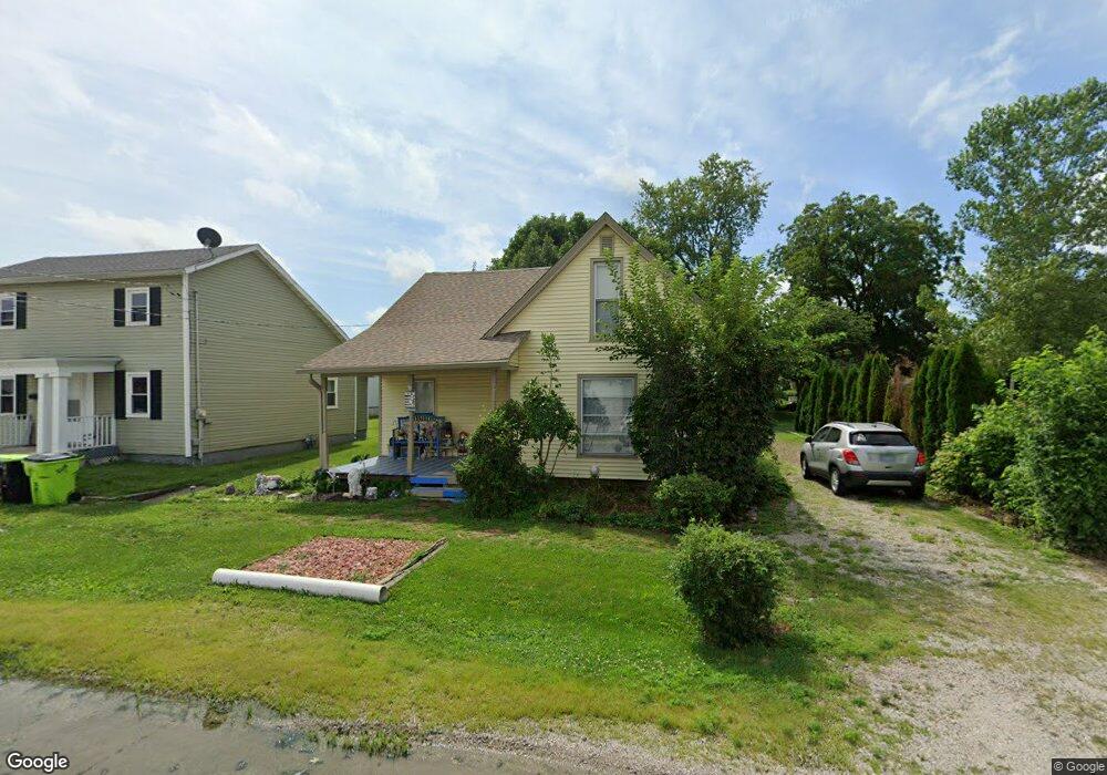
This home is located at 129 N Walnut St, Maroa, IL 61756 and is currently estimated at $121,517, approximately $94 per square foot. 129 N Walnut St is a home located in Macon County with nearby schools including Maroa-Forsyth Grade School, Maroa-Forsyth Middle School, and Maroa-Forsyth Senior High School.
Ownership History
Date
Name
Owned For
Owner Type
Purchase Details
Closed on
Dec 19, 2012
Sold by
James Rodney R
Bought by
Hamilton Annie Marie and Hamilton Richard L
Current Estimated Value
Home Financials for this Owner
Home Financials are based on the most recent Mortgage that was taken out on this home.
Original Mortgage
$67,591
Outstanding Balance
$47,377
Interest Rate
3.62%
Mortgage Type
FHA
Estimated Equity
$74,140
Purchase Details
Closed on
Sep 1, 2012
Purchase Details
Closed on
Oct 3, 2007
Sold by
James Teri L and James Rodney R
Bought by
James Rodney R
Home Financials for this Owner
Home Financials are based on the most recent Mortgage that was taken out on this home.
Original Mortgage
$25,000
Interest Rate
6.55%
Mortgage Type
Credit Line Revolving
Create a Home Valuation Report for This Property
The Home Valuation Report is an in-depth analysis detailing your home's value as well as a comparison with similar homes in the area
Purchase History
| Date | Buyer | Sale Price | Title Company |
|---|---|---|---|
| Hamilton Annie Marie | $70,000 | None Available | |
| -- | $70,000 | -- | |
| James Rodney R | -- | None Available |
Source: Public Records
Mortgage History
| Date | Status | Borrower | Loan Amount |
|---|---|---|---|
| Open | Hamilton Annie Marie | $67,591 | |
| Previous Owner | James Rodney R | $25,000 |
Source: Public Records
Tax History
| Year | Tax Paid | Tax Assessment Tax Assessment Total Assessment is a certain percentage of the fair market value that is determined by local assessors to be the total taxable value of land and additions on the property. | Land | Improvement |
|---|---|---|---|---|
| 2024 | $1,400 | $31,633 | $3,966 | $27,667 |
| 2023 | $1,422 | $29,393 | $3,685 | $25,708 |
| 2022 | $1,429 | $27,727 | $3,476 | $24,251 |
| 2021 | $1,932 | $26,337 | $3,302 | $23,035 |
| 2020 | $1,739 | $24,819 | $3,112 | $21,707 |
| 2019 | $1,739 | $24,819 | $3,112 | $21,707 |
| 2018 | $1,650 | $24,230 | $3,038 | $21,192 |
| 2017 | $1,728 | $24,332 | $3,051 | $21,281 |
| 2016 | $1,724 | $24,302 | $3,047 | $21,255 |
| 2015 | $1,613 | $23,594 | $2,958 | $20,636 |
| 2014 | $1,557 | $23,361 | $2,929 | $20,432 |
| 2013 | $1,572 | $23,361 | $2,929 | $20,432 |
Source: Public Records
Map
Nearby Homes
- 227 N Walnut St
- 214 N Maple St
- 108 N Locust St
- 412 N Wood St
- 119 Montgomery Ct
- 14479 N Oakland Ave
- 915 E Emery Rd
- 2420 Lillian
- 2460 Lillian
- 2490 Lillian
- 2440 Lillian
- 2480 Lillian
- 5353 Bailey Ave
- 2463 Red Tail Hawk Rd
- 0 Betty Ln Unit 10514801
- 505 W Forsyth Rd
- 5000 Silverado Ln
- 145 Lea Ln
- 988 W Forsyth Rd
- 8 Edgelea Cir
- 121 N Walnut St
- 137 N Walnut St
- 132 N Wood St
- 124 N Walnut St
- 107 N Walnut St
- 109 W Main St
- 109 W Main St Unit 3D
- 109 W Main St Unit 4E
- 201 N Walnut St
- 128 N Walnut St
- 111 W Washington St
- 132 N Walnut St
- 115 W Main St
- 214 N Wood St
- 211 N Walnut St
- 109 E Main St
- 111 N Hickory St
- 109 N Wood St
- 218 N Wood St
- 220 N Wood St
Your Personal Tour Guide
Ask me questions while you tour the home.