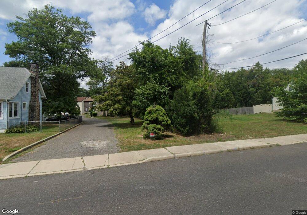
129 New Albany Rd Unit B Moorestown, NJ 08057
Estimated Value: $243,433 - $271,000
--
Bed
--
Bath
1,056
Sq Ft
$243/Sq Ft
Est. Value
About This Home
This home is located at 129 New Albany Rd Unit B, Moorestown, NJ 08057 and is currently estimated at $256,608, approximately $243 per square foot. 129 New Albany Rd Unit B is a home located in Burlington County with nearby schools including Mary E. Roberts Elementary School, Moorestown Upper Elementary School, and William Allen Middle School.
Ownership History
Date
Name
Owned For
Owner Type
Purchase Details
Closed on
Dec 29, 2000
Sold by
Ahmad Daud and Ahmed Daud
Bought by
Ahmed Daud and Suleman Muhammed
Current Estimated Value
Purchase Details
Closed on
Aug 15, 1997
Sold by
California Federal Bank
Bought by
Suleman Muhammad and Suleman Surriaya
Purchase Details
Closed on
Nov 5, 1996
Sold by
Daniels Gary L
Bought by
First Nationwide Bank
Create a Home Valuation Report for This Property
The Home Valuation Report is an in-depth analysis detailing your home's value as well as a comparison with similar homes in the area
Home Values in the Area
Average Home Value in this Area
Purchase History
| Date | Buyer | Sale Price | Title Company |
|---|---|---|---|
| Ahmed Daud | -- | -- | |
| Suleman Muhammad | $59,000 | -- | |
| First Nationwide Bank | -- | -- |
Source: Public Records
Tax History Compared to Growth
Tax History
| Year | Tax Paid | Tax Assessment Tax Assessment Total Assessment is a certain percentage of the fair market value that is determined by local assessors to be the total taxable value of land and additions on the property. | Land | Improvement |
|---|---|---|---|---|
| 2025 | $3,928 | $137,400 | $60,000 | $77,400 |
| 2024 | $3,810 | $137,400 | $60,000 | $77,400 |
| 2023 | $3,810 | $137,400 | $60,000 | $77,400 |
| 2022 | $3,791 | $137,400 | $60,000 | $77,400 |
| 2021 | $3,743 | $137,400 | $60,000 | $77,400 |
| 2020 | $3,718 | $137,400 | $60,000 | $77,400 |
| 2019 | $3,651 | $137,400 | $60,000 | $77,400 |
| 2018 | $3,544 | $137,400 | $60,000 | $77,400 |
| 2017 | $3,559 | $137,400 | $60,000 | $77,400 |
| 2016 | $3,550 | $137,400 | $60,000 | $77,400 |
| 2015 | $3,504 | $137,400 | $60,000 | $77,400 |
| 2014 | $3,332 | $137,400 | $60,000 | $77,400 |
Source: Public Records
Map
Nearby Homes
- 7 Errickson Ave
- 5 Domenica Dr
- 14 Vincent Way
- 124 E Wilson Ave
- 206 E Camden Ave
- 709 Manor Terrace
- 801 E Camden Ave
- 519 N Lincoln Ave
- 99 Grant Ave
- 112 Beacon St
- 106 Pine St
- 114 Grant Ave
- 531 Covington Terrace
- 31 S Boulevard Ave
- 403 S Lenola Rd
- 702 E Main St
- 15 S Pine Ave
- 423 Park Blvd
- 44 S Pine Ave
- 21 Foxwood Dr Unit 21
- 129 New Albany Rd Unit E
- 129 New Albany Rd Unit D
- 129 New Albany Rd Unit C
- 129 New Albany Rd Unit A
- 129 New Albany Rd
- 129 A New Albany Rd
- 131 New Albany Rd
- 127 New Albany Rd
- 135 New Albany Rd
- 111 Winstead Ave
- 119 Winstead Ave
- 139 New Albany Rd
- 124 Winstead Ave
- 123 Winstead Ave
- 65 Eraser Rd Unit 65
- 64 Eraser Rd
- 104 Errickson Ave
- 108 Errickson Ave
- 63 Eraser Rd
- 62 Eraser Rd
