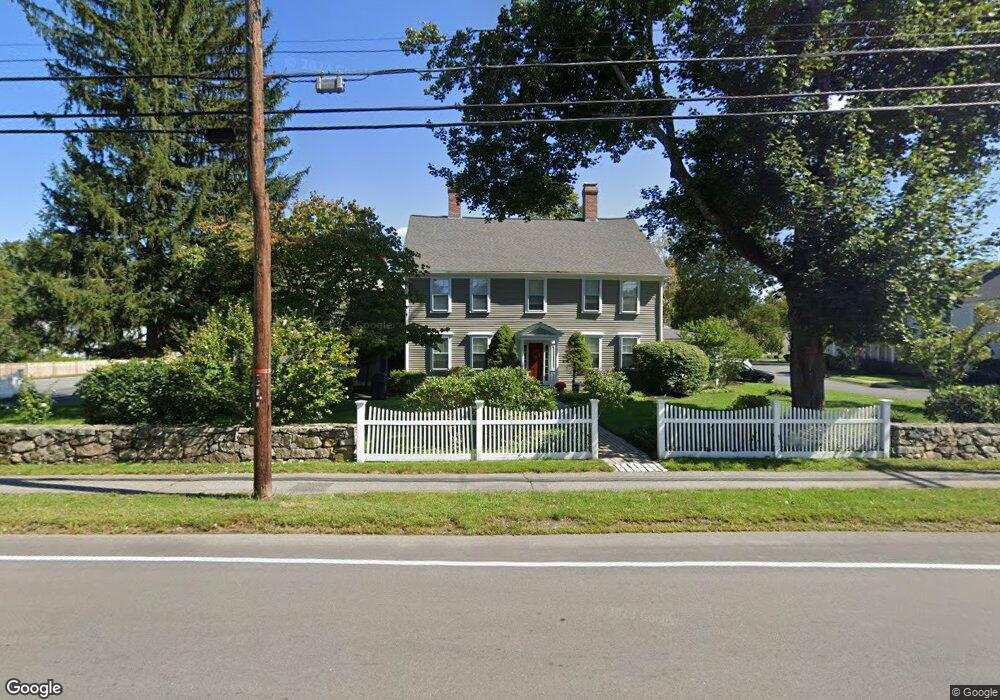
129 North St Unit 3 Medfield, MA 02052
Estimated Value: $676,543 - $883,000
3
Beds
3
Baths
1,792
Sq Ft
$436/Sq Ft
Est. Value
About This Home
This home is located at 129 North St Unit 3, Medfield, MA 02052 and is currently estimated at $780,886, approximately $435 per square foot. 129 North St Unit 3 is a home located in Norfolk County with nearby schools including Memorial School, Ralph Wheelock School, and Dale Street School.
Ownership History
Date
Name
Owned For
Owner Type
Purchase Details
Closed on
Nov 13, 2009
Sold by
Capers Ruth S
Bought by
Mackay Roger D and Mackay Nancy F
Current Estimated Value
Purchase Details
Closed on
Jul 10, 1987
Sold by
Hatch Russell T
Bought by
Nyren Paul E
Home Financials for this Owner
Home Financials are based on the most recent Mortgage that was taken out on this home.
Original Mortgage
$140,000
Interest Rate
10.71%
Mortgage Type
Purchase Money Mortgage
Create a Home Valuation Report for This Property
The Home Valuation Report is an in-depth analysis detailing your home's value as well as a comparison with similar homes in the area
Home Values in the Area
Average Home Value in this Area
Purchase History
| Date | Buyer | Sale Price | Title Company |
|---|---|---|---|
| Mackay Roger D | $443,000 | -- | |
| Mackay Roger D | $443,000 | -- | |
| Nyren Paul E | $200,000 | -- |
Source: Public Records
Mortgage History
| Date | Status | Borrower | Loan Amount |
|---|---|---|---|
| Previous Owner | Nyren Paul E | $140,000 | |
| Previous Owner | Nyren Paul E | $20,000 |
Source: Public Records
Tax History Compared to Growth
Tax History
| Year | Tax Paid | Tax Assessment Tax Assessment Total Assessment is a certain percentage of the fair market value that is determined by local assessors to be the total taxable value of land and additions on the property. | Land | Improvement |
|---|---|---|---|---|
| 2025 | $7,448 | $539,700 | $0 | $539,700 |
| 2024 | $7,622 | $520,600 | $0 | $520,600 |
| 2023 | $7,800 | $505,500 | $0 | $505,500 |
| 2022 | $8,555 | $491,100 | $0 | $491,100 |
| 2021 | $8,633 | $486,100 | $0 | $486,100 |
| 2020 | $8,667 | $486,100 | $0 | $486,100 |
| 2019 | $8,342 | $466,800 | $0 | $466,800 |
| 2018 | $7,091 | $416,400 | $0 | $416,400 |
| 2017 | $6,763 | $400,400 | $0 | $400,400 |
| 2016 | $6,707 | $400,400 | $0 | $400,400 |
| 2015 | $6,464 | $403,000 | $0 | $403,000 |
| 2014 | $6,496 | $403,000 | $0 | $403,000 |
Source: Public Records
Map
Nearby Homes
- 8 Turtlebrook Way
- 46 Frairy St
- 3 Hennery Way Bld E Unit 3
- 14 Harding St
- 34 Frairy St
- 431 Main St Unit 5
- 12 Spruce Way
- 80 West St
- 94 Pleasant St
- 3 Shining Valley Cir
- 75 Bridge St
- 6 Alcott Way
- 18 Hearthstone Dr
- 10 Hillcrest Rd
- 23 Cross St
- 3 Spring Valley Rd
- 94 Elm St
- 37 Crestview Dr
- 5 Hamlins Crossing
- 2 Partridge Hill Rd
- 129 North St
- 127 North St
- 6 Prentiss Place
- 29 Prentiss Place
- 25 Prentiss Place
- 26 Prentiss Place
- 125 North St
- 24 Prentiss Place
- 23 Prentiss Place
- 22 Prentiss Place
- 21 Prentiss Place
- 17 Prentiss Place
- 15 Prentiss Place
- 5 Prentiss Place
- 5 Prentiss Place Unit 5
- 18 Prentiss Place
- 14 Prentiss Place
- 4 Prentiss Place
- 14 Prentiss Place Unit 14
- 4 Prentiss Place Unit 4,4