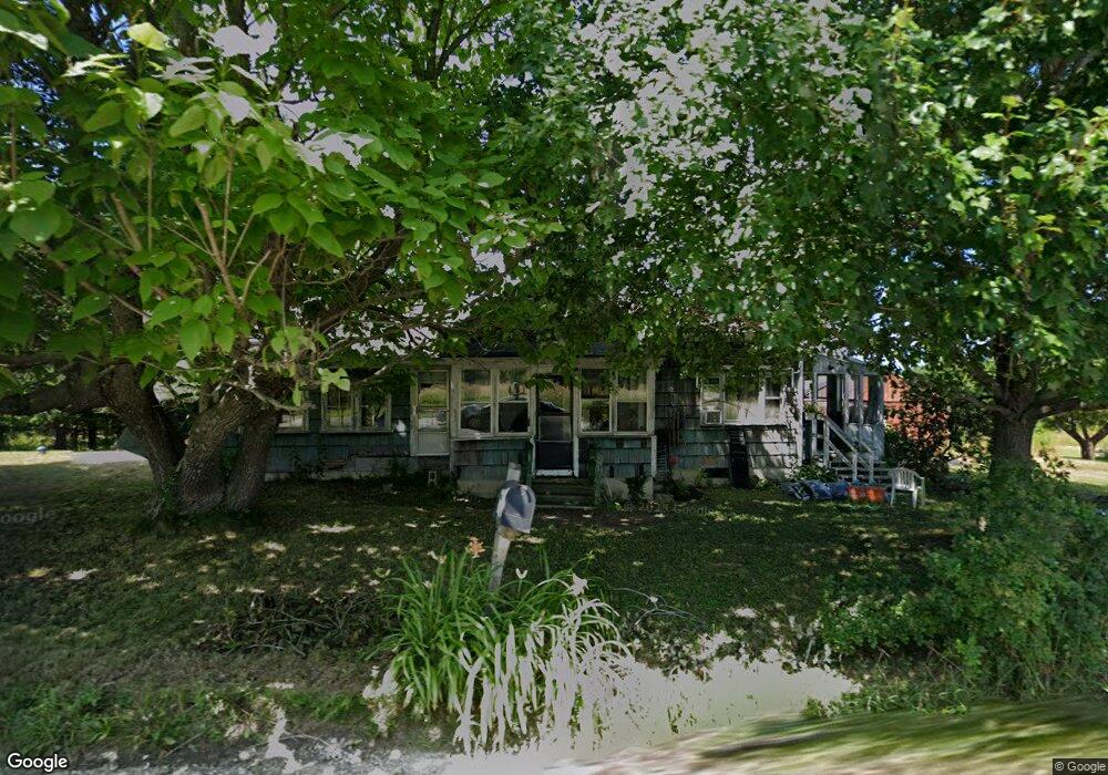
129 Pittston Rd Whitefield, ME 04353
Estimated Value: $211,000 - $305,000
2
Beds
1
Bath
800
Sq Ft
$319/Sq Ft
Est. Value
About This Home
This home is located at 129 Pittston Rd, Whitefield, ME 04353 and is currently estimated at $254,816, approximately $318 per square foot. 129 Pittston Rd is a home located in Lincoln County with nearby schools including Whitefield Elementary School.
Ownership History
Date
Name
Owned For
Owner Type
Purchase Details
Closed on
Apr 11, 2006
Sold by
Josephson Lucena
Bought by
Russell Lynnette R
Current Estimated Value
Home Financials for this Owner
Home Financials are based on the most recent Mortgage that was taken out on this home.
Original Mortgage
$58,650
Interest Rate
6.26%
Mortgage Type
Stand Alone Second
Create a Home Valuation Report for This Property
The Home Valuation Report is an in-depth analysis detailing your home's value as well as a comparison with similar homes in the area
Home Values in the Area
Average Home Value in this Area
Purchase History
| Date | Buyer | Sale Price | Title Company |
|---|---|---|---|
| Russell Lynnette R | -- | -- | |
| Russell Lynnette R | -- | -- | |
| Russell Lynnette R | -- | -- | |
| Russell Lynnette R | -- | -- |
Source: Public Records
Mortgage History
| Date | Status | Borrower | Loan Amount |
|---|---|---|---|
| Closed | Russell Lynnette R | $58,650 | |
| Closed | Russell Lynnette R | $0 |
Source: Public Records
Tax History Compared to Growth
Tax History
| Year | Tax Paid | Tax Assessment Tax Assessment Total Assessment is a certain percentage of the fair market value that is determined by local assessors to be the total taxable value of land and additions on the property. | Land | Improvement |
|---|---|---|---|---|
| 2024 | $1,849 | $183,600 | $67,400 | $116,200 |
| 2023 | $1,373 | $85,806 | $31,200 | $54,606 |
| 2022 | $1,435 | $85,806 | $31,200 | $54,606 |
| 2020 | $1,392 | $88,745 | $31,200 | $57,545 |
| 2019 | $1,392 | $88,745 | $31,200 | $57,545 |
| 2018 | $1,332 | $88,745 | $31,200 | $57,545 |
| 2017 | $1,225 | $88,745 | $31,200 | $57,545 |
| 2016 | $1,331 | $88,745 | $31,200 | $57,545 |
| 2015 | $1,305 | $88,745 | $31,200 | $57,545 |
| 2014 | $1,265 | $88,745 | $31,200 | $57,545 |
| 2013 | $1,353 | $88,745 | $31,200 | $57,545 |
Source: Public Records
Map
Nearby Homes
- Lot # 10 Pittston Road (Route 194) Rd
- 055 Wiscasset Rd
- 557 Nash Rd
- 53 Rosie Estates
- 105 N Jewett Ln
- 377 S Hunts Meadow Rd
- 00 Head Tide Hill Rd
- 59 Beech Ln
- Lot A Blinn Hill Rd
- TBD Hemlock Estates
- 37 Palmer Rd
- 692 E Pittston Rd
- 79 Head Tide Rd
- 0 E Pittston Rd Unit 1632032
- 34 Clover Ln
- 72 Henry Ln
- 848 Whitefield Rd
- 36 Dodge Rd
- 0 Nelson Rd
- 57 Parker Rd
- 15 Village View Ln
- 136 Pittston Rd
- 147 Pittston Rd
- 112 Pittston Rd
- 0 Pittston Rd & Hemlock
- 22 Village View Ln
- 21 Village View Ln
- 17 Village View Ln
- 161 Pittston Rd
- 171 Pittston Rd
- 22 Chamberlane Ln
- 11 Crocker Ave N
- 22 Chamberlain Brook Ln
- 44 Chamberlain Brook Ln
- 185 Pittston Rd
- 184 Pittston Rd
- 0 Crocker Rd Unit 1046898
- 97 Pittston Rd
- 63 Pittston Rd
- 12 Crocker Ave N