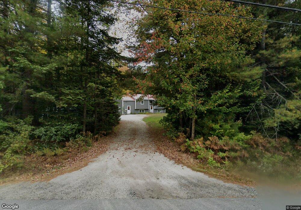
129 Rabbit Rd Durham, ME 04222
Estimated Value: $437,205 - $550,000
3
Beds
2
Baths
2,147
Sq Ft
$233/Sq Ft
Est. Value
About This Home
This home is located at 129 Rabbit Rd, Durham, ME 04222 and is currently estimated at $500,051, approximately $232 per square foot. 129 Rabbit Rd is a home located in Androscoggin County with nearby schools including Durham Community School and Freeport High School.
Ownership History
Date
Name
Owned For
Owner Type
Purchase Details
Closed on
Apr 19, 2007
Sold by
Moore Rachel C
Bought by
Triggiani Joseph J and Delong Lexie E
Current Estimated Value
Home Financials for this Owner
Home Financials are based on the most recent Mortgage that was taken out on this home.
Original Mortgage
$179,550
Outstanding Balance
$107,722
Interest Rate
6.19%
Mortgage Type
FHA
Estimated Equity
$392,329
Create a Home Valuation Report for This Property
The Home Valuation Report is an in-depth analysis detailing your home's value as well as a comparison with similar homes in the area
Home Values in the Area
Average Home Value in this Area
Purchase History
| Date | Buyer | Sale Price | Title Company |
|---|---|---|---|
| Triggiani Joseph J | -- | -- |
Source: Public Records
Mortgage History
| Date | Status | Borrower | Loan Amount |
|---|---|---|---|
| Open | Triggiani Joseph J | $179,550 |
Source: Public Records
Tax History
| Year | Tax Paid | Tax Assessment Tax Assessment Total Assessment is a certain percentage of the fair market value that is determined by local assessors to be the total taxable value of land and additions on the property. | Land | Improvement |
|---|---|---|---|---|
| 2025 | $6,202 | $184,700 | $65,200 | $119,500 |
| 2024 | $4,017 | $184,700 | $65,200 | $119,500 |
| 2023 | $3,943 | $184,700 | $65,200 | $119,500 |
| 2022 | $3,823 | $184,700 | $65,200 | $119,500 |
| 2021 | $3,823 | $184,700 | $65,200 | $119,500 |
| 2020 | $3,740 | $184,700 | $65,200 | $119,500 |
| 2019 | $3,740 | $184,700 | $65,200 | $119,500 |
| 2018 | $3,639 | $184,700 | $65,200 | $119,500 |
| 2016 | $3,472 | $184,700 | $65,200 | $119,500 |
| 2015 | $3,214 | $184,700 | $65,200 | $119,500 |
| 2014 | $3,075 | $184,700 | $65,200 | $119,500 |
| 2013 | $2,761 | $184,700 | $65,200 | $119,500 |
Source: Public Records
Map
Nearby Homes
- Lot 114 Old Brunswick Rd
- 253 Quaker Meeting House Rd
- 850 Lawrence Rd
- 768 Lawrence Rd
- 277 Ferry Rd
- 162 Durham Rd
- 42A Wardtown Rd
- 64 Wardtown Rd
- 168 Auburn Pownal Rd
- 115 Bragdon Rd
- 2 Renee Rd
- lot# Builder Ln
- Lot 9 Little Fawn Ln
- 0 Little Fawn Ln
- 4 Harper's Trail
- 118 Baker Rd
- 108 Baker Rd
- 52 Shiloh Rd
- 8 Statler Ln
- 12 Honeysuckle Ln
Your Personal Tour Guide
Ask me questions while you tour the home.