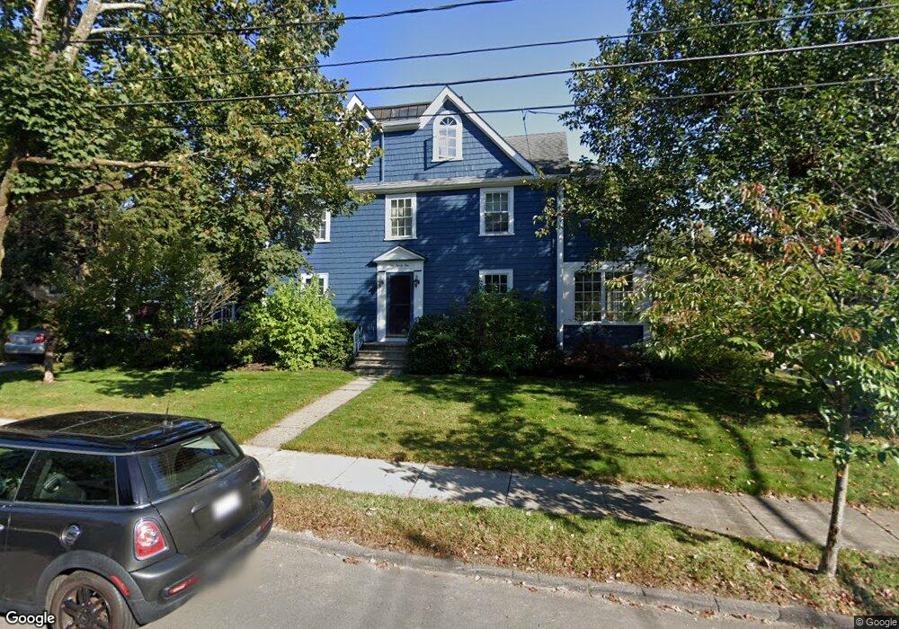
129 Robbins Rd Watertown, MA 02472
East Watertown NeighborhoodEstimated Value: $1,114,000 - $1,322,000
4
Beds
3
Baths
2,349
Sq Ft
$510/Sq Ft
Est. Value
About This Home
This home is located at 129 Robbins Rd, Watertown, MA 02472 and is currently estimated at $1,198,941, approximately $510 per square foot. 129 Robbins Rd is a home located in Middlesex County with nearby schools including The Kendall School and Beacon High School.
Ownership History
Date
Name
Owned For
Owner Type
Purchase Details
Closed on
Oct 28, 2009
Sold by
Schepis John
Bought by
Schepis John and Belcher-Schepis Jeanette
Current Estimated Value
Home Financials for this Owner
Home Financials are based on the most recent Mortgage that was taken out on this home.
Original Mortgage
$261,000
Interest Rate
5.06%
Mortgage Type
Purchase Money Mortgage
Purchase Details
Closed on
Dec 28, 1993
Sold by
Chrakian Elisha B and Tellalian Barbara
Bought by
Schepis John
Home Financials for this Owner
Home Financials are based on the most recent Mortgage that was taken out on this home.
Original Mortgage
$100,000
Interest Rate
7%
Mortgage Type
Purchase Money Mortgage
Create a Home Valuation Report for This Property
The Home Valuation Report is an in-depth analysis detailing your home's value as well as a comparison with similar homes in the area
Home Values in the Area
Average Home Value in this Area
Purchase History
| Date | Buyer | Sale Price | Title Company |
|---|---|---|---|
| Schepis John | -- | -- | |
| Schepis John | -- | -- | |
| Schepis John | -- | -- | |
| Schepis John | $210,000 | -- |
Source: Public Records
Mortgage History
| Date | Status | Borrower | Loan Amount |
|---|---|---|---|
| Open | Schepis John | $229,000 | |
| Closed | Schepis John | $261,000 | |
| Previous Owner | Schepis John | $100,000 |
Source: Public Records
Tax History
| Year | Tax Paid | Tax Assessment Tax Assessment Total Assessment is a certain percentage of the fair market value that is determined by local assessors to be the total taxable value of land and additions on the property. | Land | Improvement |
|---|---|---|---|---|
| 2025 | $11,272 | $965,100 | $480,000 | $485,100 |
| 2024 | $10,360 | $885,500 | $457,900 | $427,600 |
| 2023 | $11,111 | $818,200 | $436,400 | $381,800 |
| 2022 | $10,559 | $796,900 | $429,200 | $367,700 |
| 2021 | $9,666 | $789,100 | $422,100 | $367,000 |
| 2020 | $9,319 | $767,600 | $400,600 | $367,000 |
| 2019 | $8,784 | $682,000 | $386,300 | $295,700 |
| 2018 | $8,070 | $599,100 | $343,400 | $255,700 |
| 2017 | $8,340 | $600,400 | $343,400 | $257,000 |
| 2016 | $7,443 | $544,100 | $309,400 | $234,700 |
| 2015 | $8,178 | $544,100 | $309,400 | $234,700 |
| 2014 | $8,140 | $544,100 | $309,400 | $234,700 |
Source: Public Records
Map
Nearby Homes
- 34 Bradford Rd Unit 34
- 456 Belmont St Unit 10
- 25 Barnard Ave
- 40 Marion Rd
- 519 Belmont St
- 519 Belmont St Unit 2
- 589-591 Belmont St
- 324 Mount Auburn St Unit 2
- 85 Lowell Ave
- 235 Mount Auburn St
- 87 Lowell Ave Unit 87
- 125 Trapelo Rd Unit 21
- 125 Trapelo Rd Unit 36
- 73 Palfrey St Unit 73
- 71 Palfrey St Unit 71
- 118 Spring St Unit 118
- 28 Franklin St Unit 28
- 71 Carroll St Unit 71
- 29 Commonwealth Rd Unit 1
- 199 Palfrey St
- 198 Bellevue Rd
- 137 Robbins Rd
- 184 Bellevue Rd
- 2 Bellevue Terrace
- 141 Robbins Rd
- 119 Robbins Rd
- 178 Bellevue Rd
- 185 Bellevue Rd
- 142 Robbins Rd
- 143 Robbins Rd
- 7 Bellevue Terrace
- 5 Bellevue Terrace
- 136 Barnard Ave
- 144 Robbins Rd Unit 146
- 144 Robbins Rd Unit 1
- 209 Common St Unit 2
- 209 Common St Unit 1
- 172 Bellevue Rd
- 111 Robbins Rd
- 212 Bellevue Rd
Your Personal Tour Guide
Ask me questions while you tour the home.