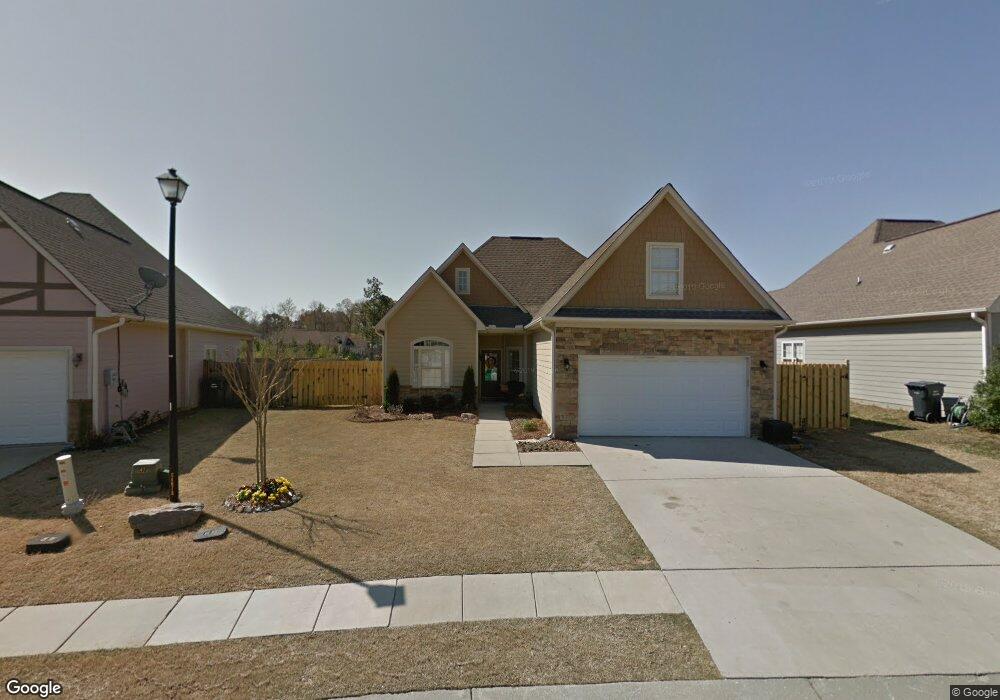
129 Robin St Unit 13 Calera, AL 35040
Estimated Value: $248,000 - $258,093
3
Beds
2
Baths
1,497
Sq Ft
$168/Sq Ft
Est. Value
About This Home
This home is located at 129 Robin St Unit 13, Calera, AL 35040 and is currently estimated at $251,523, approximately $168 per square foot. 129 Robin St Unit 13 is a home located in Shelby County with nearby schools including Calera Intermediate School, Calera Elementary School, and Calera Middle School.
Ownership History
Date
Name
Owned For
Owner Type
Purchase Details
Closed on
Dec 16, 2020
Sold by
Barnett Emily
Bought by
Walker Michele
Current Estimated Value
Home Financials for this Owner
Home Financials are based on the most recent Mortgage that was taken out on this home.
Original Mortgage
$204,250
Outstanding Balance
$181,843
Interest Rate
2.7%
Mortgage Type
New Conventional
Estimated Equity
$69,680
Purchase Details
Closed on
Feb 4, 2016
Sold by
Butler Christy L and Clarke Jonathan Edward
Bought by
Barnett Emily
Home Financials for this Owner
Home Financials are based on the most recent Mortgage that was taken out on this home.
Original Mortgage
$151,156
Interest Rate
4.04%
Mortgage Type
New Conventional
Purchase Details
Closed on
Apr 17, 2012
Sold by
Homesales Inc
Bought by
Butler Christy L and Clarke Jonathan Edward
Home Financials for this Owner
Home Financials are based on the most recent Mortgage that was taken out on this home.
Original Mortgage
$103,312
Interest Rate
3.9%
Mortgage Type
Purchase Money Mortgage
Purchase Details
Closed on
Aug 9, 2011
Sold by
Branham Angela
Bought by
Homesales Inc
Purchase Details
Closed on
Jun 25, 2008
Sold by
Clayton Enterprises Llc
Bought by
Branham Angela
Home Financials for this Owner
Home Financials are based on the most recent Mortgage that was taken out on this home.
Original Mortgage
$149,754
Interest Rate
5.96%
Mortgage Type
Purchase Money Mortgage
Purchase Details
Closed on
Dec 13, 2007
Sold by
Creed Construction Llc
Bought by
Clayton Enterprise Llc
Create a Home Valuation Report for This Property
The Home Valuation Report is an in-depth analysis detailing your home's value as well as a comparison with similar homes in the area
Home Values in the Area
Average Home Value in this Area
Purchase History
| Date | Buyer | Sale Price | Title Company |
|---|---|---|---|
| Walker Michele | $204,250 | None Available | |
| Barnett Emily | $147,000 | None Available | |
| Butler Christy L | $106,000 | None Available | |
| Homesales Inc | $89,250 | None Available | |
| Branham Angela | $146,300 | None Available | |
| Clayton Enterprise Llc | $170,758 | None Available |
Source: Public Records
Mortgage History
| Date | Status | Borrower | Loan Amount |
|---|---|---|---|
| Open | Walker Michele | $204,250 | |
| Previous Owner | Barnett Emily | $151,156 | |
| Previous Owner | Butler Christy L | $103,312 | |
| Previous Owner | Branham Angela | $149,754 |
Source: Public Records
Tax History
| Year | Tax Paid | Tax Assessment Tax Assessment Total Assessment is a certain percentage of the fair market value that is determined by local assessors to be the total taxable value of land and additions on the property. | Land | Improvement |
|---|---|---|---|---|
| 2024 | $1,391 | $25,760 | $0 | $0 |
| 2023 | $1,304 | $24,900 | $0 | $0 |
| 2022 | $1,015 | $19,560 | $0 | $0 |
| 2021 | $875 | $16,960 | $0 | $0 |
| 2020 | $827 | $16,080 | $0 | $0 |
| 2019 | $786 | $15,320 | $0 | $0 |
| 2017 | $725 | $14,180 | $0 | $0 |
| 2015 | $790 | $15,380 | $0 | $0 |
| 2014 | $703 | $13,780 | $0 | $0 |
Source: Public Records
Map
Nearby Homes
- 293 Rossburg Dr
- 1009 Daventry Way
- 2051 Rossburg Place
- 928 Daventry Trail
- 129 Little John Cir
- 5714 Smokey Rd
- 789 Merlin Dr
- 142 Creekstone Trail
- 169 the Heights Dr
- 140 Southern Hills Dr
- 157 Union Station Dr
- 172 the Heights Dr
- 558 the Heights Ln
- 185 Creekstone Trail
- 509 Union Station Place
- 161 Waterstone Way
- 229 the Heights Dr
- 237 the Heights Dr
- 209 Koslin Loop
- 377 Koslin Loop
Your Personal Tour Guide
Ask me questions while you tour the home.