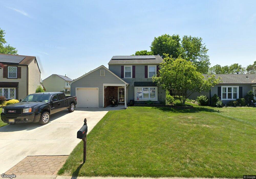
129 Robins Run E Swedesboro, NJ 08085
Logan Township NeighborhoodEstimated Value: $357,000 - $454,000
--
Bed
--
Bath
2,160
Sq Ft
$190/Sq Ft
Est. Value
About This Home
This home is located at 129 Robins Run E, Swedesboro, NJ 08085 and is currently estimated at $411,311, approximately $190 per square foot. 129 Robins Run E is a home located in Gloucester County with nearby schools including Logan Township Elementary School.
Ownership History
Date
Name
Owned For
Owner Type
Purchase Details
Closed on
Sep 10, 2004
Sold by
Rau Oscar and Rau Nancy
Bought by
Rau Nancy
Current Estimated Value
Create a Home Valuation Report for This Property
The Home Valuation Report is an in-depth analysis detailing your home's value as well as a comparison with similar homes in the area
Home Values in the Area
Average Home Value in this Area
Purchase History
| Date | Buyer | Sale Price | Title Company |
|---|---|---|---|
| Rau Nancy | -- | -- |
Source: Public Records
Tax History Compared to Growth
Tax History
| Year | Tax Paid | Tax Assessment Tax Assessment Total Assessment is a certain percentage of the fair market value that is determined by local assessors to be the total taxable value of land and additions on the property. | Land | Improvement |
|---|---|---|---|---|
| 2025 | $4,516 | $347,400 | $68,000 | $279,400 |
| 2024 | $4,764 | $347,400 | $68,000 | $279,400 |
| 2023 | $4,764 | $237,000 | $57,000 | $180,000 |
| 2022 | $4,951 | $237,000 | $57,000 | $180,000 |
| 2021 | $3,854 | $237,000 | $57,000 | $180,000 |
| 2020 | $5,155 | $237,000 | $57,000 | $180,000 |
| 2019 | $5,148 | $237,000 | $57,000 | $180,000 |
| 2018 | $5,005 | $237,000 | $57,000 | $180,000 |
| 2017 | $5,460 | $217,800 | $50,000 | $167,800 |
| 2016 | $5,371 | $217,800 | $50,000 | $167,800 |
| 2015 | $4,748 | $213,900 | $50,000 | $163,900 |
| 2014 | $4,522 | $213,900 | $50,000 | $163,900 |
Source: Public Records
Map
Nearby Homes
- 144 Robins Run W
- 128 Robins Run W
- 18 Dogwood Place
- 23 Adams St
- 111 Peachwood Dr
- 209 Windsor Dr
- 229 Westbrook Dr
- 120 Edward Dr
- 55 Hamilton St
- 112 Carriage Ln
- 60 Pedricktown Woodstown Rd
- 9 Brattleboro Rd
- 217 Spruce Trail
- 328 Pedricktown Rd
- 142 Ramona Ln
- 135 Juniper Ln
- 203 Amesbury Blvd
- 13 Sweet Bay Ln
- 17 Hickory Ln
- 330 Taft Dr
- 131 Robins Run E
- 127 Robins Run E
- 133 Robins Run E
- 125 Robins Run E
- 307 Mockingbird Ln
- 309 Mockingbird Ln
- 101 Mockingbird Ct
- 122 Robins Run E
- 305 Mockingbird Ln
- 111 Oriole Dr
- 135 Robins Run E
- 123 Robins Run E
- 120 Robins Run E
- 303 Mockingbird Ln
- 103 Mockingbird Ct
- 109 Oriole Dr
- 121 Robins Run E
- 118 Robins Run E
- 301 Mockingbird Ln
- 306 Mockingbird Ln