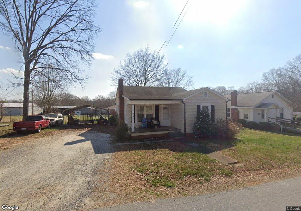
129 Rollins St Forest City, NC 28043
Estimated Value: $132,000 - $168,000
3
Beds
1
Bath
1,029
Sq Ft
$145/Sq Ft
Est. Value
About This Home
This home is located at 129 Rollins St, Forest City, NC 28043 and is currently estimated at $149,193, approximately $144 per square foot. 129 Rollins St is a home located in Rutherford County with nearby schools including Forrest W. Hunt Elementary School, Chase Middle School, and Chase High School.
Ownership History
Date
Name
Owned For
Owner Type
Purchase Details
Closed on
Nov 16, 2012
Sold by
Jpmorgan Chase Bank Na
Bought by
Wall Michael and Wall Carolyn
Current Estimated Value
Purchase Details
Closed on
Aug 16, 2012
Sold by
Roberson James M
Bought by
Jpmorgan Chase Bank Na
Purchase Details
Closed on
May 2, 2006
Sold by
Humphries J Foy
Bought by
Roberson James M
Home Financials for this Owner
Home Financials are based on the most recent Mortgage that was taken out on this home.
Original Mortgage
$56,000
Interest Rate
6.28%
Mortgage Type
New Conventional
Create a Home Valuation Report for This Property
The Home Valuation Report is an in-depth analysis detailing your home's value as well as a comparison with similar homes in the area
Home Values in the Area
Average Home Value in this Area
Purchase History
| Date | Buyer | Sale Price | Title Company |
|---|---|---|---|
| Wall Michael | $15,000 | None Available | |
| Jpmorgan Chase Bank Na | $21,250 | None Available | |
| Roberson James M | $53,500 | -- |
Source: Public Records
Mortgage History
| Date | Status | Borrower | Loan Amount |
|---|---|---|---|
| Previous Owner | Roberson James M | $56,000 |
Source: Public Records
Tax History Compared to Growth
Tax History
| Year | Tax Paid | Tax Assessment Tax Assessment Total Assessment is a certain percentage of the fair market value that is determined by local assessors to be the total taxable value of land and additions on the property. | Land | Improvement |
|---|---|---|---|---|
| 2025 | $1,125 | $103,400 | $12,000 | $91,400 |
| 2024 | $1,087 | $103,400 | $12,000 | $91,400 |
| 2023 | $648 | $103,400 | $12,000 | $91,400 |
| 2022 | $648 | $53,900 | $13,300 | $40,600 |
| 2021 | $481 | $53,900 | $13,300 | $40,600 |
| 2020 | $481 | $53,900 | $13,300 | $40,600 |
| 2019 | $473 | $53,900 | $13,300 | $40,600 |
| 2018 | $284 | $31,700 | $6,100 | $25,600 |
| 2016 | $284 | $31,700 | $6,100 | $25,600 |
| 2013 | -- | $31,700 | $6,100 | $25,600 |
Source: Public Records
Map
Nearby Homes
- 00 Sunset Dr
- 146 Summey St
- 0 Kimbrell Ln
- 179 Sunnyside St
- 187 Oakridge Dr
- 272 Washington St
- 324 Harmon St
- 178 Watkins Dr
- 170 Coventry Ln
- 115 Hill St
- 229 W Liberty St
- 0 Mulberry St
- 234 Bentwood Dr
- 183 Hollywood St
- 254 Arlington St
- 183 Caldwell St
- 281 N Quail Run
- 617 Us 221a Hwy
- 148 Westhaven St
- 168 Collins Ave
- 119 Rollins St
- 135 Rollins St
- 118 Rollins St
- 0 Westside Dr
- 134 Rollins St
- 994 S Broadway St
- 142 Rollins St Unit 146
- 121 Westside Dr
- 166 Rollins St
- 1008 S Broadway St
- 136 Westside Dr
- 960 S Broadway St
- 1016 S Broadway St
- 174 Rollins St Unit 180
- 131 Westside Dr
- 140 Eastside Dr
- 0000 Westside Dr
- 132 Eastside Dr
- 126 Westside Dr Unit 134
- 995 S Broadway St