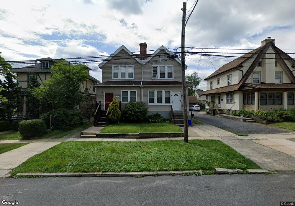
129 S Carol Blvd Upper Darby, PA 19082
Estimated Value: $277,030 - $380,000
3
Beds
1
Bath
1,802
Sq Ft
$175/Sq Ft
Est. Value
About This Home
This home is located at 129 S Carol Blvd, Upper Darby, PA 19082 and is currently estimated at $315,008, approximately $174 per square foot. 129 S Carol Blvd is a home located in Delaware County with nearby schools including Drexel Hill Middle School, Upper Darby High School, and St. Laurence's School.
Ownership History
Date
Name
Owned For
Owner Type
Purchase Details
Closed on
Sep 24, 2007
Sold by
Lin Robert and Lin Erayna L
Bought by
Blackshear Syreeta
Current Estimated Value
Home Financials for this Owner
Home Financials are based on the most recent Mortgage that was taken out on this home.
Original Mortgage
$142,405
Outstanding Balance
$90,530
Interest Rate
6.65%
Mortgage Type
Purchase Money Mortgage
Estimated Equity
$224,478
Purchase Details
Closed on
Jul 22, 2002
Sold by
Colsher Merle E and Amicone Melissa E
Bought by
Lin Robert and Lin Erayna L
Home Financials for this Owner
Home Financials are based on the most recent Mortgage that was taken out on this home.
Original Mortgage
$108,097
Interest Rate
6.39%
Mortgage Type
FHA
Purchase Details
Closed on
Mar 15, 1996
Sold by
Kline Mary A
Bought by
Colsher Melissa E and Colsher Merle E
Home Financials for this Owner
Home Financials are based on the most recent Mortgage that was taken out on this home.
Original Mortgage
$68,098
Interest Rate
7.31%
Mortgage Type
FHA
Create a Home Valuation Report for This Property
The Home Valuation Report is an in-depth analysis detailing your home's value as well as a comparison with similar homes in the area
Home Values in the Area
Average Home Value in this Area
Purchase History
| Date | Buyer | Sale Price | Title Company |
|---|---|---|---|
| Blackshear Syreeta | $149,900 | None Available | |
| Lin Robert | $109,000 | Commonwealth Land Title Ins | |
| Colsher Melissa E | $74,000 | Commonwealth Land Title Ins |
Source: Public Records
Mortgage History
| Date | Status | Borrower | Loan Amount |
|---|---|---|---|
| Open | Blackshear Syreeta | $142,405 | |
| Previous Owner | Lin Robert | $108,097 | |
| Previous Owner | Colsher Melissa E | $68,098 |
Source: Public Records
Tax History Compared to Growth
Tax History
| Year | Tax Paid | Tax Assessment Tax Assessment Total Assessment is a certain percentage of the fair market value that is determined by local assessors to be the total taxable value of land and additions on the property. | Land | Improvement |
|---|---|---|---|---|
| 2025 | $5,079 | $120,090 | $38,370 | $81,720 |
| 2024 | $5,079 | $120,090 | $38,370 | $81,720 |
| 2023 | $5,031 | $120,090 | $38,370 | $81,720 |
| 2022 | $4,896 | $120,090 | $38,370 | $81,720 |
| 2021 | $6,601 | $120,090 | $38,370 | $81,720 |
| 2020 | $5,870 | $90,740 | $27,570 | $63,170 |
| 2019 | $5,767 | $90,740 | $27,570 | $63,170 |
| 2018 | $5,700 | $90,740 | $0 | $0 |
| 2017 | $5,552 | $90,740 | $0 | $0 |
| 2016 | $498 | $90,740 | $0 | $0 |
| 2015 | $498 | $90,740 | $0 | $0 |
| 2014 | $498 | $90,740 | $0 | $0 |
Source: Public Records
Map
Nearby Homes
- 7920 W Chester Pike
- 11 S Cedar Ln
- 8125 W Chester Pike Unit A4
- 241 S Cedar Ln
- 7226 Penarth Ave
- 25 N Pennock Ave
- 105 N Fairview Ave
- 7819 Westview Ave
- 46 S State Rd
- 105 Academy Ln
- 201 Saint Laurence Rd
- 7823 Arlington Ave
- 171 N Carol Blvd
- 207 Berbro Ave
- 9 Berbro Ave
- 7409 Miller Ave
- 18 Elm Ave
- 7502 Parkview Rd
- 24 Sunshine Rd
- 7011 Hazel Ave
- 127 S Carol Blvd
- 131 S Carol Blvd
- 125 S Carol Blvd
- 137 S Carol Blvd
- 130 S Fairview Ave
- 134 S Fairview Ave
- 139 S Carol Blvd
- 126 S Fairview Ave
- 138 S Fairview Ave
- 117 S Carol Blvd
- 120 S Fairview Ave
- 143 S Carol Blvd
- 130 S Carol Blvd
- 134 S Carol Blvd
- 126 S Carol Blvd
- 138 S Carol Blvd
- 122 S Carol Blvd
- 146 S Fairview Ave
- 114 S Fairview Ave
- 120 S Carol Blvd