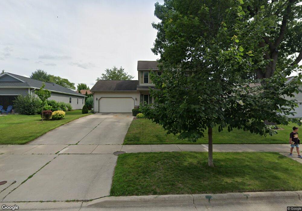
129 Sauthoff Rd Madison, WI 53704
North Lake Mendota NeighborhoodEstimated Value: $450,000 - $511,000
3
Beds
3
Baths
2,224
Sq Ft
$215/Sq Ft
Est. Value
About This Home
This home is located at 129 Sauthoff Rd, Madison, WI 53704 and is currently estimated at $478,868, approximately $215 per square foot. 129 Sauthoff Rd is a home located in Dane County with nearby schools including Mendota Elementary School, Black Hawk Middle School, and East High School.
Ownership History
Date
Name
Owned For
Owner Type
Purchase Details
Closed on
Apr 28, 2025
Sold by
Sheetz Jason E
Bought by
Cirrus Trust
Current Estimated Value
Purchase Details
Closed on
Jun 16, 2008
Sold by
Oswald Frank P and Oswald Tracy A
Bought by
Sheetz Jason E
Home Financials for this Owner
Home Financials are based on the most recent Mortgage that was taken out on this home.
Original Mortgage
$150,000
Interest Rate
6.09%
Mortgage Type
Purchase Money Mortgage
Create a Home Valuation Report for This Property
The Home Valuation Report is an in-depth analysis detailing your home's value as well as a comparison with similar homes in the area
Home Values in the Area
Average Home Value in this Area
Purchase History
| Date | Buyer | Sale Price | Title Company |
|---|---|---|---|
| Cirrus Trust | -- | None Listed On Document | |
| Sheetz Jason E | $244,000 | None Available |
Source: Public Records
Mortgage History
| Date | Status | Borrower | Loan Amount |
|---|---|---|---|
| Previous Owner | Sheetz Jason E | $150,000 |
Source: Public Records
Tax History
| Year | Tax Paid | Tax Assessment Tax Assessment Total Assessment is a certain percentage of the fair market value that is determined by local assessors to be the total taxable value of land and additions on the property. | Land | Improvement |
|---|---|---|---|---|
| 2025 | $8,301 | $464,500 | $95,600 | $368,900 |
| 2024 | $13,596 | $403,900 | $95,600 | $308,300 |
| 2023 | $6,484 | $377,500 | $89,300 | $288,200 |
| 2022 | $13,256 | $352,800 | $83,500 | $269,300 |
| 2021 | $6,149 | $304,100 | $72,000 | $232,100 |
| 2020 | $6,173 | $286,900 | $67,900 | $219,000 |
| 2019 | $6,048 | $281,300 | $66,600 | $214,700 |
| 2018 | $5,637 | $262,100 | $66,600 | $195,500 |
| 2017 | $5,394 | $240,500 | $61,100 | $179,400 |
| 2016 | $5,423 | $235,800 | $61,100 | $174,700 |
| 2015 | $5,393 | $220,200 | $57,000 | $163,200 |
| 2014 | $5,126 | $220,200 | $57,000 | $163,200 |
| 2013 | $5,221 | $215,900 | $55,900 | $160,000 |
Source: Public Records
Map
Nearby Homes
- 4102 Green Ave
- 117 Knutson Dr
- 4102 Meadow Valley Dr
- 4510 White Aspen Rd
- 4418 White Aspen Rd
- 5355 Hansons Landing Unit 104
- 718 Nancy Ln
- 4617 School Rd
- 5391 Westport Rd
- 5397 Blue Bill Park Dr Unit 8
- 5528 Catfish Ct
- 1314 Debra Ln
- 5114 Reynolds Ave
- 1610 Randy Ln
- 1506 Wheeler Rd Unit H
- 1418 Wheeler Rd Unit C
- 1426 Wheeler Ct Unit D
- 1446 Wheeler Rd Unit H
- 1518 Golf View Rd Unit C
- Lot 14 Bald Eagle Cir
- 133 Sauthoff Rd
- 125 Sauthoff Rd
- 130 Briar Crest St
- 137 Sauthoff Rd
- 121 Sauthoff Rd
- 126 Briar Crest St
- 134 Briar Crest St
- 4202 Heffernan Dr
- 4201 Heffernan Dr
- 122 Briar Crest St
- 138 Briar Crest St
- 141 Sauthoff Rd
- 117 Sauthoff Rd
- 4206 Heffernan Dr
- 4205 Heffernan Dr
- 4202 Brown Ln
- 113 Sauthoff Rd
- 125 Briar Crest St
- 129 Briar Crest St
- 4206 Brown Ln
Your Personal Tour Guide
Ask me questions while you tour the home.