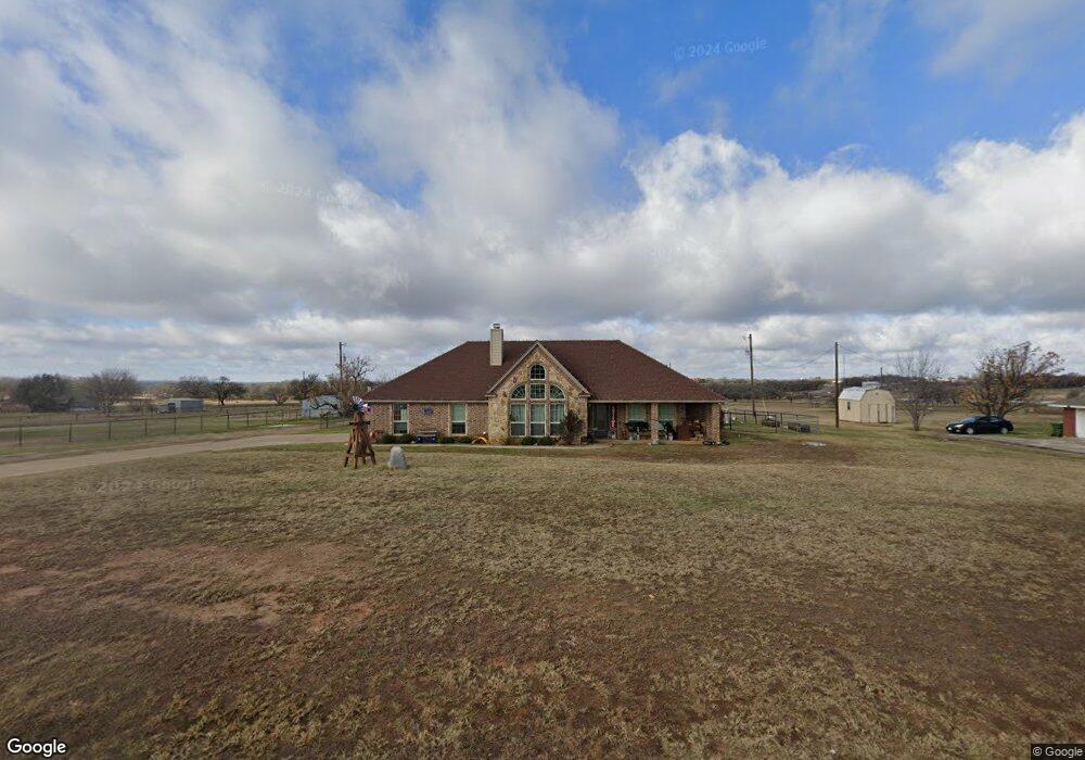
129 Savannah Dr Weatherford, TX 76087
Estimated Value: $418,711 - $459,000
3
Beds
2
Baths
1,795
Sq Ft
$246/Sq Ft
Est. Value
About This Home
This home is located at 129 Savannah Dr, Weatherford, TX 76087 and is currently estimated at $441,178, approximately $245 per square foot. 129 Savannah Dr is a home located in Parker County with nearby schools including Brock Intermediate School, Brock Junior High School, and Brock High School.
Ownership History
Date
Name
Owned For
Owner Type
Purchase Details
Closed on
Mar 1, 2017
Sold by
B & B Builders Inc
Bought by
Wylie Michael K
Current Estimated Value
Home Financials for this Owner
Home Financials are based on the most recent Mortgage that was taken out on this home.
Original Mortgage
$238,598
Outstanding Balance
$197,417
Interest Rate
4.09%
Mortgage Type
FHA
Estimated Equity
$243,761
Purchase Details
Closed on
Oct 17, 2014
Sold by
Brandon Rose M
Bought by
B&B Builders Inc
Purchase Details
Closed on
Jul 29, 2003
Sold by
Kkh Family Limited Partnership
Bought by
Wylie Michael K
Create a Home Valuation Report for This Property
The Home Valuation Report is an in-depth analysis detailing your home's value as well as a comparison with similar homes in the area
Home Values in the Area
Average Home Value in this Area
Purchase History
| Date | Buyer | Sale Price | Title Company |
|---|---|---|---|
| Wylie Michael K | -- | None Available | |
| B&B Builders Inc | -- | None Available | |
| Wylie Michael K | -- | -- |
Source: Public Records
Mortgage History
| Date | Status | Borrower | Loan Amount |
|---|---|---|---|
| Open | Wylie Michael K | $238,598 |
Source: Public Records
Tax History Compared to Growth
Tax History
| Year | Tax Paid | Tax Assessment Tax Assessment Total Assessment is a certain percentage of the fair market value that is determined by local assessors to be the total taxable value of land and additions on the property. | Land | Improvement |
|---|---|---|---|---|
| 2025 | $5,811 | $441,709 | -- | -- |
| 2024 | $5,811 | $382,008 | -- | -- |
| 2023 | $5,811 | $347,280 | $0 | $0 |
| 2022 | $6,410 | $315,710 | $40,000 | $275,710 |
| 2021 | $6,740 | $315,710 | $40,000 | $275,710 |
| 2020 | $5,520 | $255,030 | $25,000 | $230,030 |
| 2019 | $5,944 | $255,030 | $25,000 | $230,030 |
| 2018 | $5,298 | $226,300 | $25,000 | $201,300 |
| 2017 | $2,891 | $125,650 | $25,000 | $100,650 |
| 2016 | $575 | $25,000 | $25,000 | $0 |
| 2015 | $568 | $25,000 | $25,000 | $0 |
| 2014 | $574 | $25,000 | $25,000 | $0 |
Source: Public Records
Map
Nearby Homes
- 169 Savannah Dr
- 401 Brock Spur
- 181 Savannah Dr
- XXXX Wolf Hollow
- 7530 W Interstate 20
- TBD Wolf Hollow
- 1700 Fm 1189
- 4000 Luciano Dr
- 3036 Palermo Dr
- 102 Eagle Pass Ln
- 2007 Verona Dr
- 734 Young Bend Rd
- 2004 Verona Dr
- 2041 Verona Dr
- 2053 Verona Dr
- 2026 Verona Dr
- 2030 Verona Dr
- 2042 Verona Dr
- TBD Grindstone Rd
- 304 Red Roan Ridge
- 125 Savannah Dr
- 133 Savannah Dr
- 126 Savannah Dr
- 121 Savannah Dr
- 130 Savannah Dr
- 137 Savannah Dr
- 122 Savannah Dr
- 117 Savannah Dr
- 138 Savannah Dr
- 141 Savannah Dr
- 118 Savannah Dr
- 801 Fm 1189
- 144 Savannah Dr
- 145 Savannah Dr
- 113 Savannah Dr
- 626 Olive Branch Rd
- 616 Olive Branch Rd
- 638 Olive Branch Rd
- 114 Savannah Dr
- 600 Olive Branch Rd