Estimated Value: $219,620 - $288,000
--
Bed
2
Baths
1,516
Sq Ft
$169/Sq Ft
Est. Value
About This Home
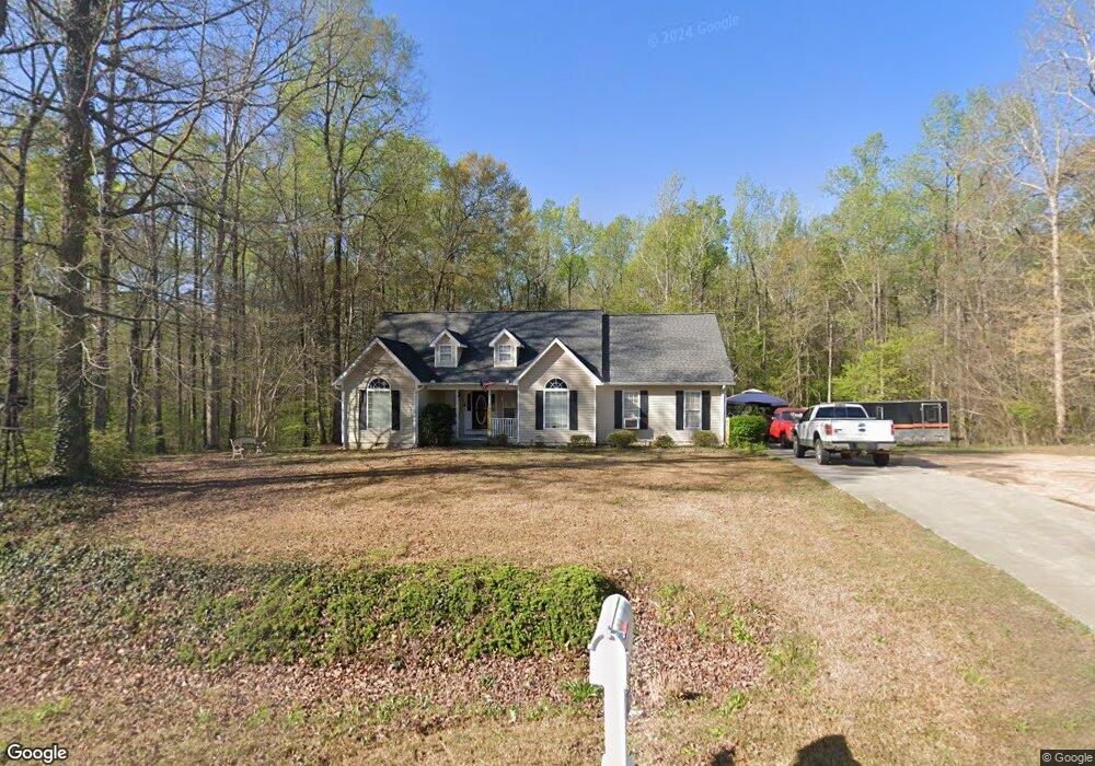
This home is located at 129 Southern Walk Cir, Gray, GA 31032 and is currently estimated at $255,655, approximately $168 per square foot. 129 Southern Walk Cir is a home located in Jones County with nearby schools including Gray Elementary School, Gray Station Middle School, and Jones County High School.
Ownership History
Date
Name
Owned For
Owner Type
Purchase Details
Closed on
Jun 28, 2023
Sold by
Monaco Concetta
Bought by
Womelsdorf Roger Guy
Current Estimated Value
Home Financials for this Owner
Home Financials are based on the most recent Mortgage that was taken out on this home.
Original Mortgage
$68,500
Outstanding Balance
$66,866
Interest Rate
6.79%
Mortgage Type
New Conventional
Estimated Equity
$188,789
Purchase Details
Closed on
May 25, 2004
Sold by
Debaccco Maria
Bought by
Monaco Concetta and Womelsdord Roger
Purchase Details
Closed on
Jan 1, 1997
Sold by
The Boston Land Company
Bought by
Greene Todd
Create a Home Valuation Report for This Property
The Home Valuation Report is an in-depth analysis detailing your home's value as well as a comparison with similar homes in the area
Home Values in the Area
Average Home Value in this Area
Purchase History
| Date | Buyer | Sale Price | Title Company |
|---|---|---|---|
| Womelsdorf Roger Guy | -- | -- | |
| Monaco Concetta | $141,400 | -- | |
| Greene Todd | $13,000 | -- |
Source: Public Records
Mortgage History
| Date | Status | Borrower | Loan Amount |
|---|---|---|---|
| Open | Womelsdorf Roger Guy | $68,500 |
Source: Public Records
Tax History Compared to Growth
Tax History
| Year | Tax Paid | Tax Assessment Tax Assessment Total Assessment is a certain percentage of the fair market value that is determined by local assessors to be the total taxable value of land and additions on the property. | Land | Improvement |
|---|---|---|---|---|
| 2023 | $2,007 | $59,576 | $7,200 | $52,376 |
| 2022 | $1,841 | $54,950 | $6,336 | $48,614 |
| 2021 | $1,843 | $54,950 | $6,336 | $48,614 |
| 2020 | $1,844 | $54,950 | $6,336 | $48,614 |
| 2019 | $1,696 | $50,818 | $6,336 | $44,482 |
| 2018 | $1,696 | $50,818 | $6,336 | $44,482 |
| 2017 | $1,696 | $50,818 | $6,336 | $44,482 |
| 2016 | $1,696 | $50,818 | $6,336 | $44,482 |
| 2015 | $1,600 | $50,818 | $6,336 | $44,482 |
| 2014 | $1,470 | $50,516 | $6,336 | $44,180 |
Source: Public Records
Map
Nearby Homes
- 209 Needlecrest Dr
- 203 Needlecrest Dr
- 00 Eatonton Hwy
- 0 Eatonton Hwy Unit 180360
- 0 Eatonton Hwy Unit 10557843
- 0 Eatonton Hwy Unit 10557840
- 0 Eatonton Hwy Unit 23385714
- 0 Eatonton Hwy Unit 10254433
- 140 E Clinton St
- 000 Eatonton Hwy
- 106 Davis St
- 124 Ridgecrest Place
- 182 Railroad St
- 0 Georgia 18 Connector Unit 177614
- 151 Bateman Ln
- 202 Railroad St
- 206 Railroad St
- 193 Virginia Ave
- 135 Southern Walk Cir
- 126 Southern Walk Cir
- 132 Southern Walk Cir
- 139 Southern Walk Cir
- 136 Southern Walk Cir
- 121 Southern Walk Cir
- 140 Southern Walk Cir
- 143 Southern Walk Cir
- 379 Georgia 22
- 146 Southern Walk Cir
- 379 Ga Highway 22 E
- 111 Southern Walk Cir
- 117 Savannah Dr
- 158 Southern Walk Cir
- 141 Savannah Dr
- 151 Southern Walk Cir
- 107 Southern Walk Cir
- 162 Southern Walk Cir
- 137 Savannah Dr
- 109 Savannah Dr