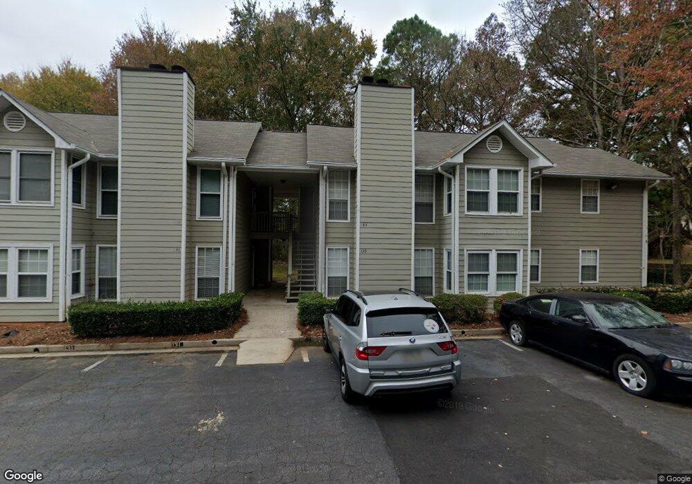
129 Sterling Ct Alpharetta, GA 30004
Estimated Value: $202,196 - $281,000
2
Beds
2
Baths
1,250
Sq Ft
$201/Sq Ft
Est. Value
About This Home
This home is located at 129 Sterling Ct, Alpharetta, GA 30004 and is currently estimated at $251,299, approximately $201 per square foot. 129 Sterling Ct is a home located in Fulton County with nearby schools including Manning Oaks Elementary School, Hopewell Middle School, and Alpharetta High School.
Ownership History
Date
Name
Owned For
Owner Type
Purchase Details
Closed on
Apr 27, 2018
Sold by
33 H Pf4 Llc
Bought by
7 Terra Investments Llc
Current Estimated Value
Purchase Details
Closed on
Oct 30, 2017
Sold by
33 Holdings Llc
Bought by
33H Pf4 Llc
Purchase Details
Closed on
Nov 28, 2016
Sold by
Bunch Shirley
Bought by
33 Holdings Llc
Home Financials for this Owner
Home Financials are based on the most recent Mortgage that was taken out on this home.
Original Mortgage
$2,000,000
Interest Rate
3.47%
Mortgage Type
Unknown
Purchase Details
Closed on
May 6, 2014
Sold by
Long Jesse C
Bought by
Ray Shirley Bunch
Create a Home Valuation Report for This Property
The Home Valuation Report is an in-depth analysis detailing your home's value as well as a comparison with similar homes in the area
Home Values in the Area
Average Home Value in this Area
Purchase History
| Date | Buyer | Sale Price | Title Company |
|---|---|---|---|
| 7 Terra Investments Llc | $113,000 | -- | |
| 33H Pf4 Llc | $127,000 | -- | |
| 33 Holdings Llc | $180,000 | -- | |
| Ray Shirley Bunch | -- | -- | |
| Ray Shirley Bunch | -- | -- |
Source: Public Records
Mortgage History
| Date | Status | Borrower | Loan Amount |
|---|---|---|---|
| Previous Owner | 33 Holdings Llc | $2,000,000 |
Source: Public Records
Tax History Compared to Growth
Tax History
| Year | Tax Paid | Tax Assessment Tax Assessment Total Assessment is a certain percentage of the fair market value that is determined by local assessors to be the total taxable value of land and additions on the property. | Land | Improvement |
|---|---|---|---|---|
| 2025 | $389 | $68,440 | $9,840 | $58,600 |
| 2023 | $1,910 | $67,680 | $9,840 | $57,840 |
| 2022 | $1,781 | $67,680 | $9,840 | $57,840 |
| 2021 | $2,161 | $65,720 | $9,560 | $56,160 |
| 2020 | $1,807 | $53,880 | $7,000 | $46,880 |
| 2019 | $304 | $52,920 | $6,880 | $46,040 |
| 2018 | $1,213 | $42,960 | $5,600 | $37,360 |
| 2017 | $815 | $27,920 | $4,040 | $23,880 |
| 2016 | $815 | $27,920 | $4,040 | $23,880 |
| 2015 | $979 | $27,920 | $4,040 | $23,880 |
| 2014 | $1,073 | $35,000 | $3,440 | $31,560 |
Source: Public Records
Map
Nearby Homes
- 12225 Clairmonte Ave
- 122 Sterling Ct Unit 122
- 138 Sterling Ct
- 12350 Clairmonte Ave
- 4040 Monroe Ct
- 1630 Homestead Trail
- 1519 Planters Ridge Ln
- 1707 Cotton Patch Ln
- 175 Jayne Ellen Way
- 208 Wade Creek Rd
- 161 Red Oak Ln
- 1035 Arborhill Ln
- 190 Crestwood Ct
- 225 Jayne Ellen Way
- 7045 Trellis Ct
- 3036 Westwood Way
- 2600 Milford Ln
- 2540 Milford Ln
- 4153 Sterling Pointe Dr
- 130 Sterling Ct
- 126 Sterling Ct
- 127 Sterling Ct
- 125 Sterling Ct
- 125 Sterling Ct Unit 125
- 128 Sterling Ct Unit 128
- 131 Sterling Ct
- 131 Sterling Ct Unit 131
- 132 Sterling Ct Unit 132
- 0 Sterling Ct Unit 7508738
- 117 Sterling Ct Unit 117
- 118 Sterling Ct
- 133 Sterling Ct
- 119 Sterling Ct
- 134 Sterling Ct
- 120 Sterling Ct
- 135 Sterling Ct
- 121 Sterling Ct
- 136 Sterling Ct