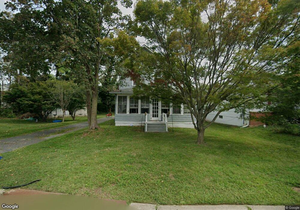
129 Vanderbilt Ave Long Branch, NJ 07740
Estimated Value: $445,000 - $501,000
2
Beds
2
Baths
1,248
Sq Ft
$379/Sq Ft
Est. Value
About This Home
This home is located at 129 Vanderbilt Ave, Long Branch, NJ 07740 and is currently estimated at $472,958, approximately $378 per square foot. 129 Vanderbilt Ave is a home located in Monmouth County with nearby schools including Long Branch High School, Holy Trinity School, and Bet Yaakov of the Jersey Shore.
Ownership History
Date
Name
Owned For
Owner Type
Purchase Details
Closed on
Feb 22, 2024
Sold by
Dafgard April M
Bought by
Dafgard April M
Current Estimated Value
Purchase Details
Closed on
Nov 20, 1992
Bought by
Dafgard Nancy J
Create a Home Valuation Report for This Property
The Home Valuation Report is an in-depth analysis detailing your home's value as well as a comparison with similar homes in the area
Home Values in the Area
Average Home Value in this Area
Purchase History
| Date | Buyer | Sale Price | Title Company |
|---|---|---|---|
| Dafgard April M | -- | None Listed On Document | |
| Dafgard April M | -- | None Listed On Document | |
| Dafgard Nancy J | $40,000 | -- |
Source: Public Records
Tax History Compared to Growth
Tax History
| Year | Tax Paid | Tax Assessment Tax Assessment Total Assessment is a certain percentage of the fair market value that is determined by local assessors to be the total taxable value of land and additions on the property. | Land | Improvement |
|---|---|---|---|---|
| 2025 | $5,003 | $387,000 | $237,500 | $149,500 |
| 2024 | $4,799 | $325,500 | $182,500 | $143,000 |
| 2023 | $4,799 | $309,000 | $172,500 | $136,500 |
| 2022 | $4,650 | $248,200 | $127,900 | $120,300 |
| 2021 | $4,650 | $232,400 | $119,900 | $112,500 |
| 2020 | $4,592 | $219,700 | $107,900 | $111,800 |
| 2019 | $4,467 | $212,500 | $105,900 | $106,600 |
| 2018 | $4,368 | $206,600 | $103,900 | $102,700 |
| 2017 | $4,157 | $201,700 | $100,900 | $100,800 |
| 2016 | $4,064 | $201,100 | $102,900 | $98,200 |
| 2015 | $4,120 | $185,000 | $95,700 | $89,300 |
| 2014 | $3,915 | $185,300 | $106,100 | $79,200 |
Source: Public Records
Map
Nearby Homes
- 88 Norwood Ave
- 28 Norwood Ave
- 2 Hilltop Rd
- 264 Norwood Ave
- 440 W End Ave
- 399 Willow Ave
- 364 Westwood Ave Unit 39
- 364 Westwood Ave Unit 71
- 364 Westwood Ave Unit 21
- 298 Poole Ave
- 54 Wall St
- 434 Westwood Ave
- 21 Dennis St
- 317 Norwood Ave
- 377 Westwood Ave
- 303 Westwood Ave
- 552 Westwood Ave
- 570 Monmouth Place
- 11 Fairway Ave
- 11 Golf St
- 133 Vanderbilt Ave
- 119 Vanderbilt Ave
- 10 Dale St
- 161 Vanderbilt Ave
- 117 Vanderbilt Ave
- 124 Vanderbilt Ave
- 126 Vanderbilt Ave Unit 128
- 12 Dale St
- 130 Vanderbilt Ave
- 113 Vanderbilt Ave
- 14 Dale St
- 107 Vanderbilt Ave
- 107 Vanderbilt Ave Unit 2
- 107 Vanderbilt Ave Unit 1
- 151 Vanderbilt Ave
- 125 Norwood Ave
- 121 Norwood Ave
- 140 Vanderbilt Ave
- 16 Dale St
- 5 Dale St