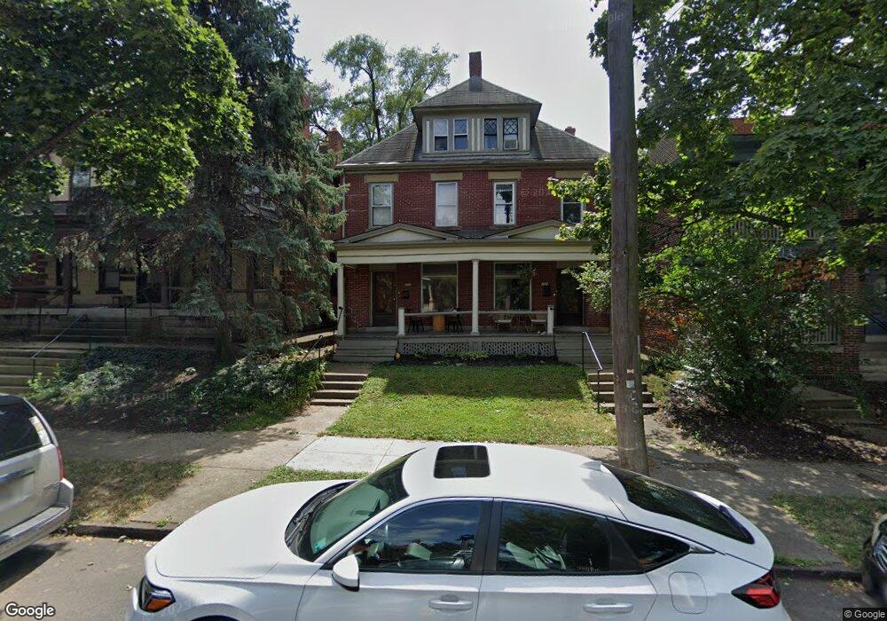
129 W 1st Ave Unit 131 Columbus, OH 43201
Short North NeighborhoodEstimated Value: $772,000 - $855,099
4
Beds
6
Baths
3,809
Sq Ft
$216/Sq Ft
Est. Value
About This Home
This home is located at 129 W 1st Ave Unit 131, Columbus, OH 43201 and is currently estimated at $823,366, approximately $216 per square foot. 129 W 1st Ave Unit 131 is a home located in Franklin County with nearby schools including Hubbard Elementary School, Dominion Middle School, and Whetstone High School.
Ownership History
Date
Name
Owned For
Owner Type
Purchase Details
Closed on
Nov 24, 2022
Sold by
Linda L Schuler Trust
Bought by
Rothan Karla R
Current Estimated Value
Purchase Details
Closed on
Aug 1, 2022
Sold by
Schuler Linda L
Bought by
Linda L Schuler Trust
Purchase Details
Closed on
Jan 13, 1994
Bought by
Schuler Linda L
Purchase Details
Closed on
Dec 19, 1991
Create a Home Valuation Report for This Property
The Home Valuation Report is an in-depth analysis detailing your home's value as well as a comparison with similar homes in the area
Home Values in the Area
Average Home Value in this Area
Purchase History
| Date | Buyer | Sale Price | Title Company |
|---|---|---|---|
| Rothan Karla R | -- | -- | |
| Linda L Schuler Trust | -- | Clark & Lowe Llc | |
| Schuler Linda L | -- | -- | |
| -- | $68,000 | -- |
Source: Public Records
Tax History Compared to Growth
Tax History
| Year | Tax Paid | Tax Assessment Tax Assessment Total Assessment is a certain percentage of the fair market value that is determined by local assessors to be the total taxable value of land and additions on the property. | Land | Improvement |
|---|---|---|---|---|
| 2024 | $9,968 | $217,510 | $77,010 | $140,500 |
| 2023 | $9,844 | $217,490 | $77,000 | $140,490 |
| 2022 | $11,137 | $209,560 | $31,930 | $177,630 |
| 2021 | $11,157 | $209,560 | $31,930 | $177,630 |
| 2020 | $11,173 | $209,560 | $31,930 | $177,630 |
| 2019 | $10,859 | $174,630 | $26,610 | $148,020 |
| 2018 | $8,804 | $174,630 | $26,610 | $148,020 |
| 2017 | $10,856 | $174,630 | $26,610 | $148,020 |
| 2016 | $7,434 | $109,420 | $28,740 | $80,680 |
| 2015 | $6,768 | $109,420 | $28,740 | $80,680 |
| 2014 | $6,784 | $109,420 | $28,740 | $80,680 |
| 2013 | $3,649 | $119,315 | $19,145 | $100,170 |
Source: Public Records
Map
Nearby Homes
- 915 Dennison Ave Unit 915
- 83 W 1st Ave
- 85-91 W 1st Ave
- 938 Hunter Ave
- 162 E 2nd Ave
- 1001 Dennison Ave
- 998 Ewing Alley Unit 998
- 969 Hunter Ave
- 986 Highland St
- 884 Neil Ave
- 11 W 1st Ave Unit B
- 845 N High St Unit 404
- 845 N High St Unit 209
- 845 N High St Unit 501 & 502
- 1025 Hunter Ave
- 1016 Neil Ave
- 17 W 3rd Ave Unit 212
- 17 W 3rd Ave Unit 213
- 1018 Neil Ave
- 769 N High St Unit 303
- 125 W 1st Ave Unit B
- 125 W 1st Ave Unit 1
- 123 W 1st Ave Unit A
- 123 W 1st Ave
- 135 W 1st Ave Unit 135 W. 1st Avenue
- 137 W 1st Ave
- 139 W 1st Ave
- 141 W 1st Ave Unit 141
- 124 W 1st Ave Unit 126
- 132 W 1st Ave Unit 1
- 132 W 1st Ave
- 120 W Prescott St
- 145 W 1st Ave Unit 147
- 118 W 1st Ave
- 138 W 1st Ave Unit 138
- 105 W 1st Ave Unit 107
- 105-107 W 1st Ave
- 107 W 1st Ave Unit 107.5
- 105 W 1st Ave Unit 105.5
- 107 W 1st Ave Unit 107 1/2