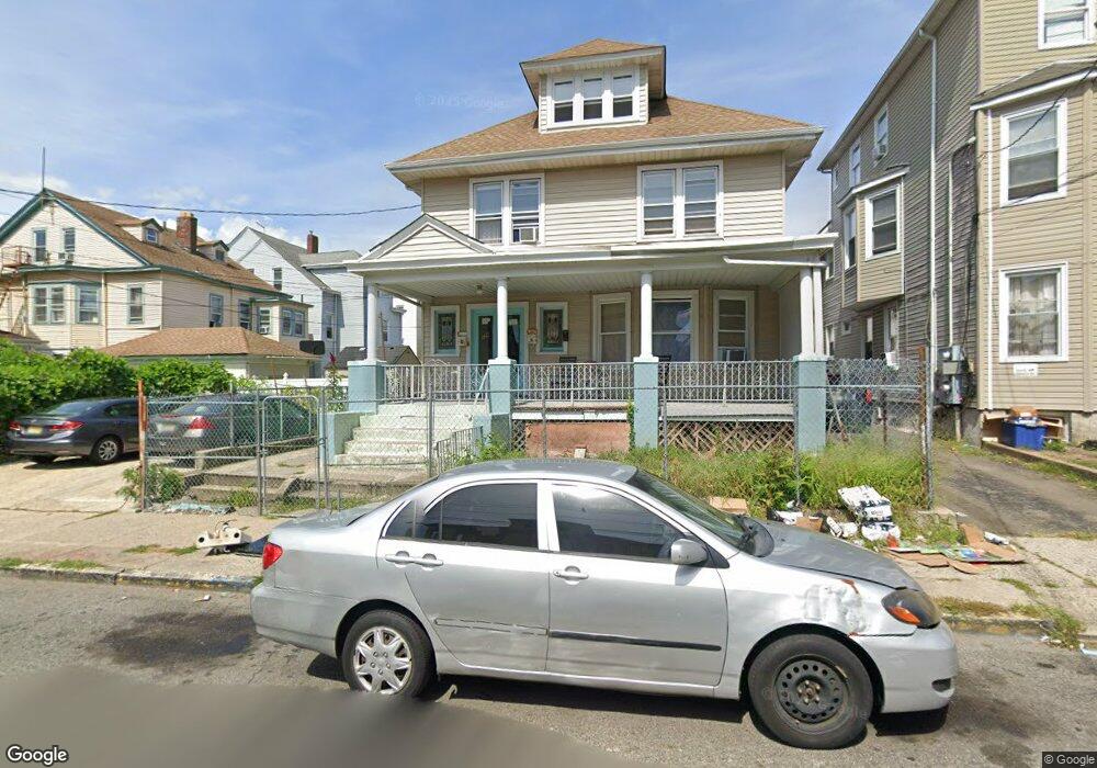
129 Walnut St Unit 131 Paterson, NJ 07522
Totowa Section NeighborhoodEstimated Value: $612,000 - $788,000
--
Bed
--
Bath
2,798
Sq Ft
$244/Sq Ft
Est. Value
About This Home
This home is located at 129 Walnut St Unit 131, Paterson, NJ 07522 and is currently estimated at $683,389, approximately $244 per square foot. 129 Walnut St Unit 131 is a home located in Passaic County with nearby schools including Dale Avenue Elementary School, Edward W. Kilpatrick School of Discovery, and Paterson Public School No. 5.
Ownership History
Date
Name
Owned For
Owner Type
Purchase Details
Closed on
May 14, 2002
Sold by
Storno Jerry
Bought by
Tahara Abdul Halim and Tahara Akthar
Current Estimated Value
Home Financials for this Owner
Home Financials are based on the most recent Mortgage that was taken out on this home.
Original Mortgage
$159,850
Outstanding Balance
$67,831
Interest Rate
7%
Mortgage Type
FHA
Estimated Equity
$615,558
Create a Home Valuation Report for This Property
The Home Valuation Report is an in-depth analysis detailing your home's value as well as a comparison with similar homes in the area
Home Values in the Area
Average Home Value in this Area
Purchase History
| Date | Buyer | Sale Price | Title Company |
|---|---|---|---|
| Tahara Abdul Halim | $175,000 | -- |
Source: Public Records
Mortgage History
| Date | Status | Borrower | Loan Amount |
|---|---|---|---|
| Open | Tahara Abdul Halim | $159,850 |
Source: Public Records
Tax History Compared to Growth
Tax History
| Year | Tax Paid | Tax Assessment Tax Assessment Total Assessment is a certain percentage of the fair market value that is determined by local assessors to be the total taxable value of land and additions on the property. | Land | Improvement |
|---|---|---|---|---|
| 2025 | $12,417 | $243,700 | $50,300 | $193,400 |
| 2024 | $11,949 | $243,700 | $50,300 | $193,400 |
| 2022 | $11,313 | $243,700 | $50,300 | $193,400 |
| 2021 | $10,908 | $243,700 | $50,300 | $193,400 |
| 2020 | $10,174 | $243,700 | $50,300 | $193,400 |
| 2019 | $9,752 | $235,900 | $47,000 | $188,900 |
| 2018 | $10,058 | $232,500 | $46,600 | $185,900 |
| 2017 | $9,597 | $230,700 | $46,300 | $184,400 |
| 2016 | $10,574 | $243,700 | $48,800 | $194,900 |
| 2015 | $10,011 | $243,700 | $48,800 | $194,900 |
| 2014 | $6,389 | $220,300 | $176,300 | $44,000 |
Source: Public Records
Map
Nearby Homes
- 288 Totowa Ave
- 72-74 Maple St
- 63 Front St
- 195 Preakness Ave
- 371 Totowa Ave Unit 373
- 241 Liberty St
- 194-196 Union Ave
- 94 Manchester Ave
- 53-55 Henderson St
- 53 Henderson St Unit 55
- 249 Edmund Ave
- 27-29 Hoxey St Unit 1
- 271-273 Preakness Ave
- 58-60 Murray Ave
- 41-43 Paterson Ave
- 120 Sherwood Ave Unit 102
- 115 Caldwell Ave
- 95-97 Caldwell Ave
- 98 Murray Ave
- 48 Jasper St
- 131 Walnut St Unit 133
- 135 Walnut St Unit 137
- 102 Preakness Ave
- 104 Preakness Ave Unit 106
- 108 Preakness Ave
- 150 Liberty St
- 152 Liberty St Unit 154
- 146 Liberty St Unit 148
- 137 Walnut St
- 137 Walnut St Unit 139
- 156 Liberty St
- 134 Walnut St
- 144 Liberty St
- 144 Liberty St Unit 1
- 96 Preakness Ave
- 158 Liberty St
- 132 Walnut St Unit 134
- 142 Liberty St
- 141 Walnut St
- 130 Walnut St Unit 132