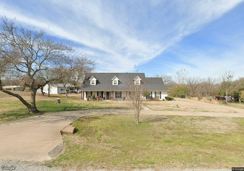
129 Westridge Trail Weatherford, TX 76087
Estimated Value: $575,000 - $716,000
3
Beds
3
Baths
2,550
Sq Ft
$246/Sq Ft
Est. Value
About This Home
This home is located at 129 Westridge Trail, Weatherford, TX 76087 and is currently estimated at $627,448, approximately $246 per square foot. 129 Westridge Trail is a home located in Parker County with nearby schools including Austin Elementary School, Hall Middle School, and Weatherford High School.
Ownership History
Date
Name
Owned For
Owner Type
Purchase Details
Closed on
Sep 29, 2020
Sold by
Brian Barnett Michael and Townley Kelly
Bought by
Barnett Michael Brain and Barnett Kelly Townley
Current Estimated Value
Home Financials for this Owner
Home Financials are based on the most recent Mortgage that was taken out on this home.
Original Mortgage
$313,500
Outstanding Balance
$277,578
Interest Rate
2.9%
Mortgage Type
New Conventional
Estimated Equity
$349,870
Purchase Details
Closed on
Sep 21, 2020
Sold by
Barnett Michael Brian and Barnett Kelly Townley
Bought by
Barnett Michael Brian and Barnett Kelly Townley
Home Financials for this Owner
Home Financials are based on the most recent Mortgage that was taken out on this home.
Original Mortgage
$313,500
Outstanding Balance
$277,578
Interest Rate
2.9%
Mortgage Type
New Conventional
Estimated Equity
$349,870
Purchase Details
Closed on
Dec 15, 2015
Sold by
Clarkson Callie Dee and Clarkson Richard
Bought by
Barnett Michael Brian and Barnett Kelly M
Home Financials for this Owner
Home Financials are based on the most recent Mortgage that was taken out on this home.
Original Mortgage
$336,000
Interest Rate
3.79%
Mortgage Type
New Conventional
Purchase Details
Closed on
Feb 24, 2009
Sold by
Hamilton Charles P
Bought by
Barnett Michael Brian and Barnett Kelly M
Home Financials for this Owner
Home Financials are based on the most recent Mortgage that was taken out on this home.
Original Mortgage
$175,900
Interest Rate
4.92%
Mortgage Type
Purchase Money Mortgage
Purchase Details
Closed on
Apr 4, 2005
Sold by
Indian Creek Property Ltd
Bought by
Hamilton Charles Patrick and Hamilton Rita Sharon
Home Financials for this Owner
Home Financials are based on the most recent Mortgage that was taken out on this home.
Original Mortgage
$134,000
Interest Rate
5.71%
Purchase Details
Closed on
Oct 28, 1988
Bought by
Barnett Michael Brian and Barnett Kelly M
Create a Home Valuation Report for This Property
The Home Valuation Report is an in-depth analysis detailing your home's value as well as a comparison with similar homes in the area
Home Values in the Area
Average Home Value in this Area
Purchase History
| Date | Buyer | Sale Price | Title Company |
|---|---|---|---|
| Barnett Michael Brain | $416,955 | None Listed On Document | |
| Barnett Michael Brian | -- | Bnt Of Texas Llc | |
| Barnett Michael Brian | -- | Attorney | |
| Barnett Michael Brian | -- | -- | |
| Clarkson Calli Dee | -- | None Available | |
| Hamilton Charles Patrick | -- | None Available | |
| Barnett Michael Brian | -- | -- |
Source: Public Records
Mortgage History
| Date | Status | Borrower | Loan Amount |
|---|---|---|---|
| Open | Barnett Michael Brain | $313,500 | |
| Previous Owner | Barnett Michael Brian | $336,000 | |
| Previous Owner | Barnett Michael Brian | $42,000 | |
| Previous Owner | Clarkson Calli Dee | $175,900 | |
| Previous Owner | Hamilton Charles Patrick | $134,000 |
Source: Public Records
Tax History Compared to Growth
Tax History
| Year | Tax Paid | Tax Assessment Tax Assessment Total Assessment is a certain percentage of the fair market value that is determined by local assessors to be the total taxable value of land and additions on the property. | Land | Improvement |
|---|---|---|---|---|
| 2025 | $8,644 | $625,000 | $150,000 | $475,000 |
| 2024 | $8,644 | $594,209 | -- | -- |
| 2023 | $8,644 | $540,190 | $0 | $0 |
| 2022 | $9,143 | $491,090 | $105,000 | $386,090 |
| 2021 | $9,913 | $491,090 | $105,000 | $386,090 |
| 2020 | $10,231 | $511,980 | $60,000 | $451,980 |
| 2019 | $9,922 | $511,980 | $60,000 | $451,980 |
| 2018 | $9,068 | $437,990 | $55,000 | $382,990 |
| 2017 | $7,428 | $389,250 | $55,000 | $334,250 |
| 2016 | $6,753 | $304,240 | $55,000 | $249,240 |
| 2015 | $6,663 | $304,240 | $55,000 | $249,240 |
| 2014 | $5,486 | $270,940 | $45,000 | $225,940 |
Source: Public Records
Map
Nearby Homes
- 105 Country Green Ct
- 344 Clear Lake Ln
- 2218 Lake Country Dr
- 104 Carriage Hill Ct
- 2214 Lake Country Dr
- 1910 Maplewood Dr
- 2020 Maplewood Dr
- 2113 Country Brook Dr
- 2102 Clear Creek Dr
- 2116 Clear Lake Rd
- 2202 Lakeforest Dr
- 1905 Clear Creek Dr
- 221 Arapahoe Ridge
- 115 Autumn Springs Ct
- 1421 Highlake Ln
- 2001 Santa fe Dr
- 510 Lockwood Ln
- 128 Black Forest Dr
- 118 Black Forest Dr
- 101 Black Forest Dr
- 133 Westridge Trail
- 125 Westridge Trail
- 132 Westridge Trail
- 128 Westridge Trail
- 124 Westridge Trail
- 103 Sunset Hill Ct
- 104 Shady Creek Ct
- 137 Westridge Trail
- 2625 Clear Lake Rd
- 136 Westridge Trail
- 121 Westridge Trail
- 120 Westridge Trail
- 105 Shady Creek Ct
- 115 Lake Circle Ct
- 100 Shady Creek Ct
- 105 Twin Hill Ct
- 111 Lake Circle Ct
- 1906 Forest Glen Ln
- 108 Forest Glen Ct
- 309 Clear Lake Ln