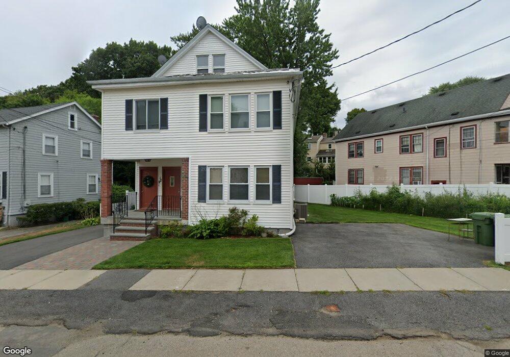
129 Worcester St Watertown, MA 02472
West Watertown NeighborhoodEstimated Value: $1,124,000 - $1,287,508
5
Beds
2
Baths
2,704
Sq Ft
$438/Sq Ft
Est. Value
About This Home
This home is located at 129 Worcester St, Watertown, MA 02472 and is currently estimated at $1,183,877, approximately $437 per square foot. 129 Worcester St is a home located in Middlesex County with nearby schools including The Kendall School and Beacon High School.
Ownership History
Date
Name
Owned For
Owner Type
Purchase Details
Closed on
Jun 26, 2024
Sold by
Konstantopoulos Peter G and Konstantopoulos Ethel
Bought by
Ethel Konstantopoulos T and Ethel Konstantopoulos
Current Estimated Value
Create a Home Valuation Report for This Property
The Home Valuation Report is an in-depth analysis detailing your home's value as well as a comparison with similar homes in the area
Home Values in the Area
Average Home Value in this Area
Purchase History
| Date | Buyer | Sale Price | Title Company |
|---|---|---|---|
| Ethel Konstantopoulos T | -- | None Available | |
| Ethel Konstantopoulos T | -- | None Available |
Source: Public Records
Tax History
| Year | Tax Paid | Tax Assessment Tax Assessment Total Assessment is a certain percentage of the fair market value that is determined by local assessors to be the total taxable value of land and additions on the property. | Land | Improvement |
|---|---|---|---|---|
| 2025 | $12,628 | $1,081,200 | $532,600 | $548,600 |
| 2024 | $11,206 | $957,800 | $518,800 | $439,000 |
| 2023 | $12,635 | $930,400 | $496,200 | $434,200 |
| 2022 | $11,733 | $885,500 | $451,100 | $434,400 |
| 2021 | $10,487 | $856,100 | $436,100 | $420,000 |
| 2020 | $10,108 | $832,600 | $421,000 | $411,600 |
| 2019 | $9,809 | $761,600 | $421,000 | $340,600 |
| 2018 | $9,445 | $701,200 | $391,000 | $310,200 |
| 2017 | $9,060 | $652,300 | $342,100 | $310,200 |
| 2016 | $8,666 | $633,500 | $323,300 | $310,200 |
| 2015 | $7,840 | $521,600 | $285,700 | $235,900 |
| 2014 | $7,522 | $502,800 | $266,900 | $235,900 |
Source: Public Records
Map
Nearby Homes
- 6 Hovey St
- 11 Barbara Terrace
- 85 Lowell Ave
- 87 Lowell Ave Unit 87
- 199 Palfrey St
- 77 Forest St
- 71 Carroll St Unit 71
- 90 Harnden Ave Unit 90
- 69 Forest St Unit 2
- 289 Waverley Ave Unit 2
- 76 Hovey St
- 76 Hovey St Unit 3
- 34 Bradford Rd Unit 34
- 170 Westminster Ave Unit 170
- 170 Westminster Ave
- 273 Edenfield Ave
- 77 Waverley Ave Unit 77
- 5 Chatham Way Unit 5
- 3 Chatham Way Unit 3
- 111 Fayette St Unit 111
- 131 Worcester St Unit 1
- 131 Worcester St
- 131 Worcester St Unit 131
- 127 Worcester St
- 40 Springfield St
- 123 Worcester St
- 34 Springfield St Unit 36
- 36 Springfield St
- 48 Springfield St Unit 48
- 48 Springfield St
- 46 Springfield St Unit 48
- 14 Marlboro Terrace Unit 16
- 16 Marlboro Terrace Unit 16
- 16 Marlboro Terrace Unit 2
- 124 Worcester St
- 30 Springfield St Unit 32
- 119 Worcester St
- 30-32 Springfield St
- 33 Springfield St Unit 35
- 33 Springfield St Unit 2
Your Personal Tour Guide
Ask me questions while you tour the home.