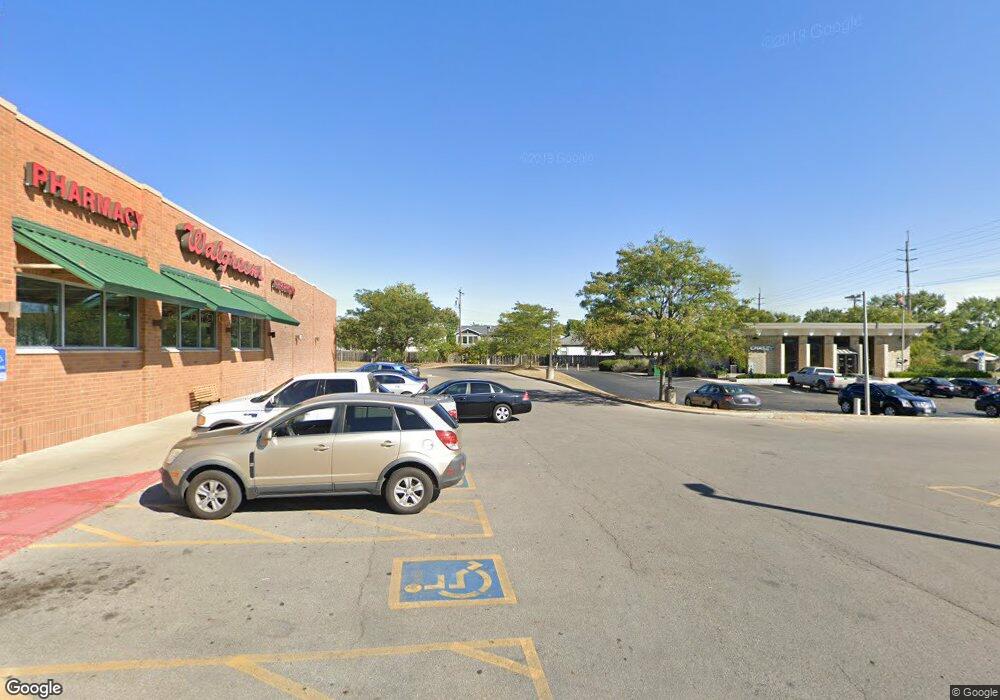
1290 Demorest Rd Columbus, OH 43204
Brookshire Neighborhood
--
Bed
--
Bath
2,339
Sq Ft
0.42
Acres
About This Home
This home is located at 1290 Demorest Rd, Columbus, OH 43204. 1290 Demorest Rd is a home located in Franklin County with nearby schools including West Franklin Elementary School, Franklin Woods Intermediate School, and Finland Middle School.
Ownership History
Date
Name
Owned For
Owner Type
Purchase Details
Closed on
Aug 23, 2022
Sold by
Cougill Llc
Bought by
Wg-Oh Llc
Purchase Details
Closed on
Dec 17, 2009
Sold by
Cougill Max E and Cougill Mary
Bought by
Cougill Llc
Purchase Details
Closed on
Mar 19, 2009
Sold by
Cougil Max E and Cougil Mary
Bought by
Franklin County Commissioners
Purchase Details
Closed on
Aug 26, 2002
Sold by
Columbus Clime Llc
Bought by
Cougill Max E
Purchase Details
Closed on
Nov 28, 2001
Sold by
Luong Hung B and Luong Shuyi Q
Bought by
Columbus Clime Llc
Purchase Details
Closed on
Nov 21, 2001
Sold by
Columbus Clime Llc
Bought by
City Of Columbus
Purchase Details
Closed on
Jul 13, 1995
Sold by
Gardes George A
Bought by
Luong Hung Bung and Luong Shuyi Qi
Purchase Details
Closed on
May 3, 1991
Purchase Details
Closed on
Mar 1, 1987
Create a Home Valuation Report for This Property
The Home Valuation Report is an in-depth analysis detailing your home's value as well as a comparison with similar homes in the area
Home Values in the Area
Average Home Value in this Area
Purchase History
| Date | Buyer | Sale Price | Title Company |
|---|---|---|---|
| Wg-Oh Llc | $4,000,000 | First American Title | |
| Cougill Llc | -- | Attorney | |
| Franklin County Commissioners | $110,562 | Attorney | |
| Cougill Max E | $3,937,500 | -- | |
| Columbus Clime Llc | $272,000 | Stewart Title | |
| City Of Columbus | -- | -- | |
| Luong Hung Bung | $150,000 | -- | |
| -- | -- | -- | |
| -- | $144,000 | -- |
Source: Public Records
Tax History Compared to Growth
Tax History
| Year | Tax Paid | Tax Assessment Tax Assessment Total Assessment is a certain percentage of the fair market value that is determined by local assessors to be the total taxable value of land and additions on the property. | Land | Improvement |
|---|---|---|---|---|
| 2024 | $3,226 | $51,140 | $51,140 | -- |
| 2023 | $3,187 | $51,135 | $51,135 | $0 |
| 2022 | $2,469 | $35,180 | $35,180 | $0 |
| 2021 | $2,541 | $35,180 | $35,180 | $0 |
| 2020 | $2,520 | $35,180 | $35,180 | $0 |
| 2019 | $2,510 | $31,960 | $31,960 | $0 |
| 2018 | $2,581 | $31,960 | $31,960 | $0 |
| 2017 | $2,583 | $31,960 | $31,960 | $0 |
| 2016 | $2,648 | $31,960 | $31,960 | $0 |
| 2015 | $2,644 | $31,960 | $31,960 | $0 |
| 2014 | $2,636 | $31,960 | $31,960 | $0 |
| 2013 | $1,311 | $31,955 | $31,955 | $0 |
Source: Public Records
Map
Nearby Homes
- 1243 Trevor Ct
- 1226 Pinnacle Dr
- 3728 Greenock Ct
- 1181 Onslow Dr
- 3360 Briggs Rd
- 3814 Clime Rd
- 1465 Tall Meadows Dr
- 1485 Demorest Rd
- 1027 S Brinker Ave
- 3551 Glorious Rd
- 3318 Miriam Dr S
- 1657 Ripplebrook Rd
- 3727-3729 Briggs Rd
- 840 Mark Place
- 3326 Bluhm Ct
- 781 Stephen Dr W
- 1037 Chestershire Rd
- 756 Brixham Rd
- 2987 Daisy Ln
- 1830 Winding Hollow Dr
- 3520 Clime Rd
- 3500 Clime Rd
- 3548 Clime Rd
- 1311 Trevor Ct
- 1299 Trevor Ct
- 3527 Trevor Dr
- 3550 Clime Rd
- 1291 Trevor Ct
- 1285 Trevor Ct
- 1279 Trevor Ct
- 1254 Demorest Rd
- 3521 Trevor Dr
- 1387 Louvaine Dr
- 1273 Trevor Ct
- 1360 Louvaine Dr
- 3515 Trevor Dr
- 1267 Trevor Ct
- 1165 Georges Place
- 3508 Trevor Dr
- 1395 Louvaine Dr
