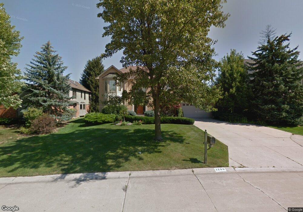
1290 Kingspath Dr Rochester Hills, MI 48306
Estimated Value: $620,820 - $664,000
4
Beds
3
Baths
3,058
Sq Ft
$211/Sq Ft
Est. Value
About This Home
This home is located at 1290 Kingspath Dr, Rochester Hills, MI 48306 and is currently estimated at $646,205, approximately $211 per square foot. 1290 Kingspath Dr is a home located in Oakland County with nearby schools including Musson Elementary School, Van Hoosen Middle School, and Rochester Adams High School.
Ownership History
Date
Name
Owned For
Owner Type
Purchase Details
Closed on
Sep 10, 2021
Sold by
Dineshbhai Modi Jiteshkumar
Bought by
Modi Jiteshkumr Dineshbhai and Modi Beth Ann
Current Estimated Value
Purchase Details
Closed on
Sep 10, 2010
Sold by
Gahman Patrick A and Gahman Christine S
Bought by
Modi Jiteshkumar
Purchase Details
Closed on
Jul 7, 1995
Sold by
Swenson Robert L
Bought by
Hetrick Eric S and Hetrick Deborah J
Home Financials for this Owner
Home Financials are based on the most recent Mortgage that was taken out on this home.
Original Mortgage
$238,000
Interest Rate
6.5%
Mortgage Type
New Conventional
Create a Home Valuation Report for This Property
The Home Valuation Report is an in-depth analysis detailing your home's value as well as a comparison with similar homes in the area
Home Values in the Area
Average Home Value in this Area
Purchase History
| Date | Buyer | Sale Price | Title Company |
|---|---|---|---|
| Modi Jiteshkumr Dineshbhai | -- | None Available | |
| Modi Jiteshkumar | $312,500 | None Available | |
| Hetrick Eric S | $297,500 | -- |
Source: Public Records
Mortgage History
| Date | Status | Borrower | Loan Amount |
|---|---|---|---|
| Previous Owner | Hetrick Eric S | $238,000 |
Source: Public Records
Tax History Compared to Growth
Tax History
| Year | Tax Paid | Tax Assessment Tax Assessment Total Assessment is a certain percentage of the fair market value that is determined by local assessors to be the total taxable value of land and additions on the property. | Land | Improvement |
|---|---|---|---|---|
| 2022 | $3,078 | $221,210 | $0 | $0 |
| 2018 | $5,101 | $194,460 | $0 | $0 |
| 2017 | $4,999 | $192,160 | $0 | $0 |
| 2015 | -- | $181,480 | $0 | $0 |
| 2014 | -- | $165,390 | $0 | $0 |
| 2011 | -- | $141,890 | $0 | $0 |
Source: Public Records
Map
Nearby Homes
- 3634 Camden Ct
- 3640 Camden Ct
- 3879 Teakwood Ln
- 3674 Merriweather Ln
- 423 Silvervale Dr
- 3534 Riverside Dr Unit 141
- 3273 Salem Dr
- 4035 Hillsdale Dr Unit 275
- 1609 Kilburn Rd N
- 1906 Independence Ct
- 2935 Woodford Cir
- 3095 Bridgewater Rd Unit 30
- 3633 Thornwood Dr
- 3639 Heatherwood Ct
- 3057 Bridgewater Rd
- 2700 Mohawk Ln
- 5700 Rolling Hills Dr
- 3780 Bald Mountain Rd
- 3333 Walton Blvd
- 2452 Lassiter Dr
- 1294 Kingspath Dr
- 1282 Kingspath Dr
- 1274 Kingspath Dr
- 1298 Kingspath Dr
- 3568 Wedgewood Dr
- 3614 Hollenshade Dr
- 3552 Wedgewood Dr
- 3613 Hollenshade Dr
- 3576 Wedgewood Dr
- 1302 Kingspath Dr
- 3600 Aynsley Dr
- 3596 Aynsley Dr
- 1303 Kingspath Dr
- 3544 Wedgewood Dr Unit Bldg-Unit
- 3544 Wedgewood Dr
- 3621 Hollenshade Dr
- 3618 Hollenshade Dr
- 3612 Aynsley Dr
- 3584 Wedgewood Dr
- 1308 Kingspath Dr