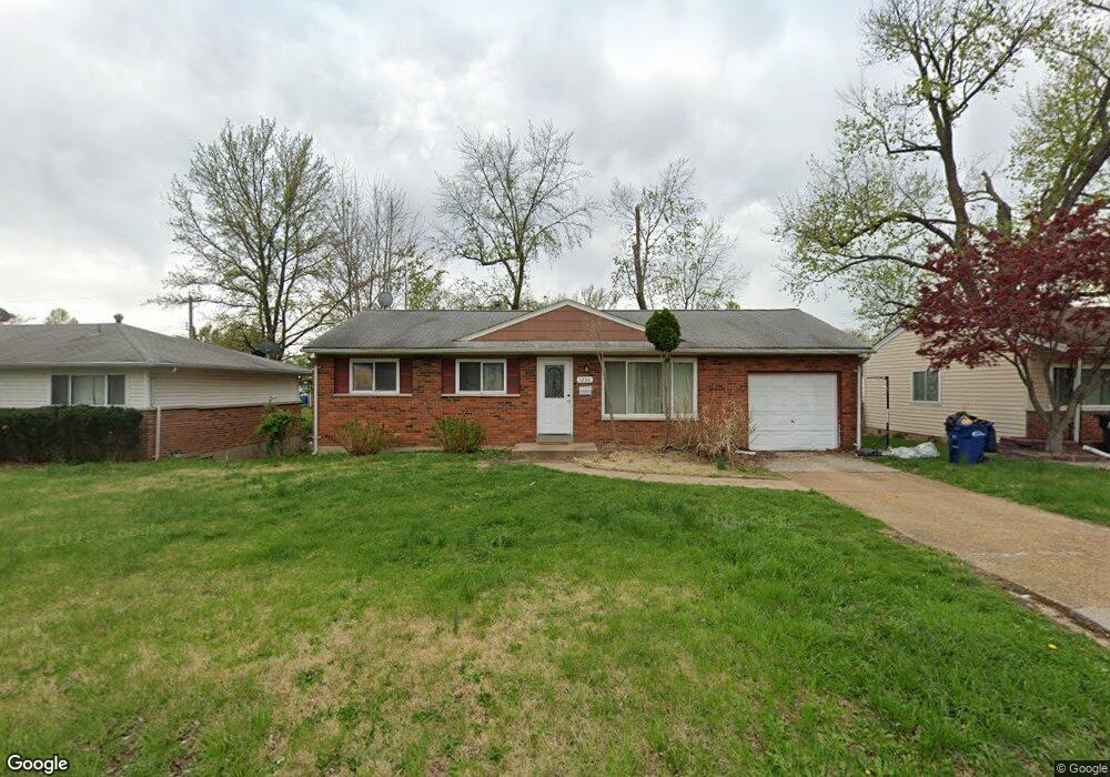
1290 Mullanphy Rd Florissant, MO 63031
Estimated Value: $135,000 - $164,000
3
Beds
1
Bath
962
Sq Ft
$160/Sq Ft
Est. Value
About This Home
This home is located at 1290 Mullanphy Rd, Florissant, MO 63031 and is currently estimated at $153,675, approximately $159 per square foot. 1290 Mullanphy Rd is a home located in St. Louis County with nearby schools including McCurdy Elementary School, Northwest Middle School, and Hazelwood West High School.
Ownership History
Date
Name
Owned For
Owner Type
Purchase Details
Closed on
Feb 28, 2007
Sold by
Deutsche Bank National Trust Co
Bought by
Turner Stanley and Turner Athena
Current Estimated Value
Home Financials for this Owner
Home Financials are based on the most recent Mortgage that was taken out on this home.
Original Mortgage
$80,655
Outstanding Balance
$54,739
Interest Rate
8.7%
Mortgage Type
Purchase Money Mortgage
Estimated Equity
$98,936
Purchase Details
Closed on
Nov 17, 2006
Sold by
Gobble Angela G
Bought by
Deutsche Bank National Trust Co and First Franklin Mortgage Loan Trust 2005-
Purchase Details
Closed on
May 31, 2005
Sold by
Gobble Delmus G and Gobble Margaret A
Bought by
Gobble Angela G
Home Financials for this Owner
Home Financials are based on the most recent Mortgage that was taken out on this home.
Original Mortgage
$99,900
Interest Rate
7.25%
Mortgage Type
Fannie Mae Freddie Mac
Create a Home Valuation Report for This Property
The Home Valuation Report is an in-depth analysis detailing your home's value as well as a comparison with similar homes in the area
Home Values in the Area
Average Home Value in this Area
Purchase History
| Date | Buyer | Sale Price | Title Company |
|---|---|---|---|
| Turner Stanley | $84,900 | Kts | |
| Deutsche Bank National Trust Co | $83,753 | None Available | |
| Gobble Angela G | -- | Integrity Land Title Co Inc |
Source: Public Records
Mortgage History
| Date | Status | Borrower | Loan Amount |
|---|---|---|---|
| Open | Turner Stanley | $80,655 | |
| Previous Owner | Gobble Angela G | $99,900 | |
| Closed | Deutsche Bank National Trust Co | -- |
Source: Public Records
Tax History Compared to Growth
Tax History
| Year | Tax Paid | Tax Assessment Tax Assessment Total Assessment is a certain percentage of the fair market value that is determined by local assessors to be the total taxable value of land and additions on the property. | Land | Improvement |
|---|---|---|---|---|
| 2025 | $2,092 | $26,470 | $5,490 | $20,980 |
| 2024 | $2,092 | $23,290 | $3,150 | $20,140 |
| 2023 | $2,092 | $23,290 | $3,150 | $20,140 |
| 2022 | $1,895 | $18,810 | $3,610 | $15,200 |
| 2021 | $1,846 | $18,810 | $3,610 | $15,200 |
| 2020 | $1,730 | $16,600 | $3,150 | $13,450 |
| 2019 | $1,704 | $16,600 | $3,150 | $13,450 |
| 2018 | $1,458 | $13,030 | $2,810 | $10,220 |
| 2017 | $1,457 | $13,030 | $2,810 | $10,220 |
| 2016 | $1,450 | $12,790 | $2,430 | $10,360 |
| 2015 | $1,419 | $12,790 | $2,430 | $10,360 |
| 2014 | $1,302 | $12,070 | $2,510 | $9,560 |
Source: Public Records
Map
Nearby Homes
- 1155 Mullanphy Rd
- 1415 Boulder Dr
- 1120 Bluebird Dr
- 1395 Bluebird Dr
- 1150 Verlene Dr
- 1505 Swallow Ln
- 890 Tyson Dr
- 6 Charlotte Dr
- 25 Hammes Dr
- 915 Iris Dr
- 200 Francisca Dr
- 1825 Swallow Ln
- 685 Mullanphy Rd
- 2186 Aristocrat Dr
- 1445 Vesper Dr
- 8 Mcnulty Dr
- 2040 Splendor Dr
- 1480 Vesper Dr
- 130 Ruth Dr
- 2255 Collier Dr
- 1300 Mullanphy Rd
- 1280 Mullanphy Rd
- 1291 Aspen Dr
- 1310 Mullanphy Rd
- 1270 Mullanphy Rd
- 1301 Aspen Dr
- 1281 Aspen Dr
- 1295 Mullanphy Rd
- 1311 Aspen Dr
- 1271 Aspen Dr
- 1285 Mullanphy Rd
- 1260 Mullanphy Rd
- 1320 Mullanphy Rd
- 1275 Mullanphy Rd
- 1335 Mullanphy Rd
- 1321 Aspen Dr
- 1261 Aspen Dr
- 1340 Mullanphy Rd
- 1240 Mullanphy Rd
- 1280 Flicker Dr