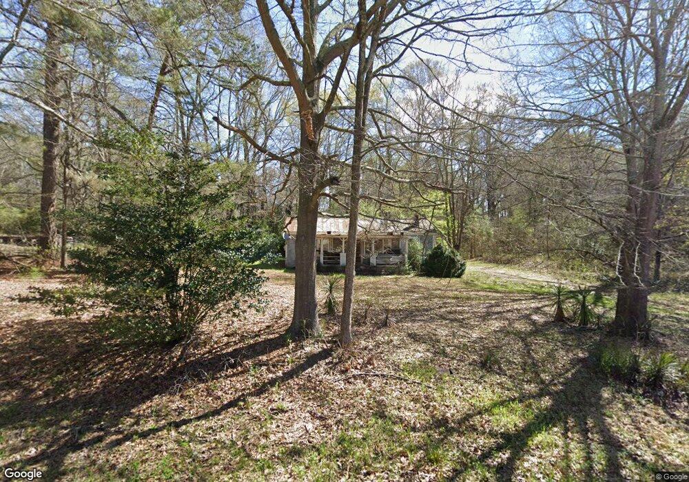
1290 Old Siloam Rd Union Point, GA 30669
Estimated Value: $70,574 - $162,000
2
Beds
1
Bath
774
Sq Ft
$149/Sq Ft
Est. Value
About This Home
This home is located at 1290 Old Siloam Rd, Union Point, GA 30669 and is currently estimated at $115,394, approximately $149 per square foot. 1290 Old Siloam Rd is a home with nearby schools including Greene County High School.
Ownership History
Date
Name
Owned For
Owner Type
Purchase Details
Closed on
Feb 6, 2025
Sold by
Barnhart Lakeria
Bought by
Barnhart Akilah
Current Estimated Value
Purchase Details
Closed on
Jan 1, 2021
Sold by
Barnhart Akilah
Bought by
Barnhart Lakeria
Purchase Details
Closed on
Feb 26, 2018
Sold by
Barnhart Bobby
Bought by
Barnhart Akilah
Purchase Details
Closed on
Dec 2, 2009
Sold by
Barnhart Becky
Bought by
Barnhart Bobby
Purchase Details
Closed on
Aug 9, 2007
Sold by
Barnhart Stevie L and Barnhart Becky
Bought by
Barnhart Becky and Barnhart Bobby
Purchase Details
Closed on
Jun 29, 2007
Sold by
Barnhart Stevie L
Bought by
Barnhart Bobby
Purchase Details
Closed on
Aug 1, 2006
Sold by
Barnhart Stevie L
Bought by
Barnhart Becky
Purchase Details
Closed on
Jun 9, 1997
Sold by
Beasley Ralph
Bought by
Barnhart Stevie L
Purchase Details
Closed on
Mar 1, 1989
Sold by
Beasley Ralph
Bought by
Beasley Ralph
Purchase Details
Closed on
Feb 1, 1989
Sold by
Beasley Ralph
Bought by
Beasley Ralph
Purchase Details
Closed on
Jan 1, 1989
Sold by
Beasley Blanche M
Bought by
Beasley Ralph
Purchase Details
Closed on
Jan 1, 1958
Bought by
Beasley Idus
Create a Home Valuation Report for This Property
The Home Valuation Report is an in-depth analysis detailing your home's value as well as a comparison with similar homes in the area
Home Values in the Area
Average Home Value in this Area
Purchase History
| Date | Buyer | Sale Price | Title Company |
|---|---|---|---|
| Barnhart Akilah | -- | -- | |
| Barnhart Lakeria | -- | -- | |
| Barnhart Lakeria | -- | -- | |
| Barnhart Akilah | -- | -- | |
| Barnhart Bobby | -- | -- | |
| Barnhart Becky | -- | -- | |
| Barnhart Bobby | -- | -- | |
| Barnhart Becky | -- | -- | |
| Barnhart Stevie L | -- | -- | |
| Beasley Ralph | -- | -- | |
| Beasley Ralph | -- | -- | |
| Beasley Ralph | -- | -- | |
| Beasley Blanche M | -- | -- | |
| Beasley Idus | -- | -- |
Source: Public Records
Tax History Compared to Growth
Tax History
| Year | Tax Paid | Tax Assessment Tax Assessment Total Assessment is a certain percentage of the fair market value that is determined by local assessors to be the total taxable value of land and additions on the property. | Land | Improvement |
|---|---|---|---|---|
| 2024 | $494 | $15,400 | $8,400 | $7,000 |
| 2023 | $476 | $14,920 | $8,400 | $6,520 |
| 2022 | $430 | $14,080 | $8,400 | $5,680 |
| 2021 | $430 | $13,480 | $8,400 | $5,080 |
| 2020 | $287 | $5,680 | $2,160 | $3,520 |
| 2019 | $290 | $5,680 | $2,160 | $3,520 |
| 2018 | $268 | $5,680 | $2,160 | $3,520 |
| 2017 | $259 | $5,682 | $2,160 | $3,522 |
Source: Public Records
Map
Nearby Homes
- 1241 Old Siloam Rd
- 1581 Highway 77 S Hwy
- 1581 Highway 77 S
- 1041 Hillcrest Dr
- 0 S Rhodes St Unit 10618488
- 202 Veazey St
- 112 Hendry St
- 324 N Rhodes St
- 215 Hunter St
- 0 Washington Hwy Unit 7276060
- 0 Woodland Ct Unit 10543600
- 5401 Union Point Hwy
- 1201 Buffalo Lick Rd
- 0 Buffalo Lick Rd Unit 10551234
- 0 Buffalo Lick Rd Unit 10551325
- 1251 Brick House Rd
- 1251 Brickhouse Rd
- 0 Old Union Point Rd Unit 1 10557753
- 1860 Washington Hwy
- 1251 Adams Rd
- 1001 Green Acres Dr
- 1321 Old Siloam Rd
- 1282 Old Siloam Rd
- 1421 Highway 77 S
- 1321 Highway 77 S
- 1360 Highway 77 S
- 1431 Highway 77 N
- 1420 Highway 77 S
- 1041 Green Acres Dr
- 1271 Country Club Dr
- 131 Green Acres Dr
- 1301 Highway 77 S
- 1261 Country Club Dr
- 1021 Green Acres Way
- 1311 Green Acres Dr
- 1190 Old Siloam Rd
- 1300 Country Club Dr
- 1300 Old Siloam Rd
- 1090 Green Acres Dr
- 1450 Highway 77 S