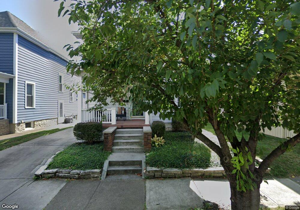
1290 Westwood Ave Columbus, OH 43212
Estimated Value: $520,000 - $791,000
4
Beds
1
Bath
1,364
Sq Ft
$500/Sq Ft
Est. Value
About This Home
This home is located at 1290 Westwood Ave, Columbus, OH 43212 and is currently estimated at $682,230, approximately $500 per square foot. 1290 Westwood Ave is a home located in Franklin County with nearby schools including Robert Louis Stevenson Elementary School, Larson Middle School, and Grandview Heights High School.
Ownership History
Date
Name
Owned For
Owner Type
Purchase Details
Closed on
Mar 2, 1998
Sold by
Hower Timothy James
Bought by
Shraim Mustafa S and Shraim Ellen S
Current Estimated Value
Purchase Details
Closed on
Dec 2, 1993
Create a Home Valuation Report for This Property
The Home Valuation Report is an in-depth analysis detailing your home's value as well as a comparison with similar homes in the area
Home Values in the Area
Average Home Value in this Area
Purchase History
| Date | Buyer | Sale Price | Title Company |
|---|---|---|---|
| Shraim Mustafa S | $125,000 | Celtic Title | |
| -- | $100,000 | -- |
Source: Public Records
Tax History Compared to Growth
Tax History
| Year | Tax Paid | Tax Assessment Tax Assessment Total Assessment is a certain percentage of the fair market value that is determined by local assessors to be the total taxable value of land and additions on the property. | Land | Improvement |
|---|---|---|---|---|
| 2024 | $10,434 | $178,890 | $93,210 | $85,680 |
| 2023 | $9,140 | $178,890 | $93,210 | $85,680 |
| 2022 | $10,177 | $169,620 | $51,630 | $117,990 |
| 2021 | $9,528 | $169,620 | $51,630 | $117,990 |
| 2020 | $9,488 | $169,620 | $51,630 | $117,990 |
| 2019 | $9,049 | $143,160 | $51,630 | $91,530 |
| 2018 | $7,823 | $143,160 | $51,630 | $91,530 |
| 2017 | $8,437 | $143,160 | $51,630 | $91,530 |
| 2016 | $6,636 | $96,400 | $41,830 | $54,570 |
| 2015 | $6,636 | $96,400 | $41,830 | $54,570 |
| 2014 | $6,657 | $96,400 | $41,830 | $54,570 |
| 2013 | $2,924 | $87,605 | $38,010 | $49,595 |
Source: Public Records
Map
Nearby Homes
- 1263 Oakland Ave
- 1459 Elmwood Ave Unit 1459
- 1313 Lincoln Rd
- 1561 Glenn Ave
- 1475 W 3rd Ave Unit 204
- 1000 Urlin Ave Unit 1822
- 1000 Urlin Ave Unit 2007
- 1000 Urlin Ave Unit 520
- 1000 Urlin Ave Unit 605
- 1000 Urlin Ave Unit 511
- 1000 Urlin Ave Unit 1007
- 1000 Urlin Ave Unit 518
- 1000 Urlin Ave Unit 1607
- 1655-1657 Ashland Ave
- 1661 Ashland Ave Unit 663
- 2015 W 5th Ave Unit 211
- 2015 W 5th Ave Unit 102
- 2015 W 5th Ave Unit 108
- 1631 Roxbury Rd Unit F3
- 1631 Roxbury Rd Unit B6
- 1294 Westwood Ave
- 1286 Westwood Ave
- 1276 Westwood Ave
- 1304 Westwood Ave
- 1274 Westwood Ave
- 1279 Elmwood Ave
- 1308 Westwood Ave
- 1283 Elmwood Ave
- 1291 Elmwood Ave
- 1289 Elmwood Ave
- 1271 Elmwood Ave
- 1275 Elmwood Ave
- 1295 Westwood Ave
- 1285 Westwood Ave
- 1297 Elmwood Ave
- 1263 Elmwood Ave
- 1309 Westwood Ave
- 1299 Westwood Ave
- 1281 Westwood Ave
- 1316 Westwood Ave