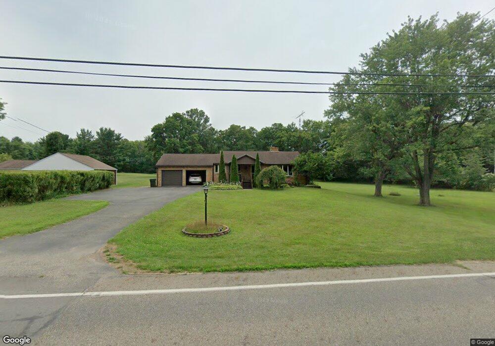
12900 Beeson St NE Alliance, OH 44601
Estimated Value: $210,940 - $271,000
3
Beds
1
Bath
1,395
Sq Ft
$169/Sq Ft
Est. Value
About This Home
This home is located at 12900 Beeson St NE, Alliance, OH 44601 and is currently estimated at $235,485, approximately $168 per square foot. 12900 Beeson St NE is a home located in Stark County with nearby schools including Marlington High School and Regina Coeli/St Joseph School.
Ownership History
Date
Name
Owned For
Owner Type
Purchase Details
Closed on
Aug 31, 2015
Sold by
Davis Catrina and Ring Catrina
Bought by
Davis Catrina
Current Estimated Value
Home Financials for this Owner
Home Financials are based on the most recent Mortgage that was taken out on this home.
Original Mortgage
$104,000
Outstanding Balance
$40,257
Interest Rate
3.16%
Mortgage Type
New Conventional
Estimated Equity
$195,228
Purchase Details
Closed on
Sep 29, 1995
Sold by
Vocila Nicholas L
Bought by
Ring Catrina
Home Financials for this Owner
Home Financials are based on the most recent Mortgage that was taken out on this home.
Original Mortgage
$69,000
Interest Rate
8%
Mortgage Type
New Conventional
Create a Home Valuation Report for This Property
The Home Valuation Report is an in-depth analysis detailing your home's value as well as a comparison with similar homes in the area
Home Values in the Area
Average Home Value in this Area
Purchase History
| Date | Buyer | Sale Price | Title Company |
|---|---|---|---|
| Davis Catrina | -- | Attorney | |
| Ring Catrina | $77,000 | -- |
Source: Public Records
Mortgage History
| Date | Status | Borrower | Loan Amount |
|---|---|---|---|
| Open | Davis Catrina | $104,000 | |
| Closed | Ring Catrina | $69,000 |
Source: Public Records
Tax History Compared to Growth
Tax History
| Year | Tax Paid | Tax Assessment Tax Assessment Total Assessment is a certain percentage of the fair market value that is determined by local assessors to be the total taxable value of land and additions on the property. | Land | Improvement |
|---|---|---|---|---|
| 2025 | -- | $50,090 | $17,010 | $33,080 |
| 2024 | -- | $50,090 | $17,010 | $33,080 |
| 2023 | $1,728 | $48,900 | $15,750 | $33,150 |
| 2022 | $1,699 | $48,900 | $15,750 | $33,150 |
| 2021 | $1,774 | $48,900 | $15,750 | $33,150 |
| 2020 | $1,676 | $41,160 | $13,580 | $27,580 |
| 2019 | $1,666 | $41,170 | $13,580 | $27,590 |
| 2018 | $1,669 | $41,170 | $13,580 | $27,590 |
| 2017 | $1,569 | $36,230 | $10,120 | $26,110 |
| 2016 | $1,631 | $37,660 | $11,690 | $25,970 |
Source: Public Records
Map
Nearby Homes
- 13061 Beeson St NE
- 10666 Wilma Ave NE
- 13334 Cindy St NE
- 0 Meadow St NE
- 0 W Main St Unit 5090123
- 1430 Westwood Ave
- 11480 Aebi Ave NE
- 2081 Marwood Cir
- 11940 Freshley Ave NE
- 11960 Freshley Ave NE
- 000 Klinger Ave
- 2377 Ansley St Unit 2377
- 13109 Edison St NE
- 12355 Edison St NE
- 432 Johnson Ave
- 0 Moulin Ave NE
- 0 Klinger Ave NE
- 1201 Overlook Dr
- 1038 Fairview Place
- 0 Johnson Ave NE Unit 5142926
- 12924 Beeson St NE
- 12940 Beeson St NE
- 0 Freshley Ave NE Unit 3953328
- 10568 Freshley Ave NE
- 10487 Freshley Ave NE
- 12965 Beeson St NE
- 12911 Beeson St NE
- 12966 Beeson St NE
- 10410 Freshley Ave NE
- 10543 Freshley Ave NE
- 10412 Freshley Ave NE
- 12990 Beeson St NE
- 12979 Beeson St NE
- 10571 Freshley Ave NE
- 10594 Freshley Ave NE
- 13006 Beeson St NE
- 12790 Beeson St NE
- 10435 Freshley Ave NE
- 10612 Freshley Ave NE
- 13020 Beeson St NE