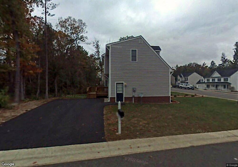
12900 Liberty Walk Dr Midlothian, VA 23112
Estimated Value: $438,463 - $472,000
3
Beds
3
Baths
2,050
Sq Ft
$225/Sq Ft
Est. Value
About This Home
This home is located at 12900 Liberty Walk Dr, Midlothian, VA 23112 and is currently estimated at $460,616, approximately $224 per square foot. 12900 Liberty Walk Dr is a home located in Chesterfield County with nearby schools including Swift Creek Elementary School, Swift Creek Middle, and Clover Hill High.
Ownership History
Date
Name
Owned For
Owner Type
Purchase Details
Closed on
May 30, 2025
Sold by
Ahmed Muzzafer and Yasmeen Mussarat
Bought by
Ahmed Muzzafer and Mussarat Yasmeen
Current Estimated Value
Purchase Details
Closed on
Jul 12, 2006
Sold by
Capitol Builders
Bought by
Ahmed Mazaffer
Home Financials for this Owner
Home Financials are based on the most recent Mortgage that was taken out on this home.
Original Mortgage
$256,500
Interest Rate
6.7%
Mortgage Type
New Conventional
Create a Home Valuation Report for This Property
The Home Valuation Report is an in-depth analysis detailing your home's value as well as a comparison with similar homes in the area
Home Values in the Area
Average Home Value in this Area
Purchase History
| Date | Buyer | Sale Price | Title Company |
|---|---|---|---|
| Ahmed Muzzafer | -- | None Listed On Document | |
| Ahmed Muzzafer | -- | None Listed On Document | |
| Ahmed Mazaffer | $285,000 | -- |
Source: Public Records
Mortgage History
| Date | Status | Borrower | Loan Amount |
|---|---|---|---|
| Previous Owner | Ahmed Mazaffer | $256,500 |
Source: Public Records
Tax History Compared to Growth
Tax History
| Year | Tax Paid | Tax Assessment Tax Assessment Total Assessment is a certain percentage of the fair market value that is determined by local assessors to be the total taxable value of land and additions on the property. | Land | Improvement |
|---|---|---|---|---|
| 2025 | $3,567 | $398,000 | $80,000 | $318,000 |
| 2024 | $3,567 | $394,000 | $80,000 | $314,000 |
| 2023 | $3,129 | $343,800 | $74,000 | $269,800 |
| 2022 | $2,952 | $320,900 | $72,000 | $248,900 |
| 2021 | $2,669 | $274,000 | $70,000 | $204,000 |
| 2020 | $2,568 | $270,300 | $70,000 | $200,300 |
| 2019 | $2,549 | $268,300 | $68,000 | $200,300 |
| 2018 | $2,436 | $256,400 | $66,000 | $190,400 |
| 2017 | $2,377 | $247,600 | $66,000 | $181,600 |
| 2016 | $2,255 | $234,900 | $66,000 | $168,900 |
| 2015 | $2,235 | $230,200 | $66,000 | $164,200 |
| 2014 | $2,192 | $225,700 | $66,000 | $159,700 |
Source: Public Records
Map
Nearby Homes
- 12918 Mill Meadow Ct
- 12760 Forest Mill Dr
- 12548 Petrel Crossing
- 12706 Forest Mill Dr
- 3807 Waterwheel Dr
- 12576 Petrel Crossing
- 3601 Quail Meadows Place
- 3401 Quail Hill Dr
- 4018 Timber Ridge Rd
- 3301 Old Hundred Rd S
- 3207 Quail Hill Dr
- 12812 Hull Street Rd
- 3208 Quail Hill Dr
- 3200 Hunts Bridge Ct
- 4200 Northwich Rd
- 3114 Fox Chase Dr
- 4013 McTyres Cove Rd
- 4717 Cloverleigh Dr
- 4825 Cloverleigh Dr
- 4821 Cloverleigh Dr
- 3718 Mill Meadow Dr
- 3712 Mill Meadow Dr
- 3800 Mill Meadow Dr
- 3706 Mill Meadow Dr
- 12901 Liberty Walk Dr
- 3719 Mill Meadow Dr
- 3801 Mill Meadow Dr
- 3713 Mill Meadow Dr
- 3700 Mill Meadow Dr
- 3700 Liberty Point Dr
- 3807 Mill Meadow Dr
- 3701 Mill Meadow Dr
- 3701 Liberty Point Dr
- 3813 Mill Meadow Dr
- 3606 Mill Meadow Dr
- 3731 Liberty Point Dr
- 3706 Liberty Point Dr
- 3607 Mill Meadow Dr
- 3706 Mill Walk Dr