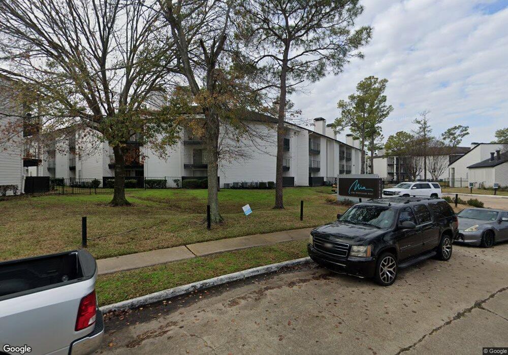
12902 Brant Rock Dr Unit 357 Houston, TX 77082
Briar Village Neighborhood
1
Bed
1
Bath
606
Sq Ft
7.03
Acres
About This Home
This home is located at 12902 Brant Rock Dr Unit 357, Houston, TX 77082. 12902 Brant Rock Dr Unit 357 is a home located in Harris County with nearby schools including Heflin Elementary School, O'Donnell Middle School, and Budewig Intermediate School.
Ownership History
Date
Name
Owned For
Owner Type
Purchase Details
Closed on
Dec 17, 2015
Sold by
Amac I Copper Cove Llc
Bought by
Integrity Cove Llc
Purchase Details
Closed on
Oct 1, 1997
Sold by
Wdn Properties Ltd
Bought by
Walden/Drever Operating Partnership Lp
Create a Home Valuation Report for This Property
The Home Valuation Report is an in-depth analysis detailing your home's value as well as a comparison with similar homes in the area
Home Values in the Area
Average Home Value in this Area
Purchase History
| Date | Buyer | Sale Price | Title Company |
|---|---|---|---|
| Integrity Cove Llc | -- | None Available | |
| Integrity Cove Llc | -- | None Available | |
| Integrity Cove Llc | -- | None Available | |
| Integrity Cove Llc | -- | None Available | |
| Integrity Cove Llc | -- | None Available | |
| Integrity Cove Llc | -- | None Available | |
| Walden/Drever Operating Partnership Lp | -- | -- | |
| Walden/Drever Operating Partnership Lp | -- | -- | |
| Walden/Drever Operating Partnership Lp | -- | -- | |
| Walden/Drever Operating Partnership Lp | -- | -- | |
| Walden/Drever Operating Partnership Lp | -- | -- | |
| Walden/Drever Operating Partnership Lp | -- | -- |
Source: Public Records
Tax History Compared to Growth
Tax History
| Year | Tax Paid | Tax Assessment Tax Assessment Total Assessment is a certain percentage of the fair market value that is determined by local assessors to be the total taxable value of land and additions on the property. | Land | Improvement |
|---|---|---|---|---|
| 2025 | $368,109 | $1,073,272 | $1,073,272 | -- |
| 2024 | $368,109 | $16,204,402 | $1,073,303 | $15,131,099 |
| 2023 | $368,109 | $19,600,000 | $1,073,303 | $18,526,697 |
| 2022 | $374,410 | $16,098,197 | $1,073,303 | $15,024,894 |
| 2021 | $333,721 | $13,671,144 | $1,073,303 | $12,597,841 |
| 2020 | $389,423 | $15,398,387 | $1,073,303 | $14,325,084 |
| 2019 | $317,128 | $11,950,225 | $1,073,303 | $10,876,922 |
| 2018 | $91,242 | $6,860,285 | $1,073,303 | $5,786,982 |
| 2017 | $163,592 | $6,227,648 | $1,073,303 | $5,154,345 |
| 2016 | $190,797 | $7,263,291 | $1,073,303 | $6,189,988 |
| 2015 | $132,438 | $5,620,823 | $1,073,303 | $4,547,520 |
| 2014 | $132,438 | $4,990,239 | $996,639 | $3,993,600 |
Source: Public Records
Map
Nearby Homes
- 13246 Rain Lily Ln
- 13061 High Star Dr
- 13306 Rain Lily Ln
- 6551 S Briar Bayou Dr
- 6223 Weststar Ln
- 13032 Clarewood Dr
- 6111 Westbranch Dr
- 6115 Westbranch Dr
- 6302 Wellness Landing Ln
- 3714 Parkridge Glen Dr
- 13206 Ensley Wood Dr
- 3806 Luton Park Dr
- 12660 Ashford Point Dr Unit 608
- 12660 Ashford Point Dr Unit 413
- 12660 Ashford Point Dr Unit 416
- 12660 Ashford Point Dr Unit 302
- 12660 Ashford Point Dr Unit 811
- 12821 Hill Branch Dr
- 3715 Golders Green Dr
- 13043 Clarewood Dr
- 12902 Brant Rock Dr Unit 103
- 12902 Brant Rock Dr Unit 212
- 12902 Brant Rock Dr Unit 130
- 12902 Brant Rock Dr Unit 201
- 12902 Brant Rock Dr Unit 204
- 12902 Brant Rock Dr Unit 209
- 12902 Brant Rock Dr Unit 353
- 12902 Brant Rock Dr Unit 706
- 12902 Brant Rock Dr Unit 382
- 12902 Brant Rock Dr Unit 387
- 12902 Brant Rock Dr Unit 346
- 12902 Brant Rock Dr Unit 321
- 12902 Brant Rock Dr Unit 363
- 12902 Brant Rock Dr Unit 631
- 12902 Brant Rock Dr Unit 330
- 12902 Brant Rock Dr Unit 326
- 12902 Brant Rock Dr Unit 415
- 12902 Brant Rock Dr Unit 223
- 12902 Brant Rock Dr Unit 222
- 12902 Brant Rock Dr Unit 215