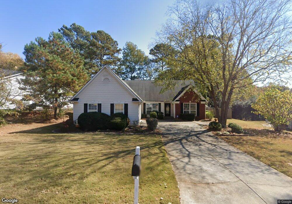
1291 Bailing Rd Unit 2 Lawrenceville, GA 30043
Estimated Value: $364,962 - $398,000
3
Beds
2
Baths
2,258
Sq Ft
$167/Sq Ft
Est. Value
About This Home
This home is located at 1291 Bailing Rd Unit 2, Lawrenceville, GA 30043 and is currently estimated at $377,241, approximately $167 per square foot. 1291 Bailing Rd Unit 2 is a home located in Gwinnett County with nearby schools including McKendree Elementary School, Creekland Middle School, and Collins Hill High School.
Ownership History
Date
Name
Owned For
Owner Type
Purchase Details
Closed on
Dec 7, 2010
Sold by
Singer Susann
Bought by
Singer Susann
Current Estimated Value
Home Financials for this Owner
Home Financials are based on the most recent Mortgage that was taken out on this home.
Original Mortgage
$84,000
Interest Rate
4.79%
Mortgage Type
New Conventional
Purchase Details
Closed on
Apr 30, 1996
Sold by
Bowen Bowen * Const Co Inc
Bought by
Ronzulla Victor Tracie S
Create a Home Valuation Report for This Property
The Home Valuation Report is an in-depth analysis detailing your home's value as well as a comparison with similar homes in the area
Home Values in the Area
Average Home Value in this Area
Purchase History
| Date | Buyer | Sale Price | Title Company |
|---|---|---|---|
| Singer Susann | -- | -- | |
| Ronzulla Victor Tracie S | $121,400 | -- |
Source: Public Records
Mortgage History
| Date | Status | Borrower | Loan Amount |
|---|---|---|---|
| Previous Owner | Singer Susann | $84,000 | |
| Closed | Ronzulla Victor Tracie S | $0 |
Source: Public Records
Tax History
| Year | Tax Paid | Tax Assessment Tax Assessment Total Assessment is a certain percentage of the fair market value that is determined by local assessors to be the total taxable value of land and additions on the property. | Land | Improvement |
|---|---|---|---|---|
| 2025 | $3,838 | $147,600 | $31,600 | $116,000 |
| 2024 | $3,970 | $147,600 | $31,600 | $116,000 |
| 2023 | $3,970 | $152,320 | $31,600 | $120,720 |
| 2022 | $3,538 | $128,360 | $27,600 | $100,760 |
| 2021 | $2,758 | $88,800 | $20,000 | $68,800 |
| 2020 | $2,777 | $88,800 | $20,000 | $68,800 |
| 2019 | $2,616 | $84,160 | $18,720 | $65,440 |
| 2018 | $2,492 | $78,440 | $15,600 | $62,840 |
| 2016 | $2,292 | $68,120 | $12,800 | $55,320 |
| 2015 | $2,240 | $65,000 | $12,800 | $52,200 |
| 2014 | $2,249 | $65,000 | $12,800 | $52,200 |
Source: Public Records
Map
Nearby Homes
- 1131 Bailing Dr
- 1129 Guernsey Dr
- 1447 Emerald Pine Ct
- 1049 Collections Dr
- 919 Colony Creek Dr Unit 1
- 830 Meadowsong Cir
- 1390 Benjamin Place Unit 1
- 1237 Raleigh Way
- 860 Meadowsong Cir
- 805 Meadowsong Cir
- 1157 Christiana Crossing
- 1070 McKendree Park Ln
- 1207 Christiana Crossing
- 1064 Mount Water Ln
- 585 Station View Run
- 1010 Burycove Ln
- 1490 Twin Bridge Ln Unit 3
- LOT 15 OF Fairview Springs Dr E
- 1260 Howard Way
- 1300 Sever Woods Dr
- 1303 Bailing Rd
- 1315 Sugar Land Ct
- 1282 Bailing Dr
- 1272 Bailing Dr
- 1305 Sugar Land Ct Unit 2
- 1311 Bailing Rd Unit 2
- 1311 Bailing Rd
- 1290 Bailing Rd Unit 2
- 1294 Bailing Rd
- 1274 Bailing Rd
- 1323 Bailing Rd
- 1300 Bailing Rd
- 1262 Bailing Dr
- 1304 Bailing Rd
- 1310 Sugar Land Ct
- 1263 Bailing Rd
- 1295 Sugar Land Ct Unit 2
- 1310 Bailing Rd
- 1335 Friendswood Cove Unit 64
- 1335 Friendswood Cove
Your Personal Tour Guide
Ask me questions while you tour the home.