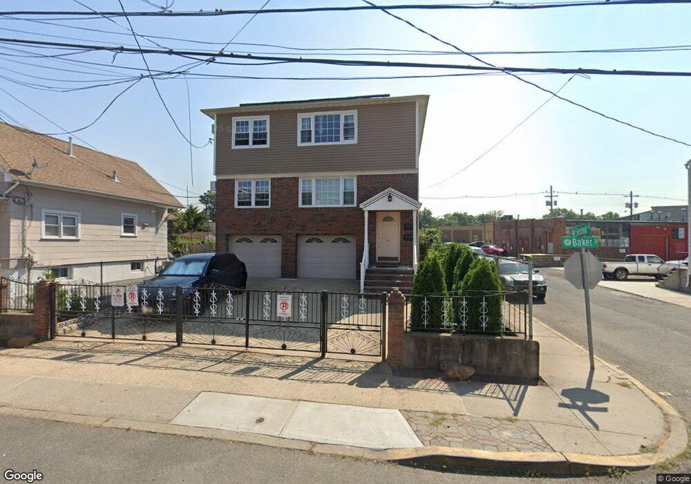
1291 Baker St Hillside, NJ 07205
Estimated Value: $525,000 - $718,000
Studio
--
Bath
2,640
Sq Ft
$239/Sq Ft
Est. Value
About This Home
This home is located at 1291 Baker St, Hillside, NJ 07205 and is currently estimated at $630,630, approximately $238 per square foot. 1291 Baker St is a home located in Union County with nearby schools including Abram P. Morris-Saybrook Elementary School, Hurden Looker School, and Ola Edwards Community School.
Ownership History
Date
Name
Owned For
Owner Type
Purchase Details
Closed on
Dec 31, 2020
Sold by
Brito Jose M and Brito Grace
Bought by
Cordeiro Valdeir R
Current Estimated Value
Home Financials for this Owner
Home Financials are based on the most recent Mortgage that was taken out on this home.
Original Mortgage
$311,250
Outstanding Balance
$277,792
Interest Rate
2.71%
Mortgage Type
New Conventional
Estimated Equity
$352,838
Purchase Details
Closed on
Aug 21, 2002
Sold by
Amorim Olivia
Bought by
Brito Jose and Brito Grace
Home Financials for this Owner
Home Financials are based on the most recent Mortgage that was taken out on this home.
Original Mortgage
$205,000
Interest Rate
6.57%
Create a Home Valuation Report for This Property
The Home Valuation Report is an in-depth analysis detailing your home's value as well as a comparison with similar homes in the area
Home Values in the Area
Average Home Value in this Area
Purchase History
| Date | Buyer | Sale Price | Title Company |
|---|---|---|---|
| Cordeiro Valdeir R | $415,000 | Prestige Title Agency Inc | |
| Brito Jose | $305,000 | -- |
Source: Public Records
Mortgage History
| Date | Status | Borrower | Loan Amount |
|---|---|---|---|
| Open | Cordeiro Valdeir R | $311,250 | |
| Previous Owner | Brito Jose | $205,000 |
Source: Public Records
Tax History Compared to Growth
Tax History
| Year | Tax Paid | Tax Assessment Tax Assessment Total Assessment is a certain percentage of the fair market value that is determined by local assessors to be the total taxable value of land and additions on the property. | Land | Improvement |
|---|---|---|---|---|
| 2025 | $13,915 | $168,600 | $55,400 | $113,200 |
| 2024 | $13,510 | $168,600 | $55,400 | $113,200 |
| 2023 | $13,510 | $168,600 | $55,400 | $113,200 |
| 2022 | $13,385 | $168,600 | $55,400 | $113,200 |
| 2021 | $13,297 | $168,600 | $55,400 | $113,200 |
| 2020 | $13,220 | $168,600 | $55,400 | $113,200 |
| 2019 | $12,964 | $168,600 | $55,400 | $113,200 |
| 2018 | $12,834 | $168,600 | $55,400 | $113,200 |
| 2017 | $12,756 | $168,600 | $55,400 | $113,200 |
| 2016 | $12,741 | $168,600 | $55,400 | $113,200 |
| 2015 | $12,628 | $168,600 | $55,400 | $113,200 |
| 2014 | $12,429 | $168,600 | $55,400 | $113,200 |
Source: Public Records
Map
Nearby Homes
- 1290 Baker St
- 149 Baltimore Ave
- 128 Baltimore Ave
- 1128 Saint Louis Ave Unit 2
- 376 Hollywood Ave
- 420 Hollywood Ave
- 1414 Boa Place Unit 2
- 1406 Maple Ave
- 105 Liberty Ct Unit 105
- 292 Crann St
- 1437 Parkview Terrace
- 75 Hillside Ave
- 1204 Salem Ave Unit 2
- 39 Hollywood Ave
- 1442 Highland Ave
- 386 Yale Ave
- 507 Locust Ave
- 600 Plymouth Rd
- 1473 Center St
- 124 Woodruff Place
- 1295 Baker St
- 1289 Baker St
- 1297 Baker St
- 1285 Baker St
- 1294 Central Ave
- 1299 Baker St
- 1300 Central Ave
- 1283 Baker St
- 1292 Baker St
- 1290 Baker St Unit 2L
- 1290 Baker St Unit 1R
- 1290 Baker St Unit 2R
- 1288 Baker St
- 1277 Baker St
- 1277 Baker St Unit 2
- 1284 Baker St
- 1300 Baker St
- 1309 Baker St
- 115 3rd St
- 1273 Baker St