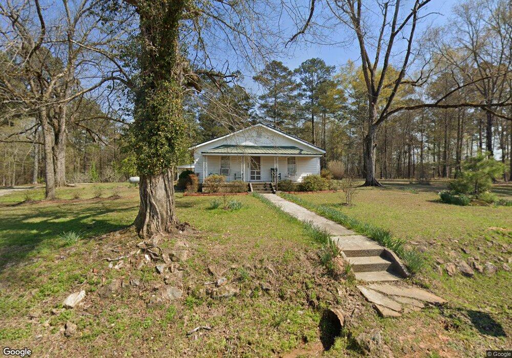
1291 Browns Chapel Rd Union Point, GA 30669
Estimated Value: $184,000 - $398,651
--
Bed
--
Bath
1,080
Sq Ft
$264/Sq Ft
Est. Value
About This Home
This home is located at 1291 Browns Chapel Rd, Union Point, GA 30669 and is currently estimated at $284,884, approximately $263 per square foot. 1291 Browns Chapel Rd is a home with nearby schools including Greene County High School.
Ownership History
Date
Name
Owned For
Owner Type
Purchase Details
Closed on
Oct 6, 2021
Sold by
Matthews Bennie Ruth C
Bought by
Georgia Transmission Corp
Current Estimated Value
Purchase Details
Closed on
Jul 15, 2021
Sold by
Pustiano Terry Croft
Bought by
Pustiano Terry Croft and Cannon James H
Purchase Details
Closed on
Apr 21, 2021
Sold by
Croft Mildred C
Bought by
Croft Bill and Pierce Carol Jane
Purchase Details
Closed on
Jan 1, 1987
Sold by
Matthews Bennie Ruth
Bought by
Matthews Bennie Ruth C Etal
Purchase Details
Closed on
Jan 1, 1980
Sold by
Rainwater Annette Etal
Bought by
Matthews Bennie Ruth
Purchase Details
Closed on
Jan 1, 1978
Sold by
Cannon H L
Bought by
Rainwater Annette Etal
Purchase Details
Closed on
Jan 1, 1968
Bought by
Cannon H L
Create a Home Valuation Report for This Property
The Home Valuation Report is an in-depth analysis detailing your home's value as well as a comparison with similar homes in the area
Home Values in the Area
Average Home Value in this Area
Purchase History
| Date | Buyer | Sale Price | Title Company |
|---|---|---|---|
| Georgia Transmission Corp | $5,000 | -- | |
| Pustiano Terry Croft | -- | -- | |
| Croft Bill | -- | -- | |
| Croft Bill | -- | -- | |
| Matthews Bennie Ruth C Etal | -- | -- | |
| Matthews Bennie Ruth | -- | -- | |
| Rainwater Annette Etal | -- | -- | |
| Cannon H L | -- | -- |
Source: Public Records
Tax History Compared to Growth
Tax History
| Year | Tax Paid | Tax Assessment Tax Assessment Total Assessment is a certain percentage of the fair market value that is determined by local assessors to be the total taxable value of land and additions on the property. | Land | Improvement |
|---|---|---|---|---|
| 2024 | $923 | $121,168 | $97,960 | $23,208 |
| 2023 | $893 | $93,768 | $71,360 | $22,408 |
| 2022 | $739 | $68,160 | $54,880 | $13,280 |
| 2021 | $737 | $66,800 | $54,960 | $11,840 |
| 2020 | $709 | $65,960 | $57,400 | $8,560 |
| 2019 | $716 | $65,960 | $57,400 | $8,560 |
| 2018 | $685 | $65,960 | $57,400 | $8,560 |
| 2017 | $641 | $66,044 | $57,454 | $8,590 |
| 2016 | $515 | $66,253 | $57,427 | $8,826 |
| 2015 | $484 | $66,254 | $57,427 | $8,827 |
| 2014 | $481 | $65,871 | $57,427 | $8,444 |
Source: Public Records
Map
Nearby Homes
- 0 Buffalo Lick Rd Unit 10551328
- 1201 Buffalo Lick Rd
- 0 Buffalo Lick Rd Unit 10551325
- 0 Buffalo Lick Rd Unit 10551234
- 3090 Bethany Church Rd
- 1860 Washington Hwy
- 0 Woodland Ct Unit 1027434
- 0 Woodland Ct Unit 10543600
- 504 Crawfordville Rd
- 202 Veazey St
- 606 Bryan Ave
- 1041 Hillcrest Dr
- 1180 Moody St
- 0 Greensboro Rd Unit 22774623
- 324 N Rhodes St
- 1241 Old Siloam Rd
- 1010 Orear Rd
- 0 S Rhodes St Unit 10618488
- 0 Washington Hwy Unit 7276060
- 0 Cato Rd Unit 10525284