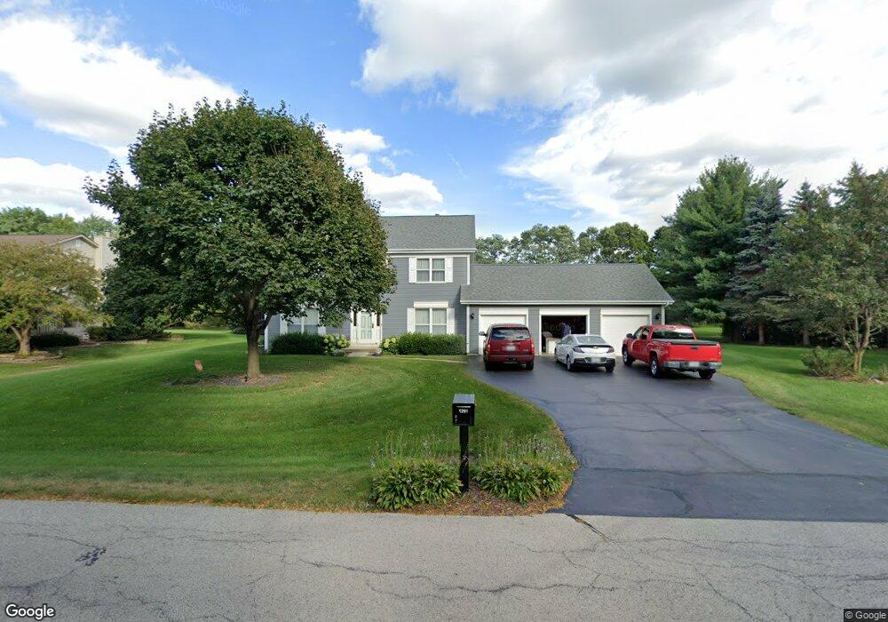
1291 Locust Dr Sleepy Hollow, IL 60118
Estimated Value: $444,169 - $556,000
4
Beds
--
Bath
2,346
Sq Ft
$212/Sq Ft
Est. Value
About This Home
This home is located at 1291 Locust Dr, Sleepy Hollow, IL 60118 and is currently estimated at $497,292, approximately $211 per square foot. 1291 Locust Dr is a home located in Kane County with nearby schools including Sleepy Hollow Elementary School, Dundee Middle School, and Dundee-Crown High School.
Ownership History
Date
Name
Owned For
Owner Type
Purchase Details
Closed on
Jun 4, 2003
Sold by
Markus Brad D and Markus Jeanne M
Bought by
Markus Brad D and Marcus Jeanne M
Current Estimated Value
Home Financials for this Owner
Home Financials are based on the most recent Mortgage that was taken out on this home.
Original Mortgage
$81,200
Interest Rate
5.78%
Mortgage Type
Purchase Money Mortgage
Create a Home Valuation Report for This Property
The Home Valuation Report is an in-depth analysis detailing your home's value as well as a comparison with similar homes in the area
Home Values in the Area
Average Home Value in this Area
Purchase History
| Date | Buyer | Sale Price | Title Company |
|---|---|---|---|
| Markus Brad D | -- | -- |
Source: Public Records
Mortgage History
| Date | Status | Borrower | Loan Amount |
|---|---|---|---|
| Closed | Markus Brad D | $81,200 |
Source: Public Records
Tax History Compared to Growth
Tax History
| Year | Tax Paid | Tax Assessment Tax Assessment Total Assessment is a certain percentage of the fair market value that is determined by local assessors to be the total taxable value of land and additions on the property. | Land | Improvement |
|---|---|---|---|---|
| 2024 | $8,883 | $134,386 | $32,592 | $101,794 |
| 2023 | $8,416 | $120,916 | $29,325 | $91,591 |
| 2022 | $7,933 | $107,733 | $29,325 | $78,408 |
| 2021 | $7,662 | $101,722 | $27,689 | $74,033 |
| 2020 | $7,512 | $99,435 | $27,066 | $72,369 |
| 2019 | $7,278 | $94,394 | $25,694 | $68,700 |
| 2018 | $8,250 | $97,342 | $28,262 | $69,080 |
| 2017 | $7,921 | $91,059 | $26,438 | $64,621 |
| 2016 | $8,115 | $88,167 | $25,598 | $62,569 |
| 2015 | -- | $82,615 | $23,986 | $58,629 |
| 2014 | -- | $83,078 | $23,324 | $59,754 |
| 2013 | -- | $85,621 | $24,038 | $61,583 |
Source: Public Records
Map
Nearby Homes
- 1042 Chateau Bluff Ln
- 37 River Ridge Dr
- 849 Hemlock Dr
- 900 Holly Ct
- 842 Winmoor Dr
- 1214 Carol Crest Dr
- 937 Willow Ln
- 0000 Strom Dr
- 214 S 7th St
- 10 Chateau Dr
- 936 Glen Oak Dr
- 325 Sharon Dr
- 215 Sharon Dr
- 503 Edinburgh Ln
- 496 Edinburgh Ln
- 1715 W Main St
- 516 S 1st St
- 404 Washington St
- 825 Lindsay Ln
- 818 Lindsay Ln
- 1295 Locust Dr
- 1287 Locust Dr Unit 20
- 1204 Locust Dr Unit 3
- 1206 Locust Dr
- 1202 Locust Dr
- 1301 Locust Dr
- 1088 Chateau Bluff Ln
- 1283 Locust Dr
- 816 Autumn Hill
- 956 Surrey Ln Unit 4
- 952 Surrey Ln Unit 2
- 950 Surrey Ln Unit 1
- 954 Surrey Ln
- 956 Surrey Ln Unit D
- 1084 Chateau Bluff Ln
- 832 Autumn Hill
- 1305 Locust Dr
- 925 Surrey Ln
- 827 Hemlock Dr
- 930 Surrey Ln Unit 1