Estimated Value: $402,000 - $409,000
2
Beds
3
Baths
1,261
Sq Ft
$322/Sq Ft
Est. Value
About This Home
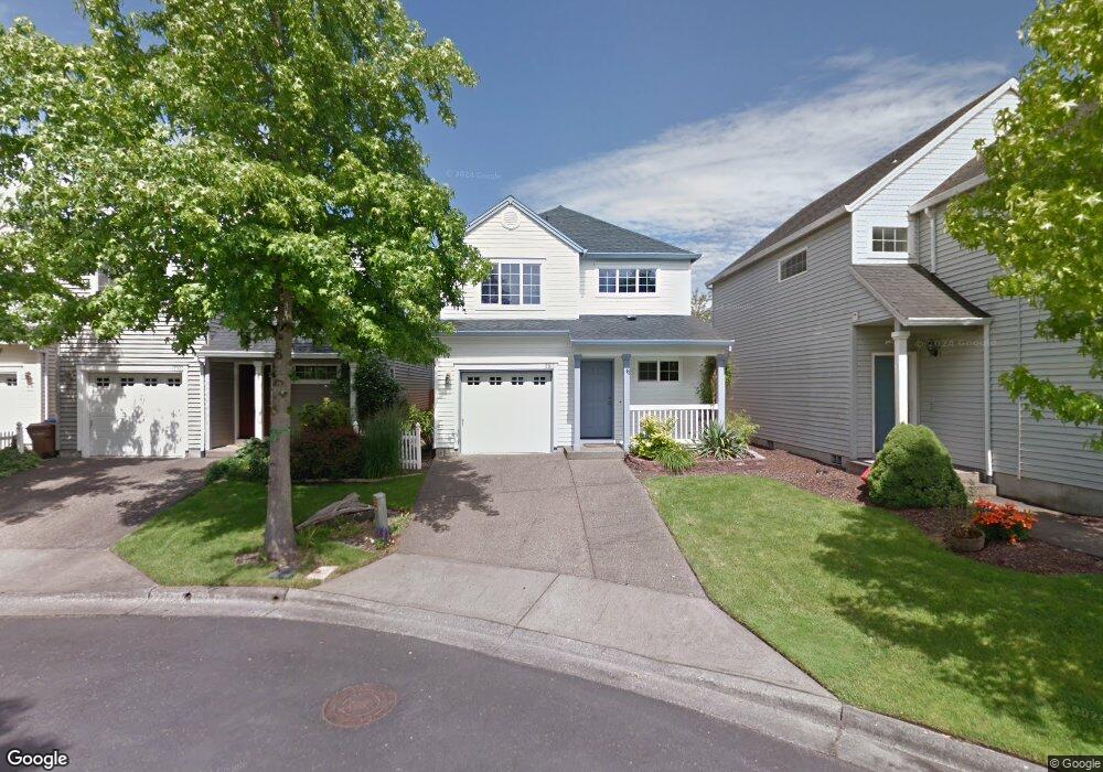
This home is located at 12910 NW Maplecrest Way, Banks, OR 97106 and is currently estimated at $405,878, approximately $321 per square foot. 12910 NW Maplecrest Way is a home located in Washington County with nearby schools including Banks Elementary School, Banks Middle School, and Banks High School.
Ownership History
Date
Name
Owned For
Owner Type
Purchase Details
Closed on
Feb 21, 2019
Sold by
Aerts Jean M
Bought by
Aerts Jean M and The Jean M Aerts Revocable Trust
Current Estimated Value
Purchase Details
Closed on
Nov 3, 2005
Sold by
Brower Laurie J and Brower Essam Laurie
Bought by
Aerts Jean M
Home Financials for this Owner
Home Financials are based on the most recent Mortgage that was taken out on this home.
Original Mortgage
$148,000
Interest Rate
5.74%
Mortgage Type
Fannie Mae Freddie Mac
Purchase Details
Closed on
Mar 25, 2000
Sold by
West Hills Development Company
Bought by
Essam Laurie J
Home Financials for this Owner
Home Financials are based on the most recent Mortgage that was taken out on this home.
Original Mortgage
$130,582
Interest Rate
8.26%
Create a Home Valuation Report for This Property
The Home Valuation Report is an in-depth analysis detailing your home's value as well as a comparison with similar homes in the area
Home Values in the Area
Average Home Value in this Area
Purchase History
| Date | Buyer | Sale Price | Title Company |
|---|---|---|---|
| Aerts Jean M | -- | None Available | |
| Aerts Jean M | $185,000 | First American Title Insuran | |
| Essam Laurie J | $131,456 | Chicago Title |
Source: Public Records
Mortgage History
| Date | Status | Borrower | Loan Amount |
|---|---|---|---|
| Closed | Aerts Jean M | $148,000 | |
| Previous Owner | Essam Laurie J | $130,582 |
Source: Public Records
Tax History Compared to Growth
Tax History
| Year | Tax Paid | Tax Assessment Tax Assessment Total Assessment is a certain percentage of the fair market value that is determined by local assessors to be the total taxable value of land and additions on the property. | Land | Improvement |
|---|---|---|---|---|
| 2025 | $4,059 | $220,940 | -- | -- |
| 2024 | $3,689 | $214,510 | -- | -- |
| 2023 | $3,689 | $208,270 | $0 | $0 |
| 2022 | $3,592 | $208,270 | $0 | $0 |
| 2021 | $3,466 | $196,330 | $0 | $0 |
| 2020 | $3,363 | $190,620 | $0 | $0 |
| 2019 | $3,228 | $185,070 | $0 | $0 |
| 2018 | $3,142 | $179,680 | $0 | $0 |
| 2017 | $3,008 | $174,450 | $0 | $0 |
| 2016 | $2,961 | $169,370 | $0 | $0 |
| 2015 | $2,846 | $164,440 | $0 | $0 |
| 2014 | $2,751 | $159,660 | $0 | $0 |
Source: Public Records
Map
Nearby Homes
- 12734 NW Hammond Place
- 42002 NW Elmhurst Ct
- 41710 NW Oak Way
- 41637 NW Buckshire St
- 41753 NW Buckshire St
- 42015 NW Buckshire St
- 42098 NW Broadshire Ln
- 42371 NW Banks Rd
- 0 NW Lodge Rd
- 48025 NW Strohmayer Rd
- 46345 NW Strohmayer Rd
- 0 NW Green Mountain Rd Unit 1 23320324
- 0 NW Green Mountain Rd Unit 24253646
- 18282 NW Hilltop Place
- 45868 NW Hillside Rd
- 11911 NW Seavey Rd
- 21076 NW Green Mountain Rd
- 36303 NW 3 Cedars Ln
- 20270 NW Pihl Rd
- 22001 NW Sellers Rd
- 12922 NW Maplecrest Way
- 12898 NW Maplecrest Way
- 12934 NW Maplecrest Way
- 12886 NW Maplecrest Way
- 12946 NW Maplecrest Loop
- 12874 NW Maplecrest Way
- 12946 NW Maplecrest Way
- 12958 NW Maplecrest Way
- 12862 NW Maplecrest Way
- 12850 NW Maplecrest Way
- 12970 NW Maplecrest Way
- 12913 NW Maplecrest Way
- 12891 NW Maplecrest Way
- 12838 NW Maplecrest Way
- 13020 NW Scottston Terrace
- 13028 NW Scottston Terrace
- 12939 NW Maplecrest Way
- 12982 NW Maplecrest Way
- 12867 NW Maplecrest Way
- 13014 NW Scottston Terrace