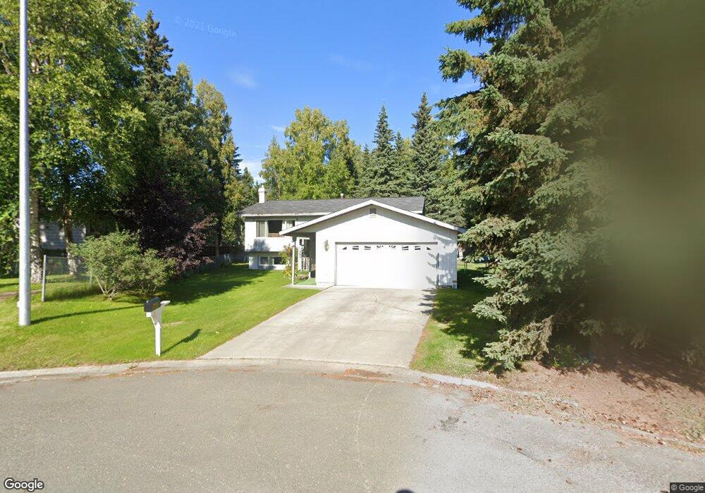
12911 Stephenson St Anchorage, AK 99515
Old Seward-Oceanview NeighborhoodEstimated Value: $325,000 - $501,000
4
Beds
2
Baths
2,200
Sq Ft
$194/Sq Ft
Est. Value
About This Home
This home is located at 12911 Stephenson St, Anchorage, AK 99515 and is currently estimated at $427,231, approximately $194 per square foot. 12911 Stephenson St is a home located in Anchorage Municipality with nearby schools including Ocean View Elementary School, Goldenview Middle School, and South Anchorage High School.
Ownership History
Date
Name
Owned For
Owner Type
Purchase Details
Closed on
Jan 3, 2002
Sold by
Heindl Gregory A and Heindl Robyn H
Bought by
Leslie Michael R and Leslie Donna J
Current Estimated Value
Home Financials for this Owner
Home Financials are based on the most recent Mortgage that was taken out on this home.
Original Mortgage
$164,000
Outstanding Balance
$64,146
Interest Rate
6.73%
Mortgage Type
Purchase Money Mortgage
Estimated Equity
$363,085
Purchase Details
Closed on
Mar 2, 1995
Sold by
Deboer Francis E
Bought by
Heindl Gregory A and Heindl Robyn H
Home Financials for this Owner
Home Financials are based on the most recent Mortgage that was taken out on this home.
Original Mortgage
$161,160
Interest Rate
9.09%
Mortgage Type
VA
Create a Home Valuation Report for This Property
The Home Valuation Report is an in-depth analysis detailing your home's value as well as a comparison with similar homes in the area
Home Values in the Area
Average Home Value in this Area
Purchase History
| Date | Buyer | Sale Price | Title Company |
|---|---|---|---|
| Leslie Michael R | -- | -- | |
| Heindl Gregory A | -- | -- | |
| Heindl Gregory A | -- | -- |
Source: Public Records
Mortgage History
| Date | Status | Borrower | Loan Amount |
|---|---|---|---|
| Open | Leslie Michael R | $164,000 | |
| Previous Owner | Heindl Gregory A | $161,160 |
Source: Public Records
Tax History Compared to Growth
Tax History
| Year | Tax Paid | Tax Assessment Tax Assessment Total Assessment is a certain percentage of the fair market value that is determined by local assessors to be the total taxable value of land and additions on the property. | Land | Improvement |
|---|---|---|---|---|
| 2025 | $5,454 | $440,300 | $111,700 | $328,600 |
| 2024 | $5,454 | $412,800 | $111,700 | $301,100 |
| 2023 | $6,310 | $370,500 | $111,700 | $258,800 |
| 2022 | $5,263 | $362,500 | $111,700 | $250,800 |
| 2021 | $6,148 | $341,200 | $111,700 | $229,500 |
| 2020 | $4,838 | $334,900 | $111,700 | $223,200 |
| 2019 | $4,650 | $334,200 | $111,700 | $222,500 |
| 2018 | $4,640 | $332,900 | $111,700 | $221,200 |
| 2017 | $4,847 | $329,500 | $105,800 | $223,700 |
| 2016 | $4,093 | $322,000 | $105,800 | $216,200 |
| 2015 | $4,093 | $310,600 | $106,500 | $204,100 |
| 2014 | $4,093 | $299,300 | $93,300 | $206,000 |
Source: Public Records
Map
Nearby Homes
- 13105 Stephenson St
- 2020 Steeple Dr
- 1800 Hamilton Dr
- 2048 Meander Dr
- 13322 Diggins Dr
- 13103 Brandon St Unit 14
- 12653 Bona Kim Loop Unit 7
- 13351 Venus Way
- 2000 Jarvis Ave
- 1677 Circlewood Dr
- 12496 Silver Fox Ln Unit 6
- 2701 Kempton Hills Dr
- 2521 Winterchase Cir
- 13530 Westwind Dr
- 12283 Timberwood Cir
- 12921 Aro Cir
- 13901 Jarvi Dr
- 13470 Baywind Cir
- 13481 Baywind Dr
- 3040 Chesapeake Cir
- 12901 Stephenson St
- 12831 Stephenson St
- 12921 Stephenson St
- 12821 Stephenson St
- 12931 Stephenson St
- 12941 Stephenson St
- 12811 Stephenson St
- 12910 Stephenson St
- 12900 Stephenson St
- 13021 Bates Cir
- 12920 Stephenson St
- 12930 Stephenson St
- 13011 Bates Cir
- 12830 Stephenson St
- 13001 Stephenson St
- 12820 Stephenson St
- 13025 Bates Cir
- 1711 Helen Dr
- 12810 Stephenson St
- 12801 Stephenson St