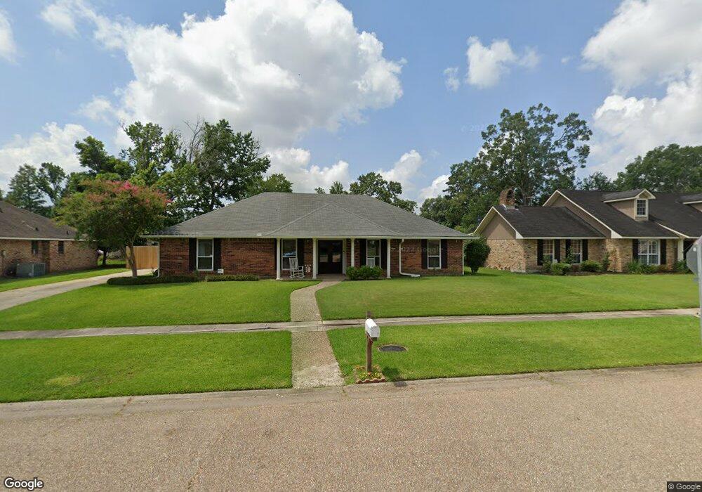
12912 Newcastle Ave Baton Rouge, LA 70816
Shenandoah NeighborhoodEstimated Value: $244,000 - $285,000
4
Beds
3
Baths
2,079
Sq Ft
$127/Sq Ft
Est. Value
About This Home
This home is located at 12912 Newcastle Ave, Baton Rouge, LA 70816 and is currently estimated at $263,592, approximately $126 per square foot. 12912 Newcastle Ave is a home located in East Baton Rouge Parish with nearby schools including Wedgewood Elementary School, Southeast Middle School, and Tara High School.
Ownership History
Date
Name
Owned For
Owner Type
Purchase Details
Closed on
Jul 31, 1998
Sold by
Oubre David Michael
Bought by
Oubre David Michael and Oubre Twyla Fletcher
Current Estimated Value
Home Financials for this Owner
Home Financials are based on the most recent Mortgage that was taken out on this home.
Original Mortgage
$90,450
Outstanding Balance
$18,902
Interest Rate
6.94%
Estimated Equity
$244,690
Create a Home Valuation Report for This Property
The Home Valuation Report is an in-depth analysis detailing your home's value as well as a comparison with similar homes in the area
Home Values in the Area
Average Home Value in this Area
Purchase History
| Date | Buyer | Sale Price | Title Company |
|---|---|---|---|
| Oubre David Michael | $76,756 | -- |
Source: Public Records
Mortgage History
| Date | Status | Borrower | Loan Amount |
|---|---|---|---|
| Open | Oubre David Michael | $90,450 |
Source: Public Records
Tax History Compared to Growth
Tax History
| Year | Tax Paid | Tax Assessment Tax Assessment Total Assessment is a certain percentage of the fair market value that is determined by local assessors to be the total taxable value of land and additions on the property. | Land | Improvement |
|---|---|---|---|---|
| 2024 | $1,990 | $23,725 | $2,000 | $21,725 |
| 2023 | $1,990 | $20,630 | $2,000 | $18,630 |
| 2022 | $2,463 | $20,630 | $2,000 | $18,630 |
| 2021 | $2,407 | $20,630 | $2,000 | $18,630 |
| 2020 | $2,437 | $20,630 | $2,000 | $18,630 |
| 2019 | $2,291 | $18,550 | $2,000 | $16,550 |
| 2018 | $2,264 | $18,550 | $2,000 | $16,550 |
| 2017 | $2,264 | $18,550 | $2,000 | $16,550 |
| 2016 | $723 | $12,758 | $2,000 | $10,758 |
| 2015 | $1,297 | $17,550 | $2,000 | $15,550 |
| 2014 | $1,293 | $17,550 | $2,000 | $15,550 |
| 2013 | -- | $17,550 | $2,000 | $15,550 |
Source: Public Records
Map
Nearby Homes
- 12526 Beldart Ct
- 3134 Woodland Ridge Blvd
- 16153 Chancel Ave Unit B2
- 16149 Chancel Ave Unit A2
- 16133 Chancel Ave Unit A2
- 12426 Lake Sherwood Ave N
- 12847 Oxley Dr
- 3534 Harris Dr
- 3014 Lancelot Dr
- 3635 Woodland Ridge Blvd
- 4220 Lake Sherwood Ave E
- 12111 Lake Sherwood Ave N
- 12536 Mallory Ave
- 4352 Stumberg Ln
- 4130 Country Glen Dr
- 4436 Stumberg Ln
- 12326 Lake Sherwood Ave S
- 4410 Stumberg Ln
- 4342 Stumberg Ln
- 4398 Stumberg Ln
- 12880 Newcastle Ave
- 12922 Newcastle Ave
- 12851 Woodshire Place
- 12841 Woodshire Place
- 12840 Newcastle Ave
- 12932 Newcastle Ave
- 12861 Woodshire Place
- 12831 Woodshire Place
- 12881 Newcastle Ave
- 12929 Newcastle Ave
- 12913 Woodshire Place
- 12830 Newcastle Ave
- 12845 Newcastle Ave
- 12811 Woodshire Place
- 12942 Newcastle Ave
- 12939 Newcastle Ave
- 12825 Newcastle Ave
- 12842 Woodshire Place
- 12923 Woodshire Place
- 12949 Newcastle Ave