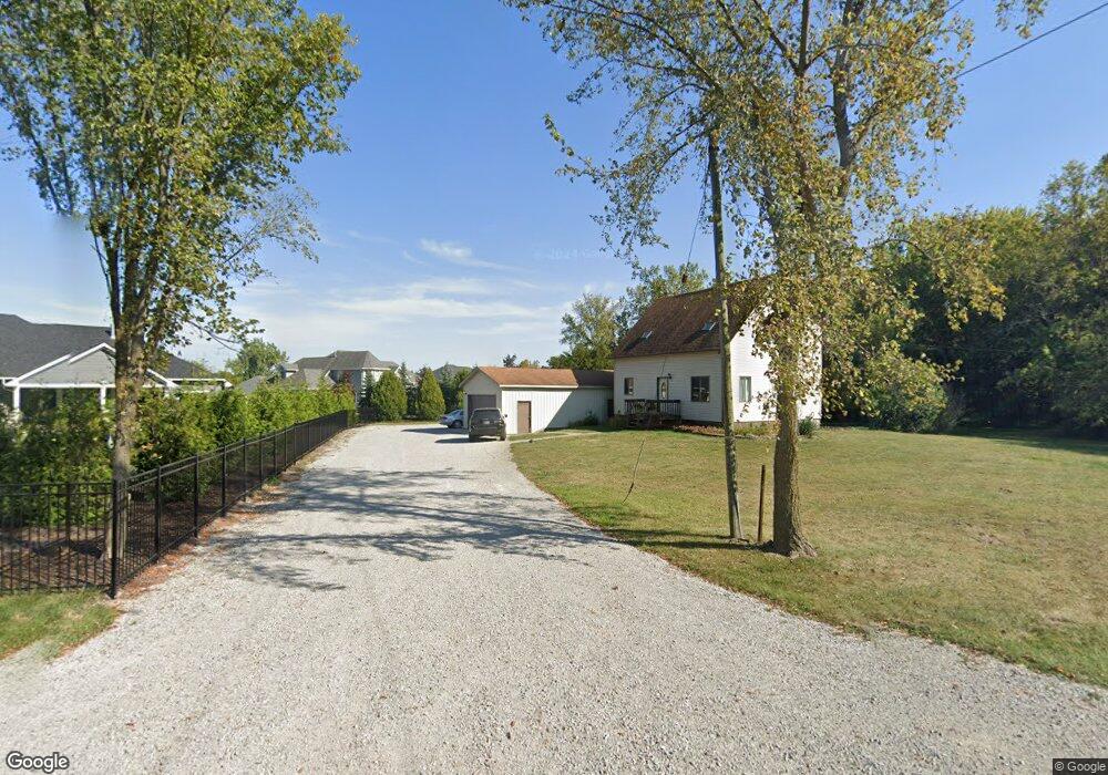
12913 Cedar Lake Rd Crown Point, IN 46307
Estimated Value: $238,000 - $288,000
3
Beds
2
Baths
1,660
Sq Ft
$157/Sq Ft
Est. Value
About This Home
This home is located at 12913 Cedar Lake Rd, Crown Point, IN 46307 and is currently estimated at $261,361, approximately $157 per square foot. 12913 Cedar Lake Rd is a home located in Lake County with nearby schools including Lake Street Elementary School, Robert Taft Middle School, and Crown Point High School.
Ownership History
Date
Name
Owned For
Owner Type
Purchase Details
Closed on
May 24, 2010
Sold by
Mccoy Joseph and Goldsmith Michelle L
Bought by
Nelson Phillip L
Current Estimated Value
Home Financials for this Owner
Home Financials are based on the most recent Mortgage that was taken out on this home.
Original Mortgage
$100,700
Outstanding Balance
$67,726
Interest Rate
5.12%
Mortgage Type
New Conventional
Estimated Equity
$193,635
Create a Home Valuation Report for This Property
The Home Valuation Report is an in-depth analysis detailing your home's value as well as a comparison with similar homes in the area
Home Values in the Area
Average Home Value in this Area
Purchase History
| Date | Buyer | Sale Price | Title Company |
|---|---|---|---|
| Nelson Phillip L | -- | Chicago Title Insurance Co |
Source: Public Records
Mortgage History
| Date | Status | Borrower | Loan Amount |
|---|---|---|---|
| Open | Nelson Phillip L | $100,700 |
Source: Public Records
Tax History Compared to Growth
Tax History
| Year | Tax Paid | Tax Assessment Tax Assessment Total Assessment is a certain percentage of the fair market value that is determined by local assessors to be the total taxable value of land and additions on the property. | Land | Improvement |
|---|---|---|---|---|
| 2024 | $3,307 | $169,200 | $29,800 | $139,400 |
| 2023 | $1,177 | $155,600 | $29,800 | $125,800 |
| 2022 | $1,177 | $145,500 | $29,800 | $115,700 |
| 2021 | $1,010 | $135,800 | $29,800 | $106,000 |
| 2020 | $1,043 | $133,900 | $29,800 | $104,100 |
| 2019 | $999 | $126,200 | $29,800 | $96,400 |
| 2018 | $1,004 | $136,000 | $29,800 | $106,200 |
| 2017 | $1,029 | $123,400 | $29,800 | $93,600 |
| 2016 | $1,031 | $123,000 | $29,800 | $93,200 |
| 2014 | $941 | $122,500 | $29,800 | $92,700 |
| 2013 | $924 | $121,300 | $29,800 | $91,500 |
Source: Public Records
Map
Nearby Homes
- 12715 Cedar Lake Rd
- 12812 Whitcomb St
- 12201 Cedar Lake Rd
- 834 Copper Creek Dr
- 1575 S Feather Rock Dr
- 12860 Baker Ct
- 3721 W 133rd Ave
- The Cottonwood Plan at Golden Meadow
- The Magnolia Plan at Golden Meadow
- The Birch Plan at Golden Meadow
- 1540 Brackenbury Ln
- The Willow Plan at Golden Meadow
- 4422 W 133rd Ave
- 12768 Ellsworth Place
- 2725 W 127th Ln
- 11498 Hancock Dr
- The Ganby Plan at Sawgrass
- The Monarch Plan at Sawgrass
- The Keystone Plan at Sawgrass
- The Breckenridge Plan at Sawgrass
- 1125 Jamie Ct
- 12715 Cedar Rd
- 1111 Jamie Ct
- 12812 Cedar Lake Rd
- 12819 Whitcomb St
- 12823 Whitcomb St
- 1101 Jamie Ct
- 12808 Cedar Lake Rd
- 12811 Whitcomb St
- 1137 Jamie Ct
- 1915 S Feather Rock Dr
- 12804 Cedar Lake Rd
- 12807 Whitcomb St
- 1130 Jamie Ct
- 1925 S Feather Rock Dr
- 12738 Cedar Lake Rd
- 12803 Whitcomb St
- 12818 Whitcomb St
- 3870 W 129th Ct
- 1118 Jamie Ct