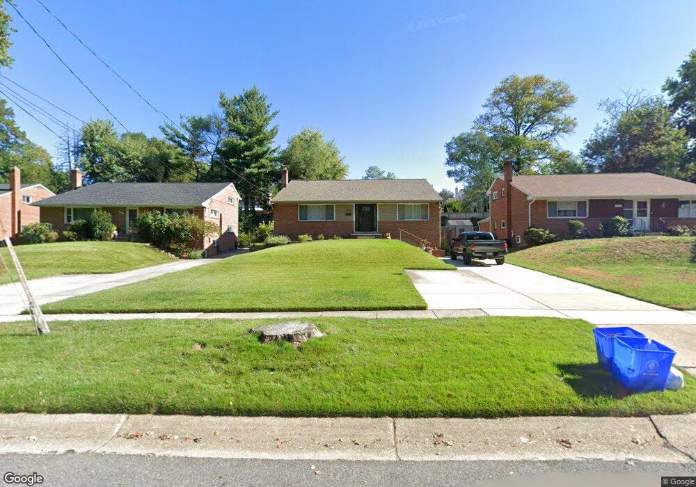
12915 Dean Rd Silver Spring, MD 20906
Connecticut Avenue Park NeighborhoodEstimated Value: $424,975 - $542,000
Studio
2
Baths
1,680
Sq Ft
$295/Sq Ft
Est. Value
About This Home
This home is located at 12915 Dean Rd, Silver Spring, MD 20906 and is currently estimated at $495,744, approximately $295 per square foot. 12915 Dean Rd is a home located in Montgomery County with nearby schools including Weller Road Elementary School, A. Mario Loiederman Middle School, and Wheaton High School.
Ownership History
Date
Name
Owned For
Owner Type
Purchase Details
Closed on
Jul 17, 2014
Sold by
Yones Mohammed and Castillanos Fatima
Bought by
Castillanos Fatima
Current Estimated Value
Purchase Details
Closed on
Dec 14, 1993
Sold by
Basso M F
Bought by
Lloyd Fatima
Home Financials for this Owner
Home Financials are based on the most recent Mortgage that was taken out on this home.
Original Mortgage
$123,600
Interest Rate
6.78%
Create a Home Valuation Report for This Property
The Home Valuation Report is an in-depth analysis detailing your home's value as well as a comparison with similar homes in the area
Home Values in the Area
Average Home Value in this Area
Purchase History
| Date | Buyer | Sale Price | Title Company |
|---|---|---|---|
| Castillanos Fatima | -- | None Available | |
| Lloyd Fatima | $137,000 | -- |
Source: Public Records
Mortgage History
| Date | Status | Borrower | Loan Amount |
|---|---|---|---|
| Closed | Lloyd Fatima | $123,600 |
Source: Public Records
Tax History
| Year | Tax Paid | Tax Assessment Tax Assessment Total Assessment is a certain percentage of the fair market value that is determined by local assessors to be the total taxable value of land and additions on the property. | Land | Improvement |
|---|---|---|---|---|
| 2025 | $5,078 | $412,600 | $195,900 | $216,700 |
| 2024 | $5,078 | $383,500 | $0 | $0 |
| 2023 | $4,031 | $354,400 | $0 | $0 |
| 2022 | $3,491 | $325,300 | $173,900 | $151,400 |
| 2021 | $3,273 | $319,700 | $0 | $0 |
| 2020 | $3,273 | $314,100 | $0 | $0 |
| 2019 | $3,178 | $308,500 | $158,800 | $149,700 |
| 2018 | $3,115 | $305,033 | $0 | $0 |
| 2017 | $3,126 | $301,567 | $0 | $0 |
| 2016 | -- | $298,100 | $0 | $0 |
| 2015 | $2,525 | $285,067 | $0 | $0 |
| 2014 | $2,525 | $272,033 | $0 | $0 |
Source: Public Records
Map
Nearby Homes
- 3701 Kenway St
- 12800 Connecticut Ave
- 3608 Janet Rd
- 12929 Valleywood Dr
- 13130 Valleywood Dr
- 13009 Matey Rd
- 3409 Janet Rd
- 13116 Estelle Rd
- 13218 Holdridge Rd
- 12816 Valleywood Dr
- 12828 Littleton St
- 13216 Turkey Branch Pkwy
- 3405 Fredale St
- 12605 Bluhill Rd
- 12420 Feldon St
- 2829 Vixen Ln
- 13017 Parkland Dr
- 3234 Hewitt Ave Unit 24
- 13316 Foxhall Dr
- 3230 Hewitt Ave Unit 13
- 12917 Dean Rd
- 12913 Dean Rd
- 12919 Dean Rd
- 12912 Crisfield Rd
- 12911 Dean Rd
- 12914 Crisfield Rd
- 12908 Crisfield Rd
- 12921 Dean Rd
- 12916 Crisfield Rd
- 12909 Dean Rd
- 12906 Crisfield Rd
- 12918 Crisfield Rd
- 12923 Dean Rd
- 12914 Dean Rd
- 12916 Dean Rd
- 12907 Dean Rd
- 12904 Crisfield Rd
- 12912 Dean Rd
- 12918 Dean Rd
- 12920 Crisfield Rd
Your Personal Tour Guide
Ask me questions while you tour the home.