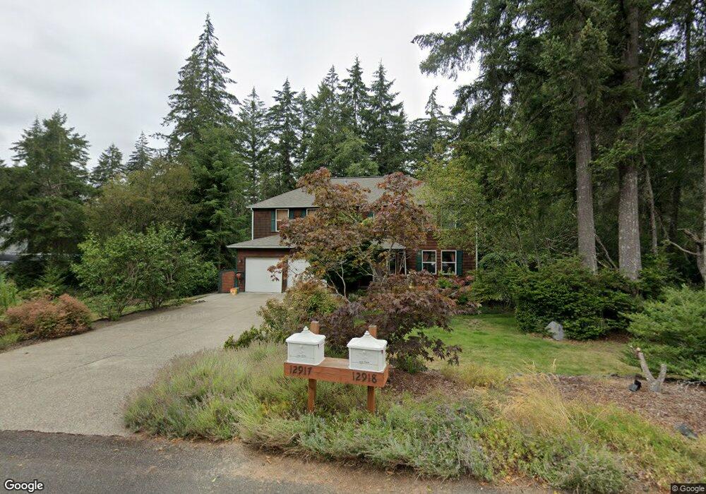
12918 133rd Avenue Kp N Unit KN Gig Harbor, WA 98329
Estimated Value: $758,885 - $840,000
4
Beds
3
Baths
2,394
Sq Ft
$335/Sq Ft
Est. Value
About This Home
This home is located at 12918 133rd Avenue Kp N Unit KN, Gig Harbor, WA 98329 and is currently estimated at $802,221, approximately $335 per square foot. 12918 133rd Avenue Kp N Unit KN is a home located in Pierce County with nearby schools including Vaughn Elementary School, Key Peninsula Middle School, and Peninsula High School.
Ownership History
Date
Name
Owned For
Owner Type
Purchase Details
Closed on
Jul 24, 1998
Sold by
Ferguson & Cole Inc
Bought by
Lowe Ronald A and Lowe Valerie A
Current Estimated Value
Home Financials for this Owner
Home Financials are based on the most recent Mortgage that was taken out on this home.
Original Mortgage
$174,950
Outstanding Balance
$35,492
Interest Rate
6.9%
Estimated Equity
$766,729
Purchase Details
Closed on
Oct 15, 1997
Sold by
Belridge Group Inc
Bought by
Ferguson & Cole Inc
Home Financials for this Owner
Home Financials are based on the most recent Mortgage that was taken out on this home.
Original Mortgage
$295,120
Interest Rate
7.49%
Mortgage Type
Construction
Create a Home Valuation Report for This Property
The Home Valuation Report is an in-depth analysis detailing your home's value as well as a comparison with similar homes in the area
Home Values in the Area
Average Home Value in this Area
Purchase History
| Date | Buyer | Sale Price | Title Company |
|---|---|---|---|
| Lowe Ronald A | $194,950 | Chicago Title | |
| Ferguson & Cole Inc | $78,000 | Chicago Title |
Source: Public Records
Mortgage History
| Date | Status | Borrower | Loan Amount |
|---|---|---|---|
| Open | Lowe Ronald A | $174,950 | |
| Previous Owner | Ferguson & Cole Inc | $295,120 |
Source: Public Records
Tax History Compared to Growth
Tax History
| Year | Tax Paid | Tax Assessment Tax Assessment Total Assessment is a certain percentage of the fair market value that is determined by local assessors to be the total taxable value of land and additions on the property. | Land | Improvement |
|---|---|---|---|---|
| 2025 | $6,261 | $791,500 | $211,200 | $580,300 |
| 2024 | $6,261 | $721,100 | $216,900 | $504,200 |
| 2023 | $6,080 | $694,100 | $237,500 | $456,600 |
| 2022 | $6,214 | $702,400 | $222,600 | $479,800 |
| 2021 | $5,743 | $532,500 | $125,600 | $406,900 |
| 2019 | $5,431 | $550,500 | $94,700 | $455,800 |
| 2018 | $2,779 | $512,100 | $82,700 | $429,400 |
| 2017 | $5,246 | $470,300 | $71,700 | $398,600 |
| 2016 | $4,300 | $397,300 | $62,200 | $335,100 |
| 2014 | $4,011 | $342,900 | $57,300 | $285,600 |
| 2013 | $4,011 | $328,100 | $53,700 | $274,400 |
Source: Public Records
Map
Nearby Homes
- 12718 131st St NW
- 14014 131st St NW
- 13721 137th St NW
- 13202 142nd Ave NW
- 13112 Grouse Hollow Dr NW
- 13916 140th Ave NW
- 13619 Sandy Point East NW
- 12711 144th Ave NW
- 12901 122nd Ave NW
- 14413 134th St NW
- 13510 145th Ave NW
- 18703 Washington 302
- 5301 Washington 302
- 3151 Washington 302
- 13617 144th St NW
- 14720 Parkdale Dr NW
- 13257 118th Ave NW
- 0 154th Ave NW Unit NWM2322039
- 0 X 154th Ave NW
- 11320 146th Avenue Ct NW
- 13214
- 12912 133rd Avenue Kp N
- 12912 133rd Avenue Kp N Unit KN
- 12924 133rd Avenue Kp N
- 12924 133rd Avenue Kp N Unit KN
- 12924 133rd Ave NW
- 12912 133rd Ave NW
- 12917 133rd Ave NW
- 12917 133rd Avenue Kp N
- 12917 133rd Avenue Kp N Unit KN
- 131st 166th St NW
- 13221 130th Street Kp N Unit KN
- 13219 129th Street Kp N Unit KN
- 12904 133rd Avenue Kp N Unit KN
- 13219 129th St NW
- 0 XXXX 134th Street Kpn
- 13912 137th Street Kpn
- 18411 Hwy 302
- 14716 113th Street Kpn
- 13719 Sr 302 Kpn