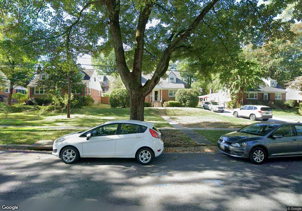
12918 Dean Rd Silver Spring, MD 20906
Connecticut Avenue Park NeighborhoodEstimated Value: $427,460 - $528,000
Studio
2
Baths
1,504
Sq Ft
$323/Sq Ft
Est. Value
About This Home
This home is located at 12918 Dean Rd, Silver Spring, MD 20906 and is currently estimated at $485,865, approximately $323 per square foot. 12918 Dean Rd is a home located in Montgomery County with nearby schools including Weller Road Elementary School, A. Mario Loiederman Middle School, and Wheaton High School.
Ownership History
Date
Name
Owned For
Owner Type
Purchase Details
Closed on
May 19, 2015
Sold by
Peffley Robert L and Peffley Catherine A
Bought by
Peffley Family Trust
Current Estimated Value
Purchase Details
Closed on
Mar 29, 2013
Sold by
Catherine B Boyce Trust
Bought by
Peffley Robert L and Peffley Catherine A
Home Financials for this Owner
Home Financials are based on the most recent Mortgage that was taken out on this home.
Original Mortgage
$200,000
Outstanding Balance
$141,683
Interest Rate
3.55%
Mortgage Type
New Conventional
Estimated Equity
$344,182
Purchase Details
Closed on
Mar 3, 2004
Sold by
Boyce Robert K and Boyce B C
Bought by
Boyce Catherine B Tr
Create a Home Valuation Report for This Property
The Home Valuation Report is an in-depth analysis detailing your home's value as well as a comparison with similar homes in the area
Home Values in the Area
Average Home Value in this Area
Purchase History
| Date | Buyer | Sale Price | Title Company |
|---|---|---|---|
| Peffley Family Trust | -- | Attorney | |
| Peffley Robert L | $275,000 | Sec Title Guar Corp Of Balti | |
| Boyce Catherine B Tr | -- | -- |
Source: Public Records
Mortgage History
| Date | Status | Borrower | Loan Amount |
|---|---|---|---|
| Open | Peffley Robert L | $200,000 |
Source: Public Records
Tax History
| Year | Tax Paid | Tax Assessment Tax Assessment Total Assessment is a certain percentage of the fair market value that is determined by local assessors to be the total taxable value of land and additions on the property. | Land | Improvement |
|---|---|---|---|---|
| 2025 | $5,113 | $405,500 | $199,000 | $206,500 |
| 2024 | $5,113 | $386,600 | $0 | $0 |
| 2023 | $4,185 | $367,700 | $0 | $0 |
| 2022 | $3,751 | $348,800 | $177,000 | $171,800 |
| 2021 | $3,587 | $345,667 | $0 | $0 |
| 2020 | $3,587 | $342,533 | $0 | $0 |
| 2019 | $3,519 | $339,400 | $161,800 | $177,600 |
| 2018 | $3,306 | $322,333 | $0 | $0 |
| 2017 | $3,167 | $305,267 | $0 | $0 |
| 2016 | -- | $288,200 | $0 | $0 |
| 2015 | $2,654 | $282,467 | $0 | $0 |
| 2014 | $2,654 | $276,733 | $0 | $0 |
Source: Public Records
Map
Nearby Homes
- 3701 Kenway St
- 12800 Connecticut Ave
- 3409 Janet Rd
- 12929 Valleywood Dr
- 13130 Valleywood Dr
- 13116 Estelle Rd
- 12816 Valleywood Dr
- 12828 Littleton St
- 3405 Fredale St
- 13216 Turkey Branch Pkwy
- 12420 Feldon St
- 2829 Vixen Ln
- 13017 Parkland Dr
- 12300 Downer Dr
- 13316 Foxhall Dr
- 3234 Hewitt Ave Unit 24
- 13530 Vandalia Dr
- 12220 Centerhill St
- 3301 Hewitt Ave Unit 501
- 3301 Hewitt Ave Unit 403
- 12916 Dean Rd
- 12920 Dean Rd
- 3711 Kayson St
- 12914 Dean Rd
- 12922 Dean Rd
- 3709 Kayson St
- 3713 Kayson St
- 3707 Kayson St
- 12912 Dean Rd
- 12924 Dean Rd
- 3715 Kayson St
- 3705 Kayson St Unit Basement
- 3705 Kayson St
- 12919 Dean Rd
- 12917 Dean Rd
- 12921 Dean Rd
- 12910 Dean Rd
- 12926 Dean Rd
- 3717 Kayson St
- 12915 Dean Rd
Your Personal Tour Guide
Ask me questions while you tour the home.