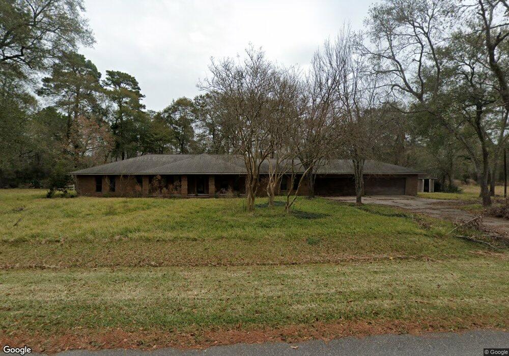
12918 Maxwell Rd Cypress, TX 77429
Estimated Value: $426,000 - $1,391,000
3
Beds
3
Baths
2,839
Sq Ft
$320/Sq Ft
Est. Value
About This Home
This home is located at 12918 Maxwell Rd, Cypress, TX 77429 and is currently estimated at $908,500, approximately $320 per square foot. 12918 Maxwell Rd is a home located in Harris County with nearby schools including Hamilton Elementary School, Hamilton Middle School, and Cy-Fair High School.
Ownership History
Date
Name
Owned For
Owner Type
Purchase Details
Closed on
Aug 15, 2017
Sold by
Davidson Adam T
Bought by
Doyle Stephanie Elizabeth and Doyle Brian Christopher
Current Estimated Value
Home Financials for this Owner
Home Financials are based on the most recent Mortgage that was taken out on this home.
Original Mortgage
$269,000
Outstanding Balance
$224,460
Interest Rate
3.96%
Mortgage Type
New Conventional
Estimated Equity
$684,040
Create a Home Valuation Report for This Property
The Home Valuation Report is an in-depth analysis detailing your home's value as well as a comparison with similar homes in the area
Purchase History
| Date | Buyer | Sale Price | Title Company |
|---|---|---|---|
| Doyle Stephanie Elizabeth | -- | Stewart Title |
Source: Public Records
Mortgage History
| Date | Status | Borrower | Loan Amount |
|---|---|---|---|
| Open | Doyle Stephanie Elizabeth | $269,000 |
Source: Public Records
Tax History
| Year | Tax Paid | Tax Assessment Tax Assessment Total Assessment is a certain percentage of the fair market value that is determined by local assessors to be the total taxable value of land and additions on the property. | Land | Improvement |
|---|---|---|---|---|
| 2025 | -- | -- | -- | -- |
| 2024 | -- | -- | -- | -- |
| 2023 | -- | -- | -- | -- |
| 2022 | $0 | $0 | $0 | $0 |
| 2021 | $6,426 | $406,393 | $36,676 | $369,717 |
| 2020 | $6,019 | $270,000 | $25,605 | $244,395 |
| 2019 | $6,261 | $270,000 | $25,605 | $244,395 |
| 2018 | $2,750 | $270,000 | $25,605 | $244,395 |
| 2017 | $7,126 | $307,867 | $25,605 | $282,262 |
| 2016 | $7,084 | $307,867 | $25,605 | $282,262 |
| 2015 | $2,536 | $307,867 | $25,605 | $282,262 |
| 2014 | $2,536 | $252,933 | $25,605 | $227,328 |
Source: Public Records
Map
Nearby Homes
- 13515 Maxwell Rd
- 12802 Jarvis Rd
- 13326 Hartford Bay Trail
- 13302 Lakewood Meadow Dr
- 12534 Saracen Dr
- 12614 Campsite Trail
- 13523 Lakecrest Dr
- 12631 Texas Army Trail
- 12611 Campsite Trail
- 11711 Lismore Lake Dr
- 13803 Oak Fair Bend
- 13123 Parc Lake Edge Dr
- 12626 Scouts Ln
- 12207 Lakewood Glade Ct
- 13635 Kluge Corner Ln
- 13430 Lakewood Meadow Dr
- 0 N Moss Creek Dr Unit 46829968
- 12710 Ravensway Dr
- 13912 Barrow Cliff Ln
- 13327 Little Ranch Rd
- 12926 Maxwell Rd
- 12906 Maxwell Rd
- 12915 Maxwell Rd
- 12923 Maxwell Rd
- 13006 Maxwell Rd
- 13506 Robbins Rd
- 12423 Maxwell Rd
- 13502 Robbins Rd
- 13518 Robbins
- 13510 Robbins Rd
- 13514 Robbins Rd
- 12503 Maxwell Rd
- 2629 Robbins Rd
- 13022 Maxwell Rd
- 12807 Maxwell Rd
- 12806 Maxwell Rd
- 13423 Lindsey Rd
- 83 & 84 Lindsey Rd
- 12511 Maxwell Rd
- 12422 Maxwell Rd
Your Personal Tour Guide
Ask me questions while you tour the home.